


A few years ago we found ourselves in Grand Canyon during the last week of April. We tried for and were issued a walk-up permit to backpack down into the Canyon, spending a few blissful days and nights soaking in its grandeur. Right then and there we got hooked on the splendor and intimacy of a trek below the rim. And so every year since, we have made it a point to return to that big crack in the earth and tackle a below-the-rim route.
Options abound when it comes to exploring Grand Canyon on foot -- yet only a tiny fraction of visitors to this wonder of the world take the opportunity. The Inner Canyon Corridor, connecting the South and North rims via the shortest route, accommodates most below-the-rim adventurers. But there are the less popular trails (and countless trail-less routes) beyond the Inner Canyon too, which offer a variety of backpacking experiences -- from maintained trails leading to designated campgrounds to primitive, off-the-beaten-path destinations visited only by the most intrepid.
Over the years we backpacked both on and off the Inner Canyon Corridor. Here we share details about various routes.
South Rim to the River via South Kaibab and Bright Angel Trails
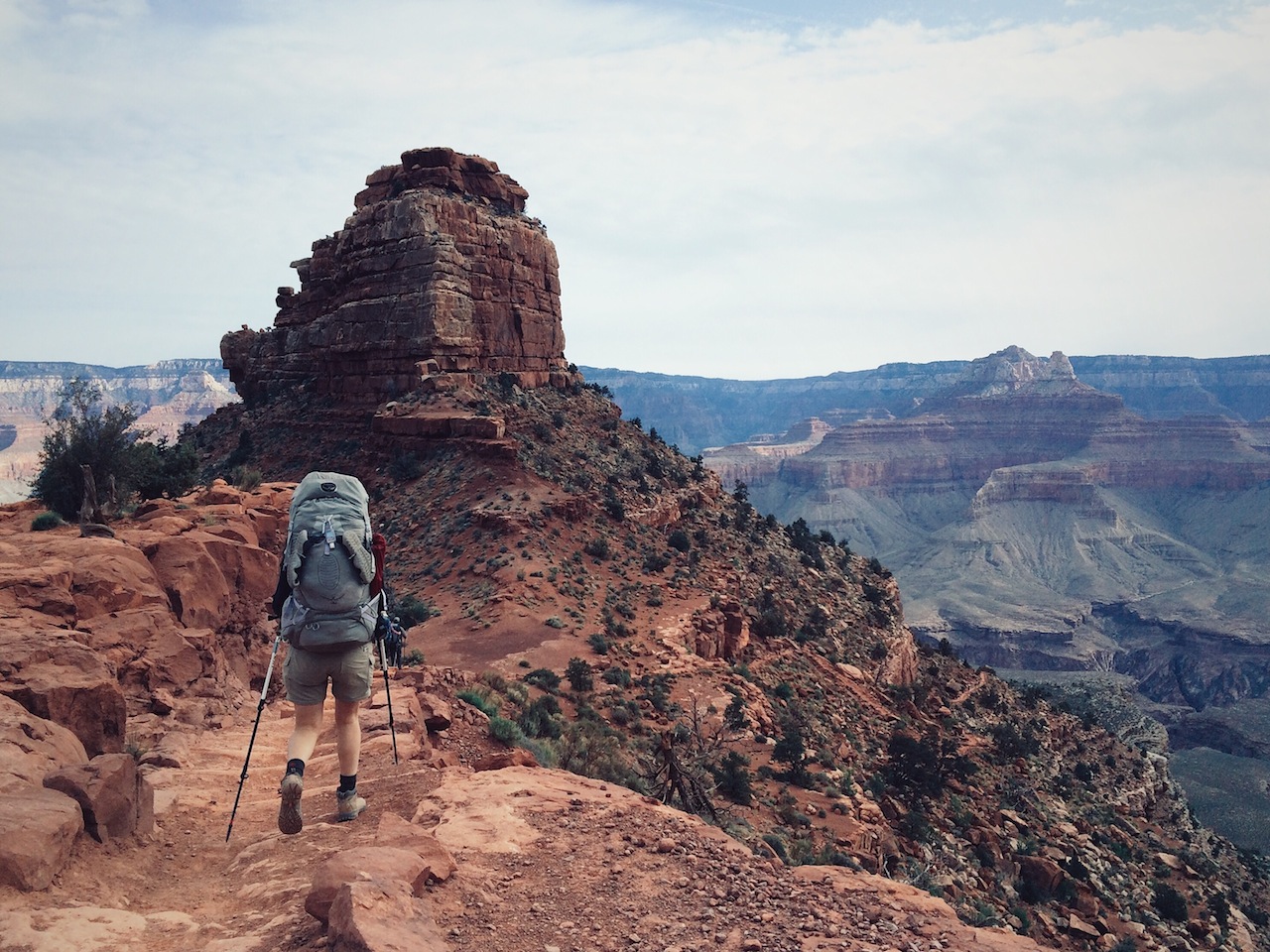
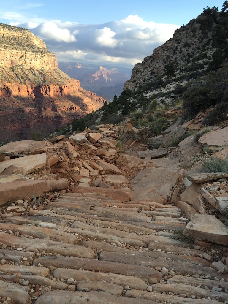
This is a classic way to get an introduction to the Canyon below the rim, and is a splendid choice. The trails of South Kaibab and Bright Angel provide very different views and experiences, and it's worthwhile to plan an itinerary that visits both rather than going out and back on the same trail. South Kaibab is shorter, steeper and more elemental in its sparseness. Bright Angel is a bit longer and more forgiving in steepness, and is also more shaded and verdant (and except in the cold season, there are rest stops with water at 3 miles and 1 ½ miles from the rim). The ideal direction is to go down South Kaibab and up Bright Angel.
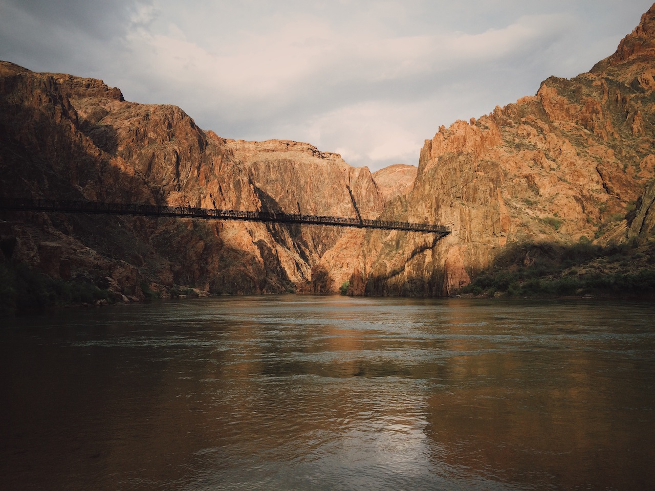
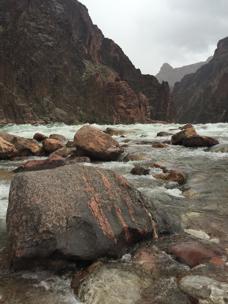
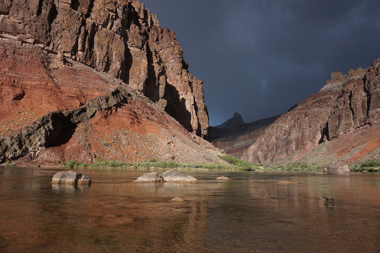
The trip includes a visit down to Phantom Ranch, just past the ribbon of the Colorado River, the mighty force that carved this wonder bit by bit. While you can vie for a coveted stay at a cabin in the Ranch, you can more easily (and cheaply) stay at Bright Angel Campground near the Ranch and still enjoy the atmosphere of Phantom Ranch -- with its canteen, cold beer, warm meals, ranger programs and campfires. If you choose to and plan sufficiently far in advance, you can order meals from the canteen even when camping at Bright Angel -- though in all the times we've been down there, we've never brought ourselves to ordering a meal. It always seemed overpriced and not veggie-friendly enough for our palates. But we sure have enjoyed the cold beers, iced tea and board games at the canteen -- available to all without pre-purchasing!
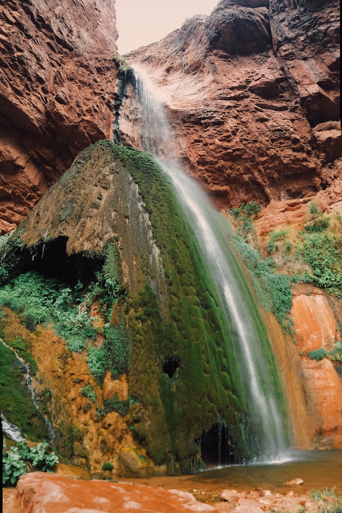
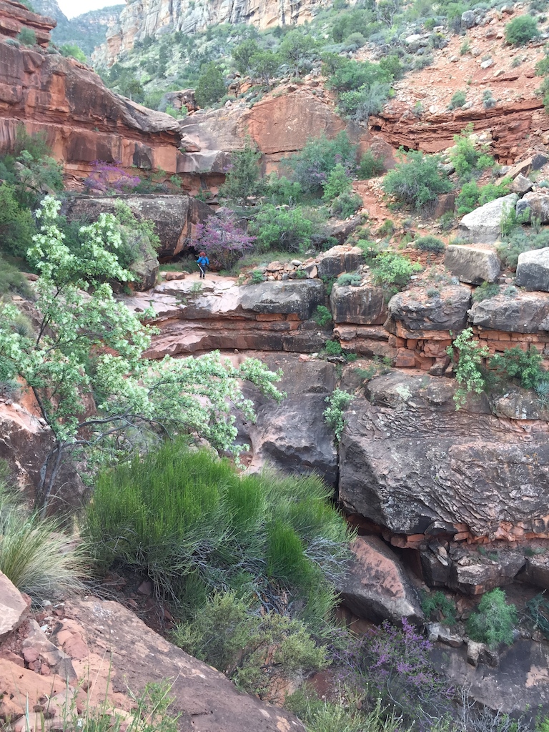
Ribbon Falls is a wonderful day hike from Phantom Ranch. Signage near Phantom Ranch says it's 6 miles one way, but our GPS told us it was closer to 7, making it nearly a 14-mile out-and-back. The water in these 50-foot-high falls has deposited minerals that formed a 30-foot travertine “dome” that is home to iridescent canyon treefrogs and American Dipper birds, which make their nests in misty, mossy caves within the dome. A trail leads up and behind the waterfall, where water hits the rocks and creates a small pool suspended 30 feet above the bottom of the falls.
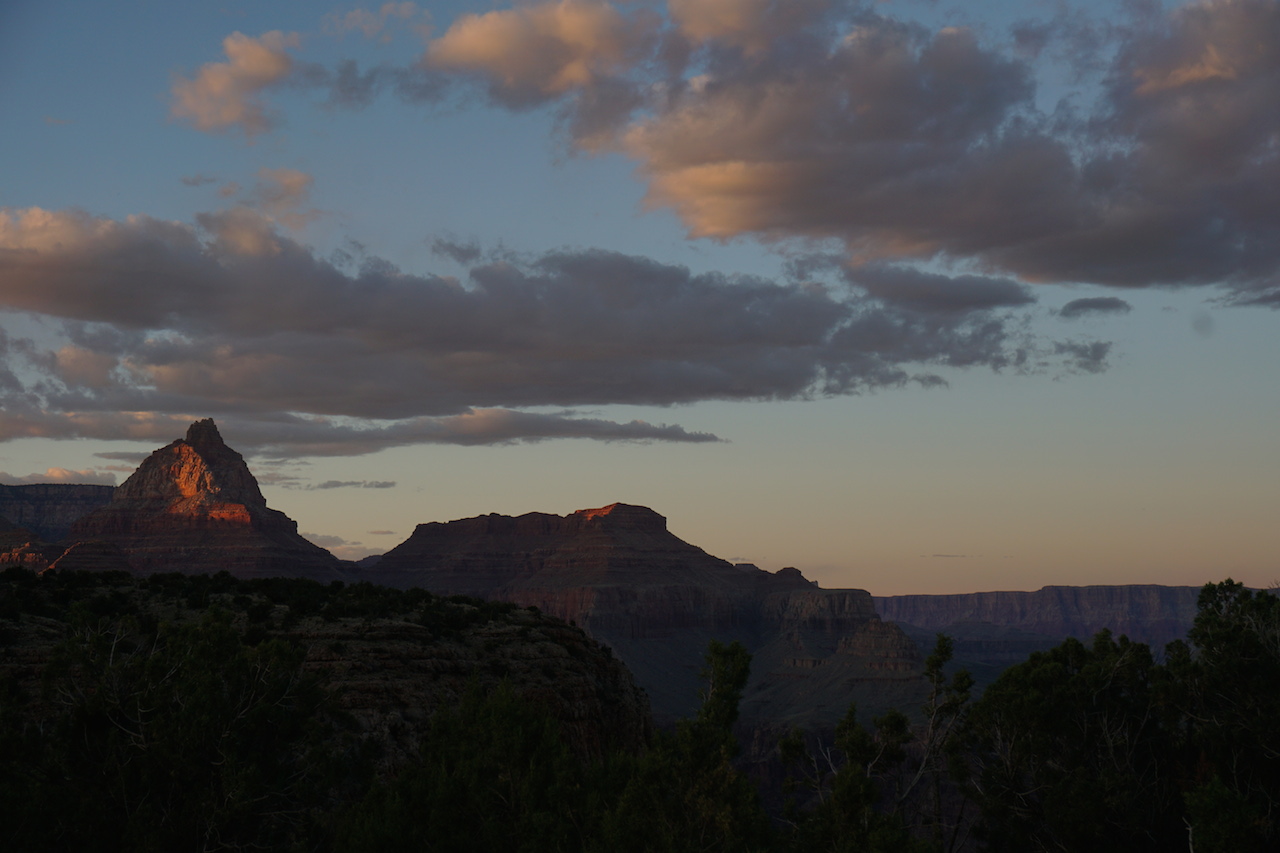
Indian Garden is 4.7 miles from and about 1,300' higher than Bright Angel Campground. Though you can certainly hike up from the river to the rim in one day, a one-night stop at the verdant oasis of Indian Garden is more than worth it. Plateau Point, just 1.5 miles from the campground, is a phenomenal place to be during sunset: the light bathes the canyon softly in hues that change by the minute. Here you may see a California condor (with a wingspan of nearly 10 feet) soaring above. We recommend packing dinner and enjoying the ever-changing views from this majestic spot. Pack your headlamp for the hike back.
The remaining ascent along Bright Angel Trailhead is steeper than the first uphill segment to Indian Garden. There are two "rest houses" with seasonal water stations on the way up that are usually turned on each year sometime in April.
More info available through NPS on the South Kaibab and Bright Angel trails.
Days: 3-4
Mileage: 35 mi. (including optional 14 mi. r/t to Ribbon Falls and 3 mi. r/t to Plateau Point)
Elevation: South Kaibab trailhead 7,260'; Colorado River 2,400'; Bright Angel trailhead 6,860'.
Camp locations: Bright Angel Campground, Indian Garden CG
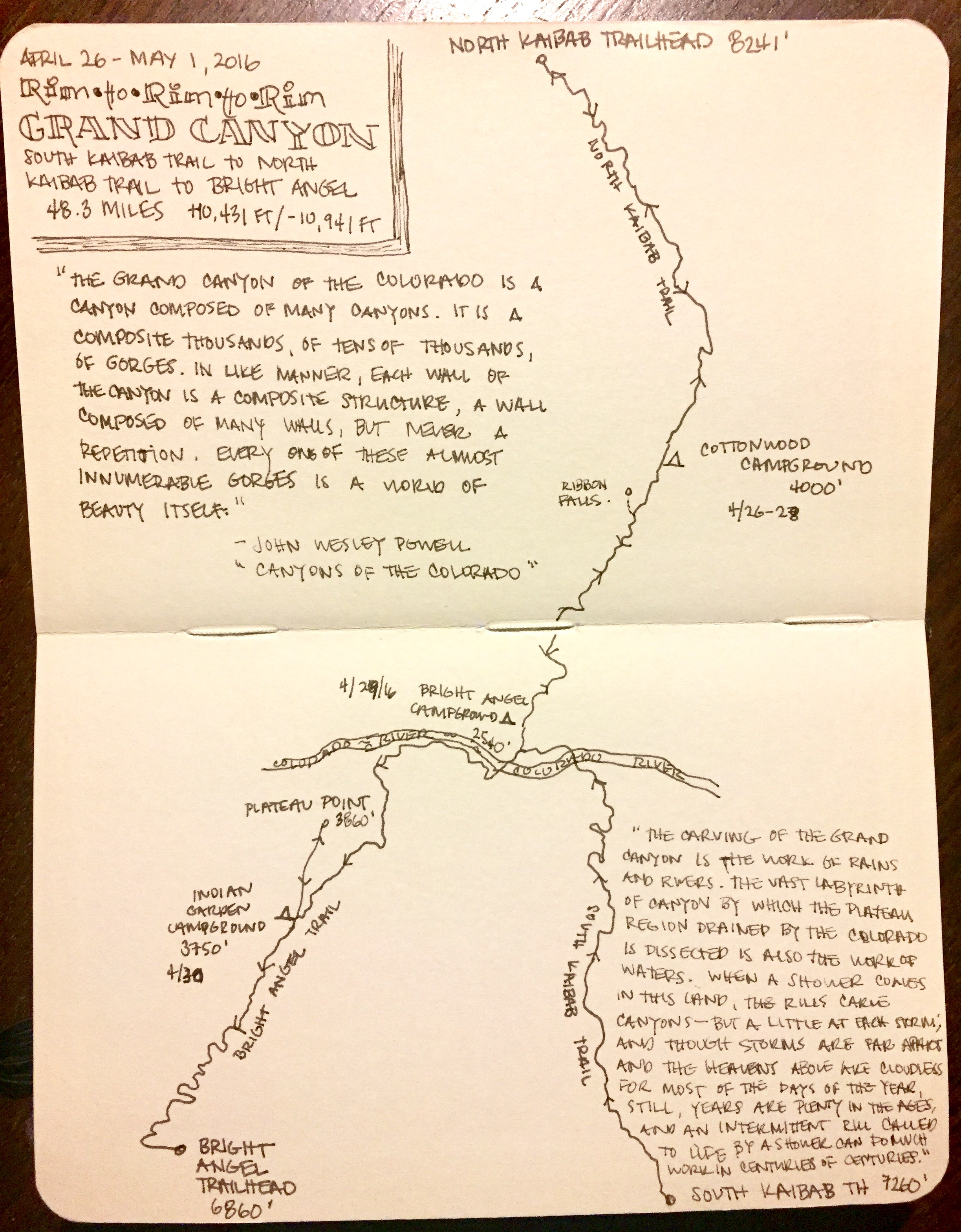
Rim-to-Rim-to-Rim
Returning to the Grand Canyon each spring over a few years, we worked up an appetite to hike Rim-to-Rim. We decided 2016 would be the year to feed that craving, and further decided that we might as well make it a yo-yo hike (South Rim to North Rim and back to South Rim) while we were at it. Logistical planning for shuttling between the two rims can be pricey and a bit complicated. That, and the North Rim does not open to vehicles until mid-May (about 2 weeks after our planned hike). And so we decided we'd start and end in the South Rim, taking a different route out and back.
Our itinerary was for 2 nights at Cottonwood Campground, followed by one night each at Bright Angel and Indian Garden. We went down the South Kaibab and up Bright Angel trail and were joined by four friends. In retrospect, reaching Cottonwood that first day made for a very long and tiring day, maybe because hiking in a group tends to make for a slower pace. We had just over 14 miles to cover according to the map, but our GPS registered closer to 16. But the effort was more than justified when got to observe two bighorn sheep enjoying their afternoon just off the trail on our way to camp,.
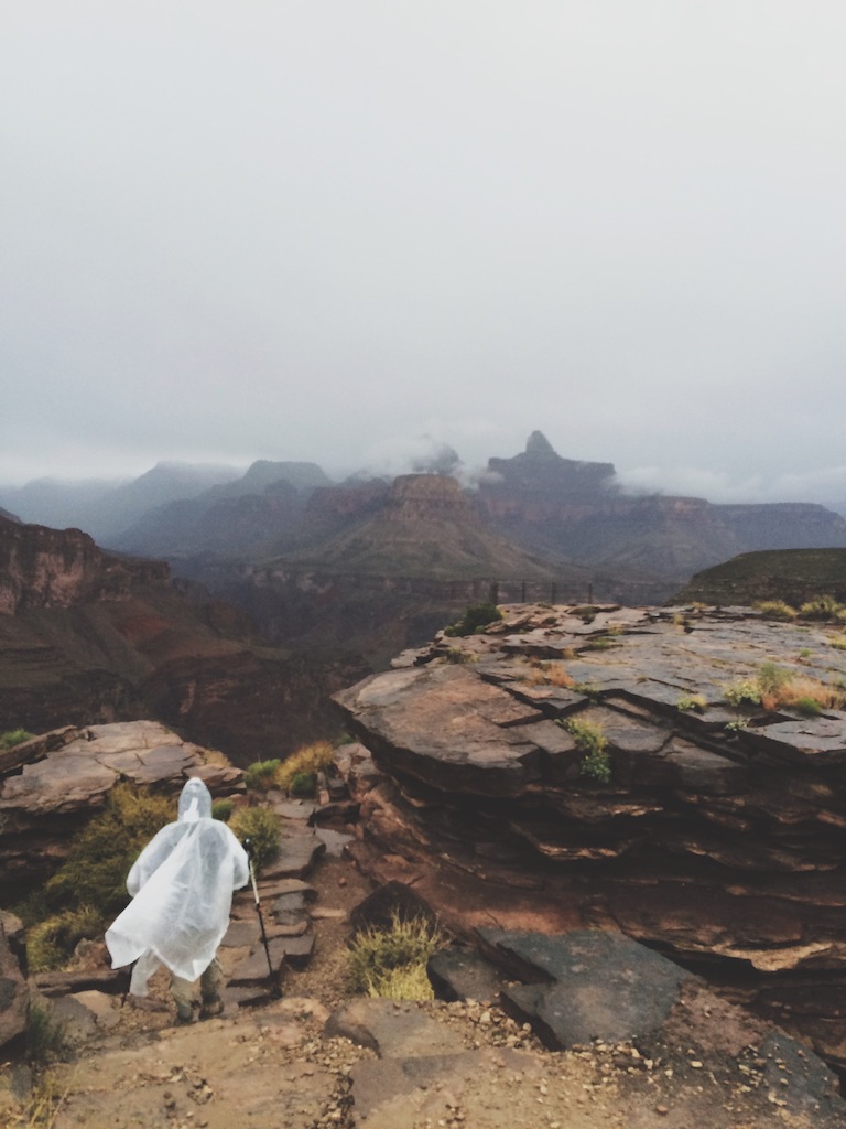
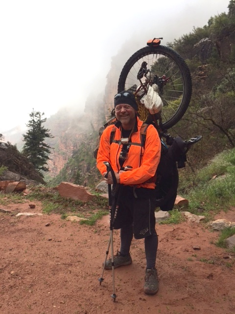
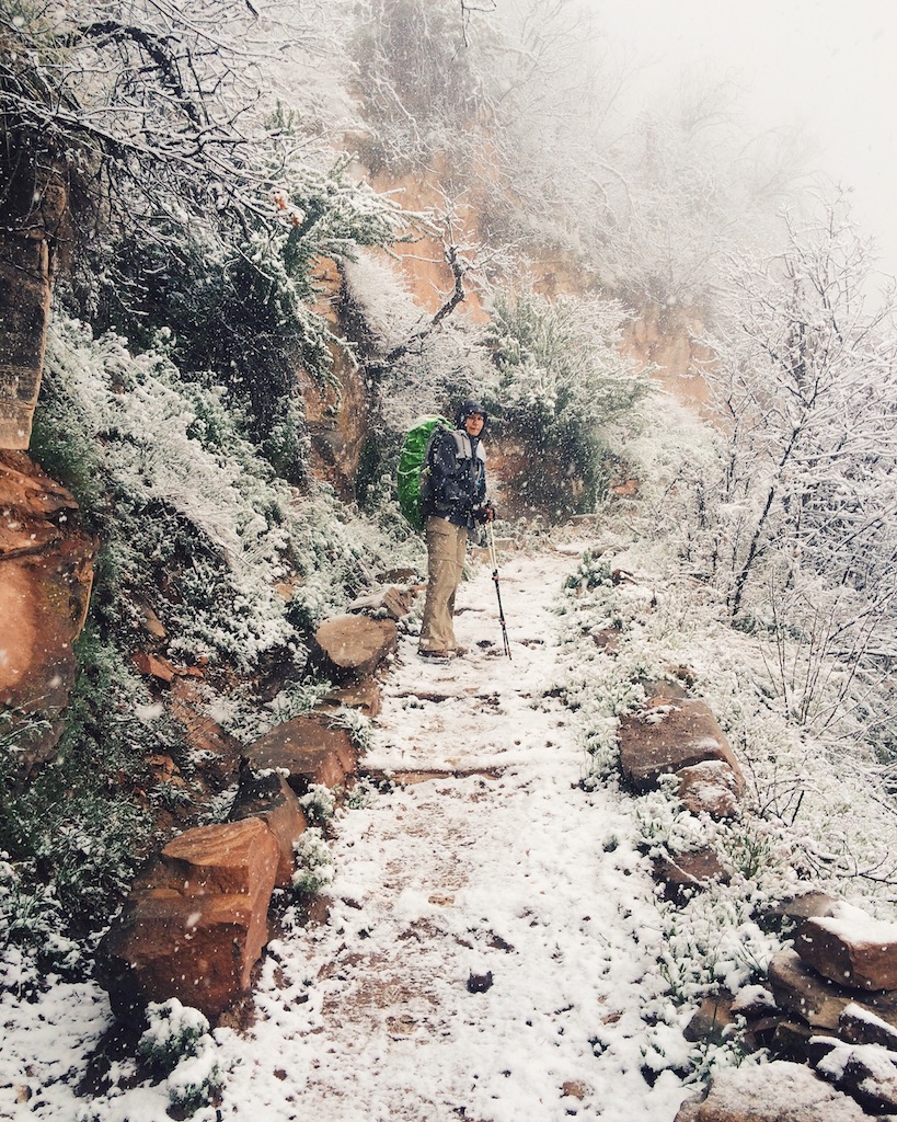
On day 2 we hiked to the North Rim and back. A storm was in the forecast, which manifested as rain at the canyon bottom and snow at higher elevations. Several inches of the fluffy stuff accumulated on the trail, trees and our packs. It made for a magical experience, especially in the relative solitude we had with just a few other intrepid hikers heading to or from the closed North Rim. We greeted passing hikers with "Merry Christmas in April!" Another unexpected sight was seeing bike-packers doing the Arizona Trail carrying partly-disassembled mountain bikes hoisted on their backs. Much of the Arizona Trail is done by mountain bike, but riding through the National Park is not permitted -- prompting this innovative solution.
Day 3 included a stop at Ribbon Falls on the way to Bright Angel Campground, and then plenty of time to enjoy drinks and board games at the canteen.
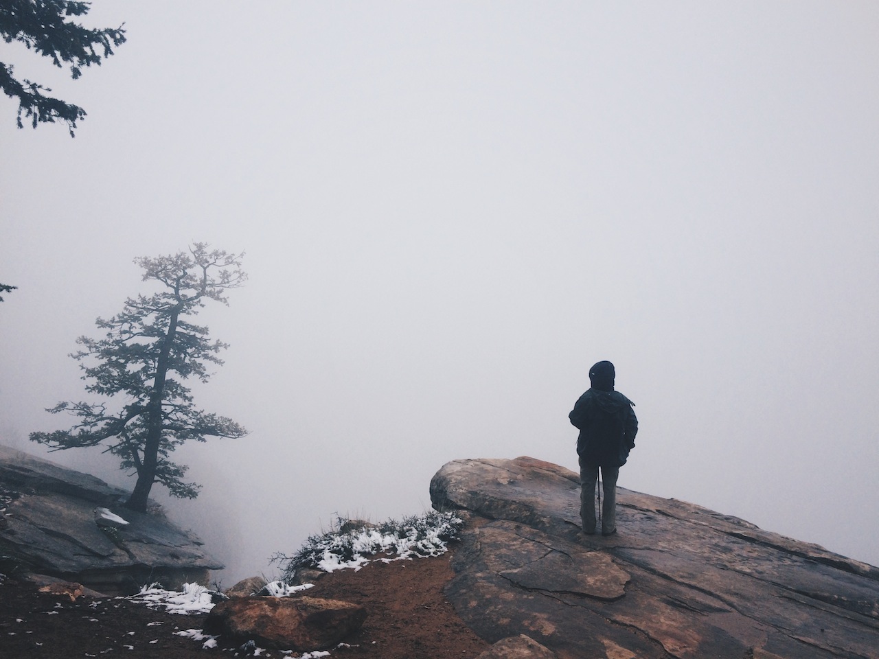
On Day 4 we hiked to Indian Garden just as another storm rolled in. By the time we arrived at camp it was pouring. We learned before our trip that a group of friends were planning a trip to the Canyon around the same time and that their itinerary was for a night at Indian Garden on the same day as us. They arrived after us as the worst of the downpour was happening. Despite the conditions, everyone was happy to see each other and help out. That afternoon we also learned that a planned gathering of multiple parties on different permits is a big no-no by park rules -- presumably to limit overuse of resources by larger groups. The ranger on site misunderstood our chance gathering and thought we it was a pre-meditated rendezvous. Fortunately, he let us off the hook. It continued to rain much of the afternoon. As we hiked out to Plateau Point the rain became intermittent, making for beautiful views in the distance as rain clouds gathered and dissipated.
On our final day we said goodbye to our friends and headed up to the rim in time to have a celebratory pizza and beer lunch in the Village.
See info sheets available through NPS on the South Kaibab, North Kaibab and Bright Angel trails
Days: 5
Mileage: 48.25 mi. (including optional 0.75 mi. to Ribbon Falls and 3 mi. r/t to Plateau Point)
Elevation: South Kaibab trailhead 7,260'; Colorado River 2,400'; North Kaibab trailhead 8.241': Bright Angel trailhead 6,860'.
Camp locations: Cottonwood Campground (1st and 2nd night), Bright Angel CG, Indian Garden CG.
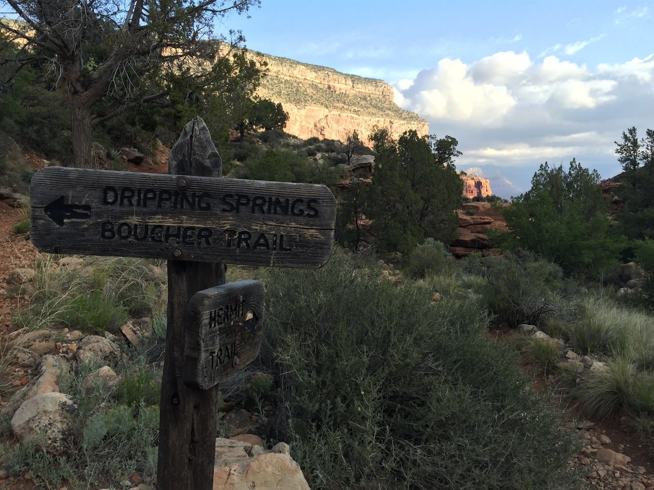
Hermit Trail
The Hermit Trail is an excellent introduction to going beyond the Inner Canyon Corridor. The trailhead is located west of the South Rim village and is accessed via Hermit Road, a gated road closed to most park visitors during high-visitation months. Backpackers with a permit are allowed access.
Driving ourselves to the trailhead instead of relying on the hiker shuttle allowed us to start at Hermits Rest trailhead very early, just as the sun came up. The trail is steep and unmaintained, losing about 2,000 feet of elevation is 2.5 miles, and a few portions of trail are concealed under rockslides. Give yourself extra time for route-finding, navigating challenging terrain and taking in the breathtaking views. Our destination on Day 1 was Monument Creek (BL7), 9.3 miles and about 3,650 feet down. Look for the "monument" of Monument Creek, a pinnacle that towers about 250' near the creek. There are designated campsites which are dispersed rather than concentrated in a campground like sites in the Inner Canyon Corridor. A 1.6-mile (one-way) hike down to the river leads to Granite Rapids and is worth the effort.
One of the more curious features of this hike is the series of 3-walled toilets at Monument Creek. There are three such thrones arranged in a row, rather like cubicles, with one open side. These are truly "loos with a view" (as our hiker friend Rosie likes to say), but they won't do much to help your bowels relax -- unless you just don't give a sh!t about looking into other backpackers' campsites and having them look back at you. To our surprise, this isn't the only place in the Canyon with this arrangement. We would encounter it again near Horseshoe Mesa.
On Day 2 we followed the West Tonto Trail as it meanders eastward along the open benchland of the Tonto Platform. The Tonto is a 95-mile unmaintained trail that parallels the Colorado River from Garnet Canyon to Red Canyon. It weaves in and out along the Canyon's drainages and formations, losing and gaining little elevation. Along the way you pass Horn Creek, which is a naturally radioactive water source that should be avoided. After about 10.7 miles, you arrive at Indian Garden. We recommend a sunset/dinner hike to the Point, as described in the trips above.
On Day 3 we hiked the 4.8-mile ascent up Bright Angel Trail to the rim. From Bright Angel trailhead we took the Hermit Road Shuttle (Red Route) to pick up our car, and celebrated as we usually do with a pizza and beer lunch in the Village.
The NPS info sheet on the Hermit Trail has more information. Animal-proofing is required as ammo boxes are not provided at Monument Creek. The backcountry office sometimes has critter-proof Outsaks available to lend or rent. The market at the Village Market Plaza sells them.
Days: 3
Mileage: 31 mi. (including optional 3.2 mi. r/t to Granite Rapids and 3 mi. r/t to Plateau Point)
Elevation: Hermit trailhead 6,640'; Monument Creek 2,995'; Granite Rapids 2,330'; Bright Angel trailhead 6,860'.
Camp locations: Monument Creek, Indian Garden
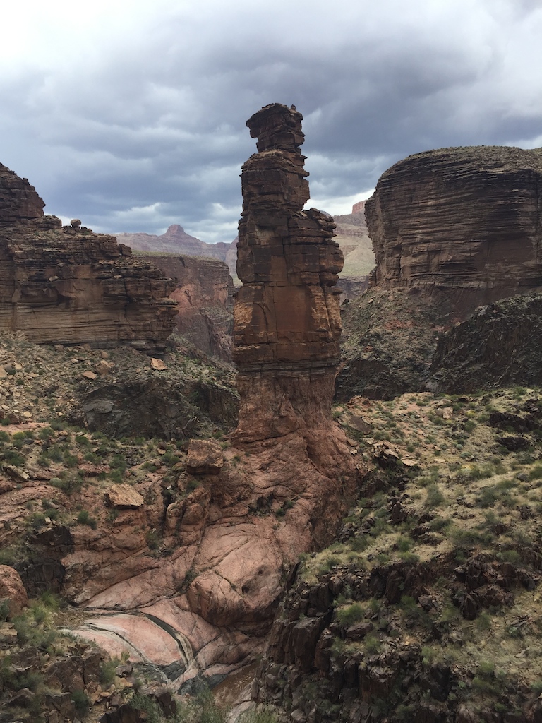
New Hance Trail to Grandview Trail
This route is along one of the oldest and hardest trails into the Canyon. New Hance is an unmaintained, steep and rocky trail with loose footing and plenty of opportunity to practice class 2 scrambles.
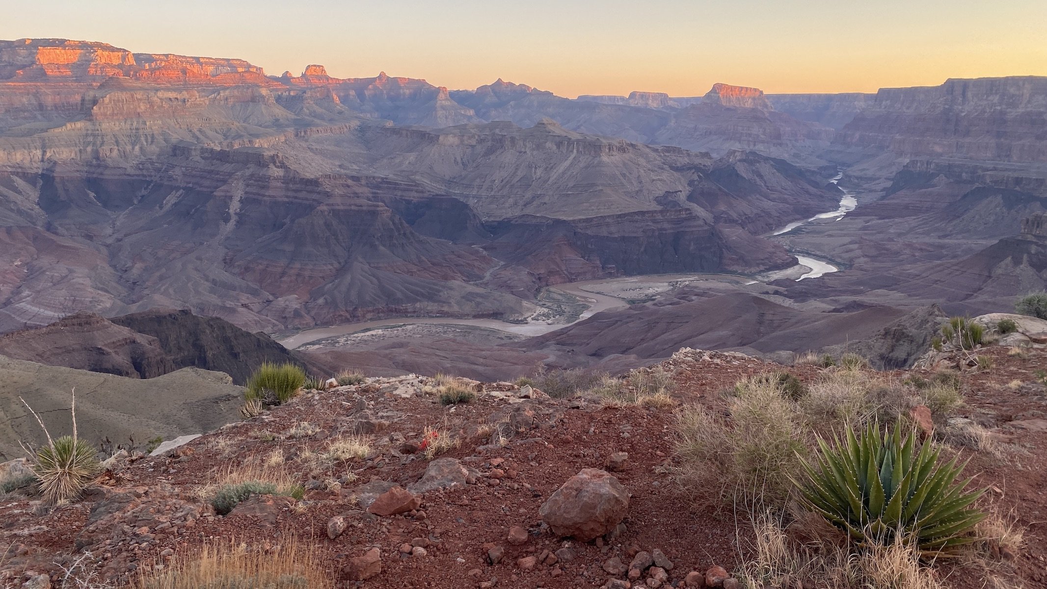
We started at New Hance trailhead, located between Grand Canyon Village and Desert View. Though the distance to the river is only 6.5 miles, be prepared to have it be very slow-going. Rockfalls and boulders make portions of the trail difficult to maneuver, while in parts the trail is unclear or offers multiple faint pathways that require route-finding. There is no reliable water along this route until the river. The last third or so of this segment is along Red Canyon, where the path follows the drainage down to the Colorado. Primitive, at-large camping is at the mouth Red Canyon near Hance Rapids (BD9). We chose an established site just upstream of the rapids. There were several sites, closer or farther from the river, but we were the only ones camping in this area that night.
On Day 2 we followed the Tonto East trail for about 7 miles before heading southwest for an ascent up to Horseshoe Mesa. The final 1.5 miles include a very steep ascent. A short spur trail to Page Spring provides an opportunity to take a break and fill up water before that final push. Camping at Horseshoe Mesa (BF5) is in spacious designated sites with great views of the surrounding formations. Bathroom facilities are the same innovative configuration as at Monument Creek -- three walls to kind of cover you, and no door to actually cover you. At least here they are dispersed rather than lined up in a row as they are in Monument Creek.
After dinner at camp our group went spelunking at Cave of the Domes, one of an estimated 1,000+ caves in Grand Canyon National Park but the only that is open to the public. The cave was closed for a period in 2016 due to risk of exposure to hantavirus but was deemed safe and reopened prior to our trip. The cave is approximately one mile from camp and has many "rooms," only a handful of which we entered. Stalagmites, stalactites, glistening minerals and inscriptions that are over a century old will keep you busy during your exploration. The cave's floor is covered in a very fine dust and you will be more comfortable if you bring a neck gaiter or bandanna to cover your nose and mouth. And of course it helps to have a good description and detailed map to find the cave.
On our final day we followed Grandview Trail up the short, steep 3-mile stretch to the rim, ending at Grandview Point. We picked up our party's second vehicle at the starting trailhead and of course headed into the Village for obligatory pizza and beer to celebrate.
Trailhead logistics for this route require some planning. The shuttle buses from the Village do not serve either of the trailheads, and there is limited parking near New Hance trailhead (and no parking immediately adjacent to it). Since we hiked with friends, we were able to shuttle between the starting and ending points. I looked into alternatives in the event our friends weren't going to be able to make it, and short of hitchhiking or walking the 5.5 miles between starting and ending points, I didn't find any viable alternatives.
More details on this route are available on the NPS info sheets for New Hance and Grandview/Horseshoe Mesa.
Days: 3
Mileage: 20.2 mi. (including 2 mi. r/t to Cave of the Domes)
Elevation: New Hance trailhead 6,982'; Hance Rapids 2,560'; Horseshoe Mesa 4,900'; Grandview trailhead 7,400'.
Camp locations: Hance Rapids, Horseshoe Mesa


Miscellaneous Details and Recommendations
Secure your permits about 5 months in advance. Start by reading the excellent info on the park's backcountry trails and camping page. One of the nice things about the Grand Canyon backcountry permit system (as opposed to the less nice aspects such as, say, faxing your request in and not knowing if it was received) is that your permit is issued by camping location for up to 6 people, not by number of hikers. A regular (non-group) permit covers up to 6 people. We have successfully added friends to our permit after first securing the permit. Of course it's not always possible to plan months ahead of time. If you find yourself in this position, don't be discouraged. If you have a bit of flexibility in terms of starting date and maybe route, you can try for a walk-up permit at the backcountry office.
Getting to the trailhead. The park operates multiple shuttles serving several South Rim routes. The shuttles will get you to all trailheads described above except for New Hance and Grandview. Rides are free; time tables change depending on the month. Overnight parking is available at the Backcounty Information Center.
Camping or lodging before the hike. We've done it both ways. We have camped at Mather Campground prior to starting our hike but now prefer to stay at Yavapai Lodge instead (it's usually the most reasonably-priced hotel in the area). There are two reasons for this. First, we start our hikes in Grand Canyon as early as possible, often waking up at 4 or 4:30am. Camping the night before means packing our backpacks the morning of the hike takes longer. Second, depending on the weather a night at the rim in April can be well below freezing, and we're more likely to get a good night's sleep if we're not shivering.
Weather. That brings us to weather. Spring and fall in Grand Canyon can bring almost any weather -- hot and sunny or cold and wet. In addition to that range of possibilities, there is huge variability between weather at the rim and on the Canyon floor. The temperature when you start your hike before sunrise at the rim you might be in the 30s. On a hot day in April, mid-day temps at Phantom Ranch can be in the 90s. Check the forecast prior to your hike and pack accordingly.
Know your limits. Park officials like to remind people that going down is optional but going up is mandatory. The Canyon is a stunning place to visit because its jagged and varied topography makes it a true wonder. That topography that makes it splendid is physically challenging to travel and can be difficult to navigate depending on many factors -- your skill and experience; your physical condition (which means not only how fit you are but whether you happened to injure yourself while hiking); the often-times unpredictable weather; how well hydrated you are; and many more variables. Park officials can issue warnings until the cows come home, but ultimately you must know your limits and know when you are being humbled by nature. Hike your own hike and don't go so far beyond your limits that you will endanger yourself. And yet it happens to Grand Canyon hikers every year. So please plan carefully and don't overdo it. Even a modest itinerary is comparatively grand in this land -- there is no need to start big. I don't want anyone reading this to end up in the next edition of Over the Edge: Death in Grand Canyon.
Celebration meals before and/or after the hike. A lovely way to celebrate being in this wonder of the world is to have dinner at the historic El Tovar Dining Room. We like to go the night before a beginning our hike. Reservations are available up to 30 days in advance. If you finish your hike in time for lunch, pizza and beer at the Maswik Lodge food court always hits the spot.
You can pre-order a meal in advance at Phantom Ranch. Or you can just enjoy a convivial time at the Phantom Ranch canteen without it. The canteen is closed to commoners without reservations during dining hours.