


It's a lucky thing to live in California and have an excuse to visit the High Sierra in late July. Our excuse: J's birthday is July 26 -- prime time to get into those higher elevations. Every year, we make it a point to reserve a few days (or weeks) out of the summer calendar to explore a portion of the Sierra's endless network of trails. This time around we were in the mood for a shorter trek with day hiking and cross-country options for going away from camp. This loop fit the bill perfectly.
Here's how we did it:
On Day 0 (Saturday, July 21), we arrived to Lone Pine's Eastern Sierra Interagency Visitor Center in the late morning to inquire about nabbing a walk-in permit starting at Cottonwood Pass trailhead and ending at Cottonwood Lakes trailhead. We had no problem securing a permit. After running a few errands and eating a hearty lunch at Alabama Hills Cafe, we drove up to the walk-in campground at Horseshoe Meadows (18 sites at the campground nearest Cottonwood Pass trailhead; another 12 available near Cottonwood Lakes trailhead). The campground was not full -- even on a Saturday -- but if it had been, a ranger told us that overflow camping is permitted in this area. There are plenty of bear boxes available for hikers to store any scented items not needed on the trail.
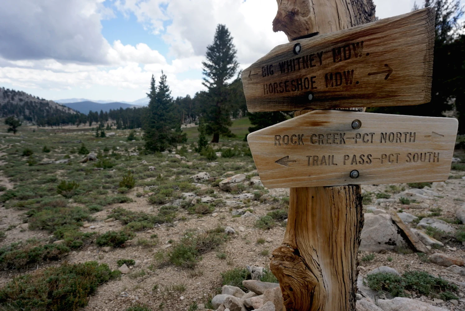
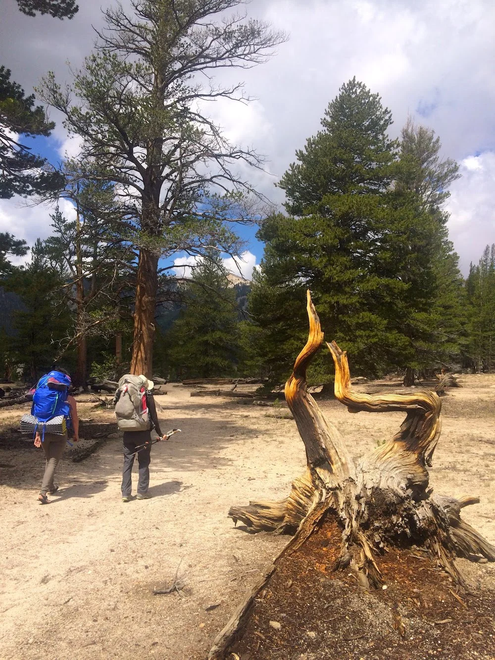
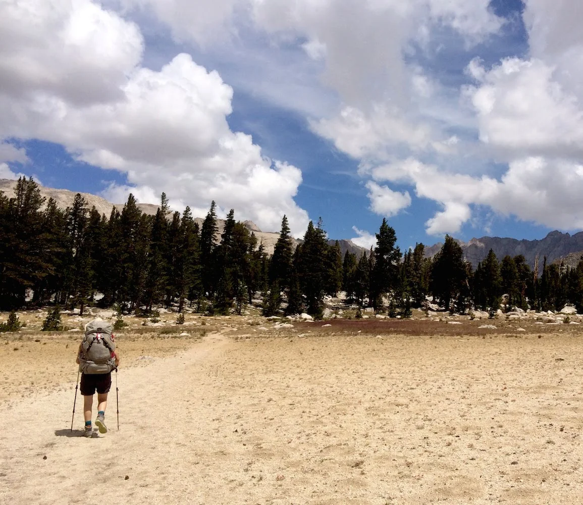
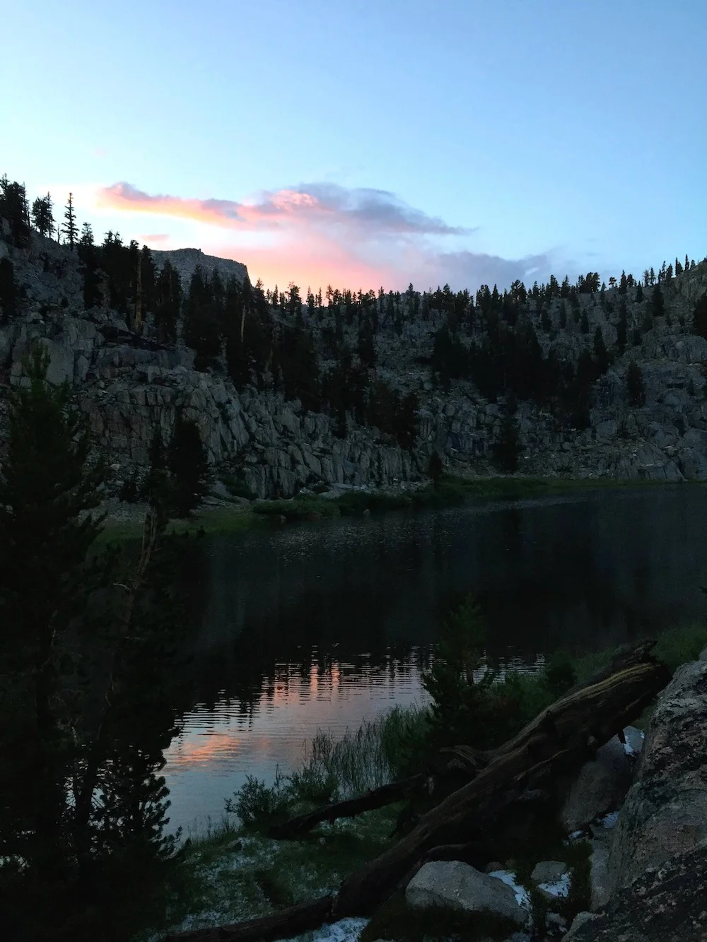
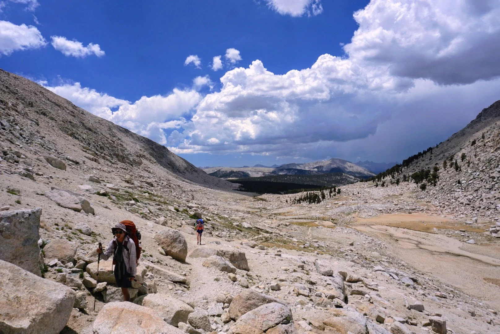
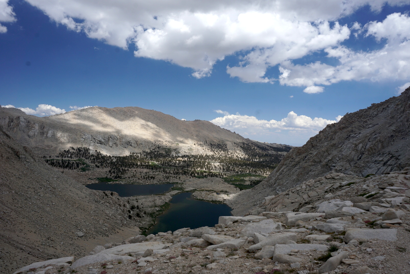
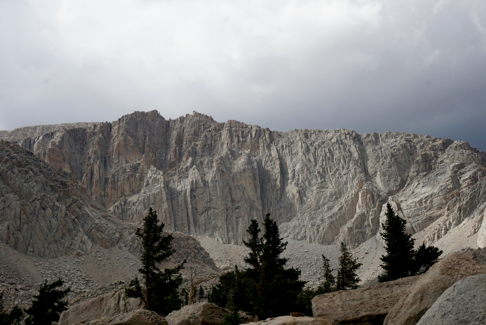
On Day 1, our adventure pal Jenna joined us. We had a slow start from Cottonwood Pass trailhead and found ourselves gradually ascending though lodgepole and foxtail pine too close for comfort to this Sierra no-no: if there is a chance of thunderstorms, do not attempt to go over a pass after 11am. Thunder started just as we neared the pass, though fortunately we made it to the other side safely. Just over the pass we joined the northbound Pacific Crest Trail, following it to Chicken Spring Lake, a pretty spot flanked by a dramatic, rocky cirque. We ate lunch and decided to make this home for the night.
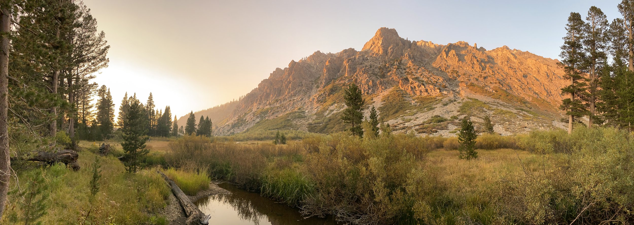
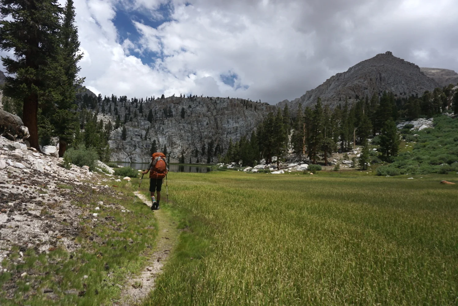
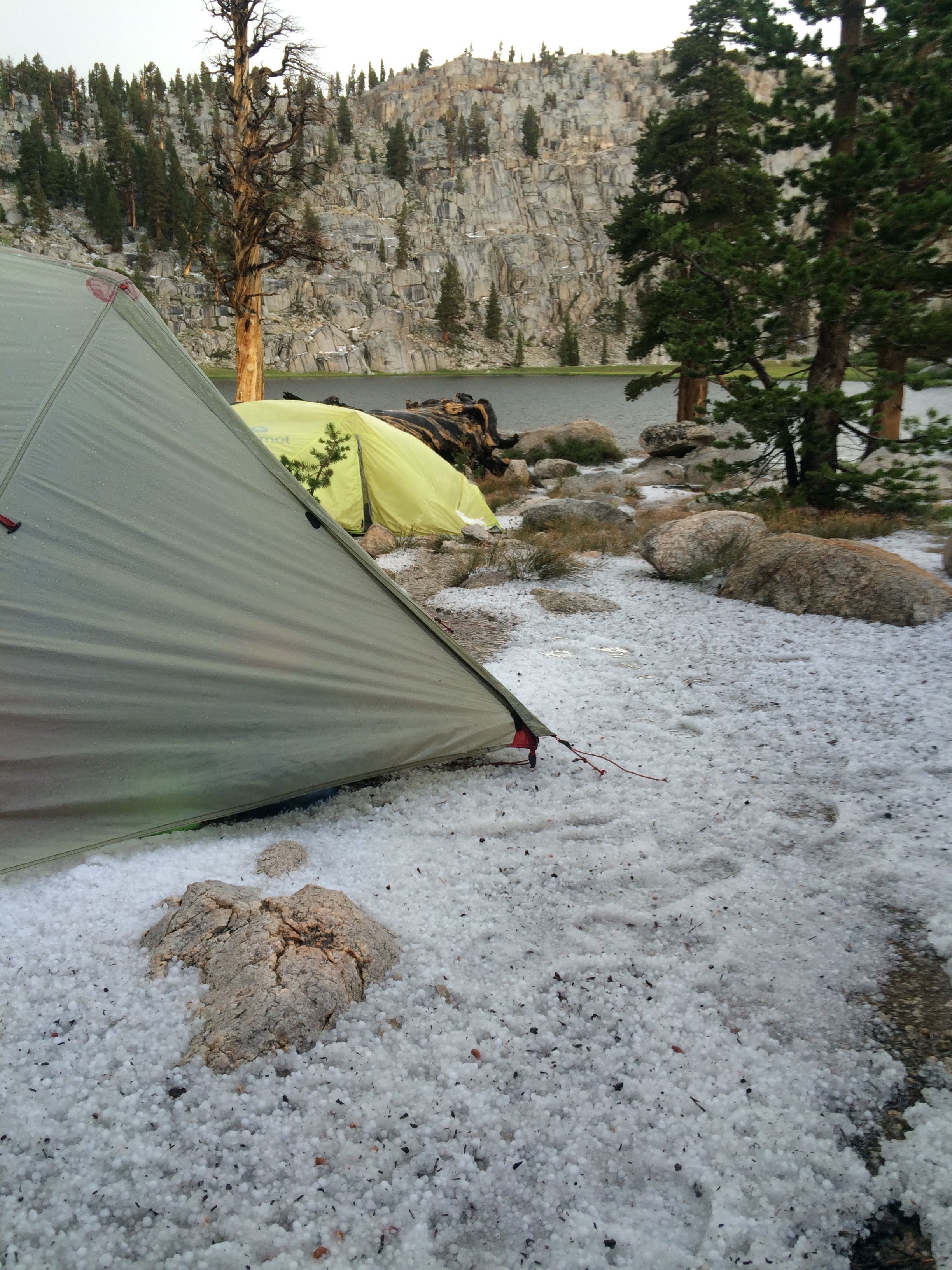
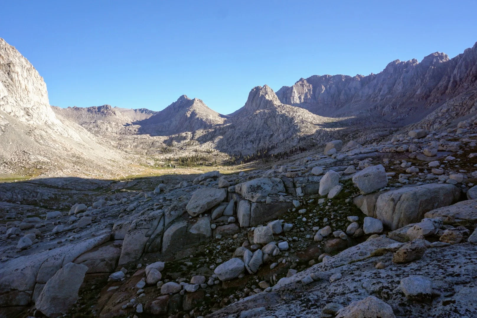
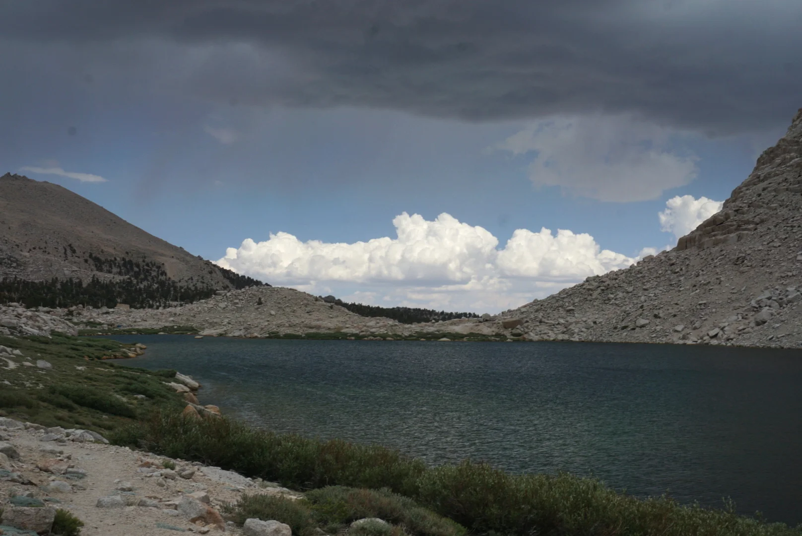
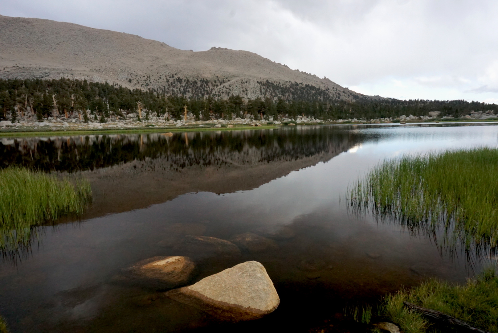
Day 2 took us about 6 miles from Chicken Spring Lake to Soldier Lake, an idyllic spot alternately covered by forest shade and verdant meadows. Thunder and lightning once again started by early afternoon. We ate lunch and set up camp just in time for the strongest storm of our trip to begin -- a deluge that dumped more than two inches of mixed precipitation, from hail, to rain, to sleet -- over a few hours. When it was finally over, the storm had covered the area in a winter wonderland sprinkling of white. We had intended to hike up to Miter Basin after lunch but fortunately had enough flexibility in our itinerary to delay our cross-country jaunt to the next day, which we hoped would offer more favorable weather.
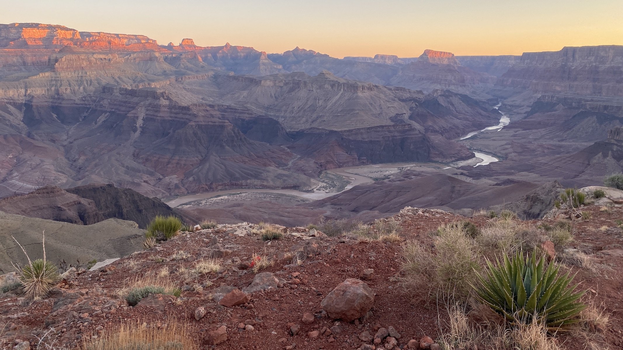
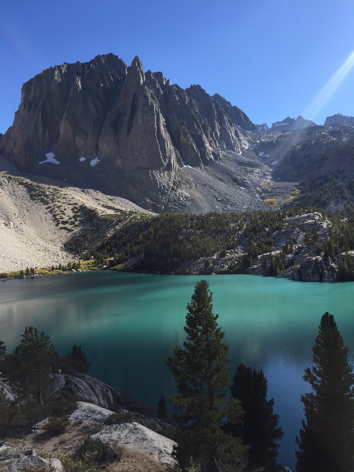
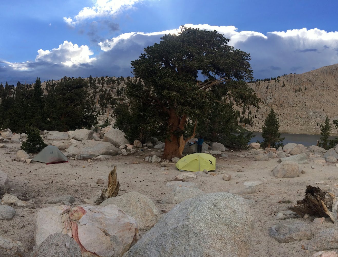
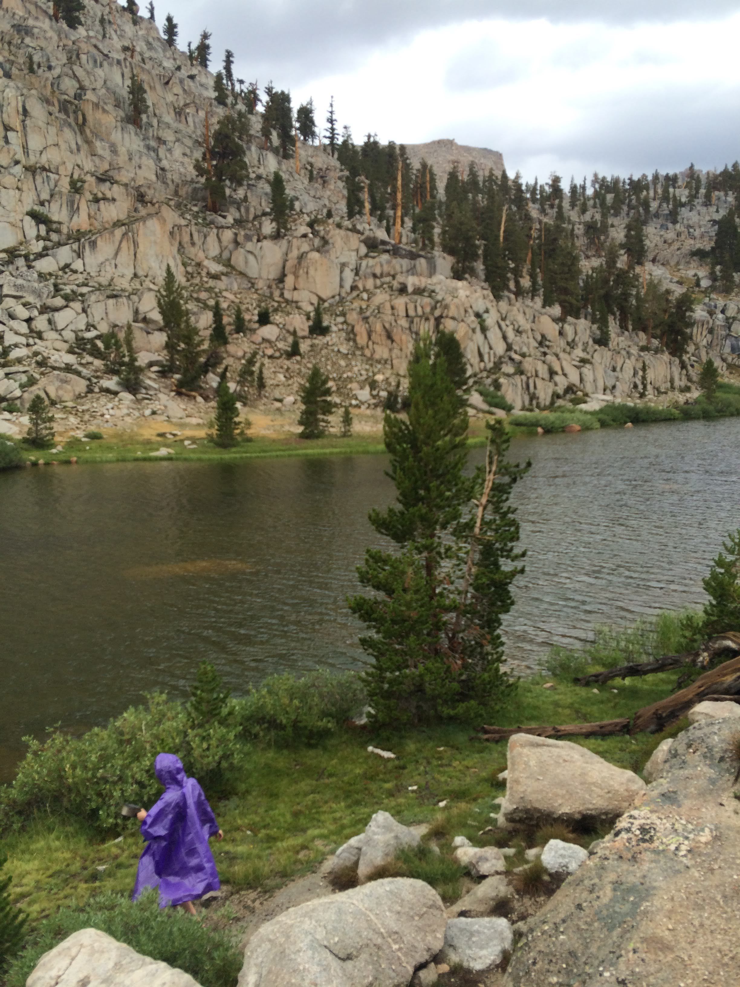
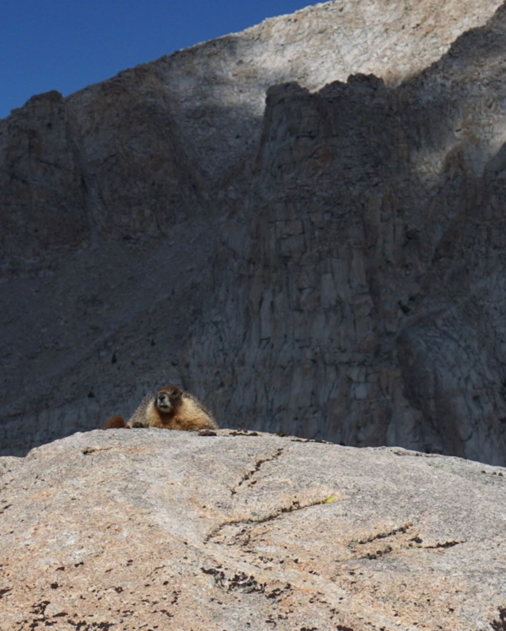
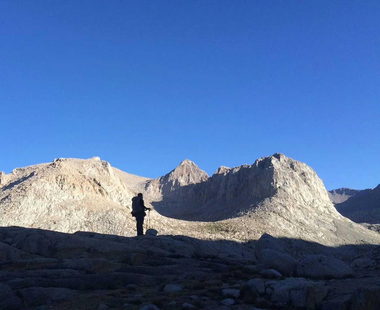
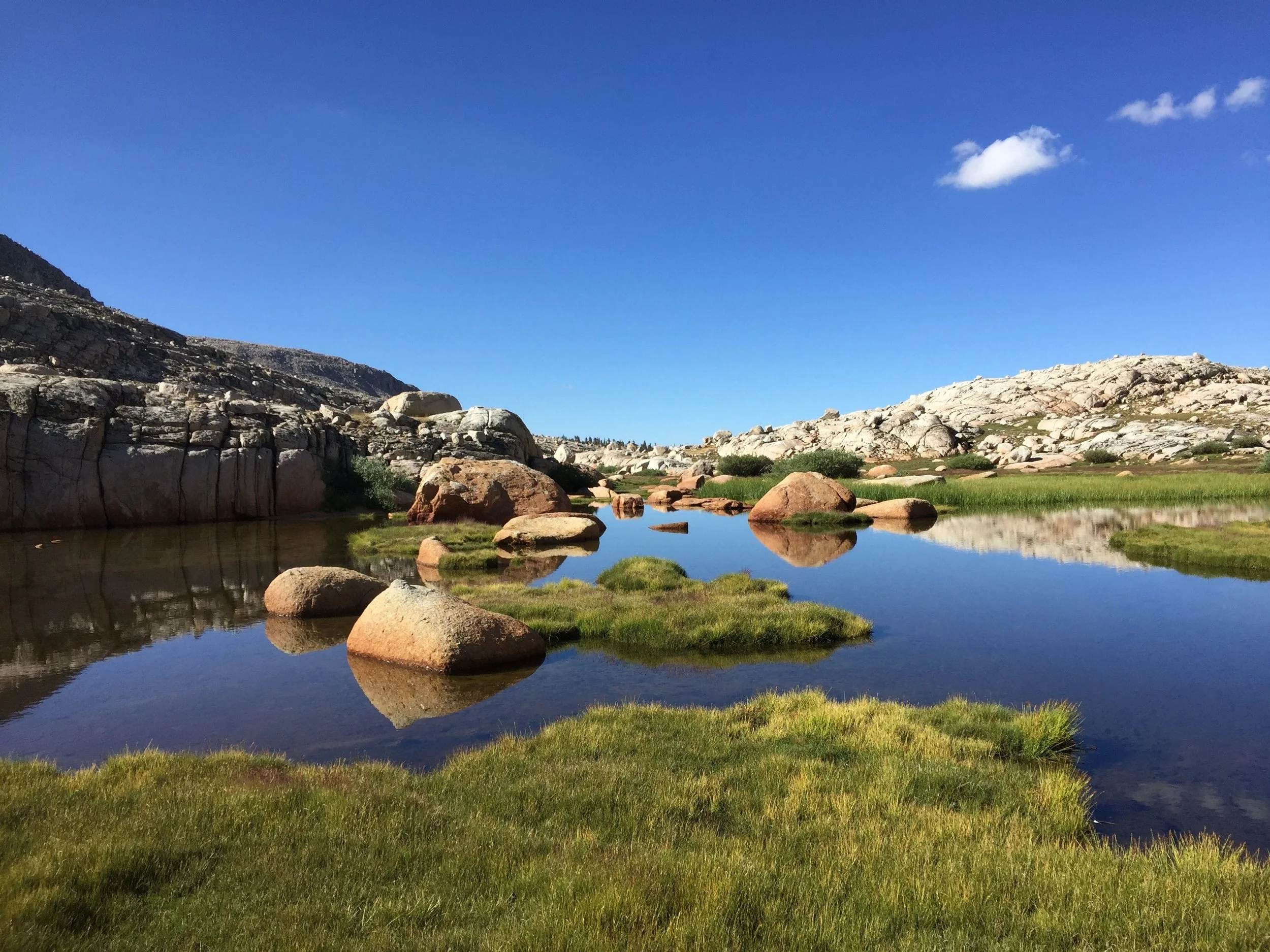
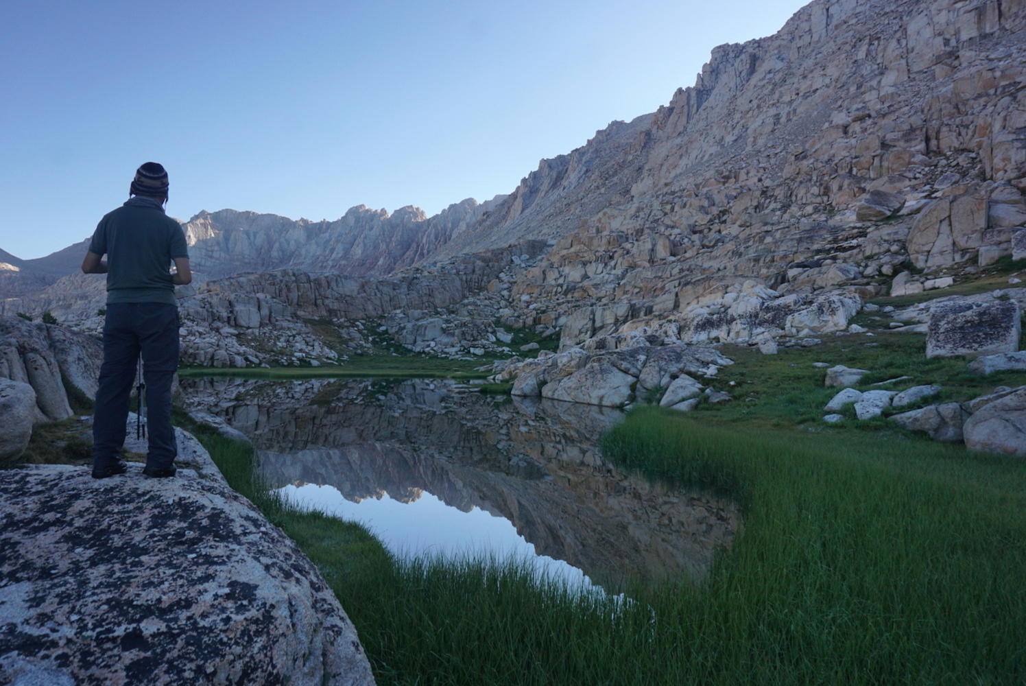
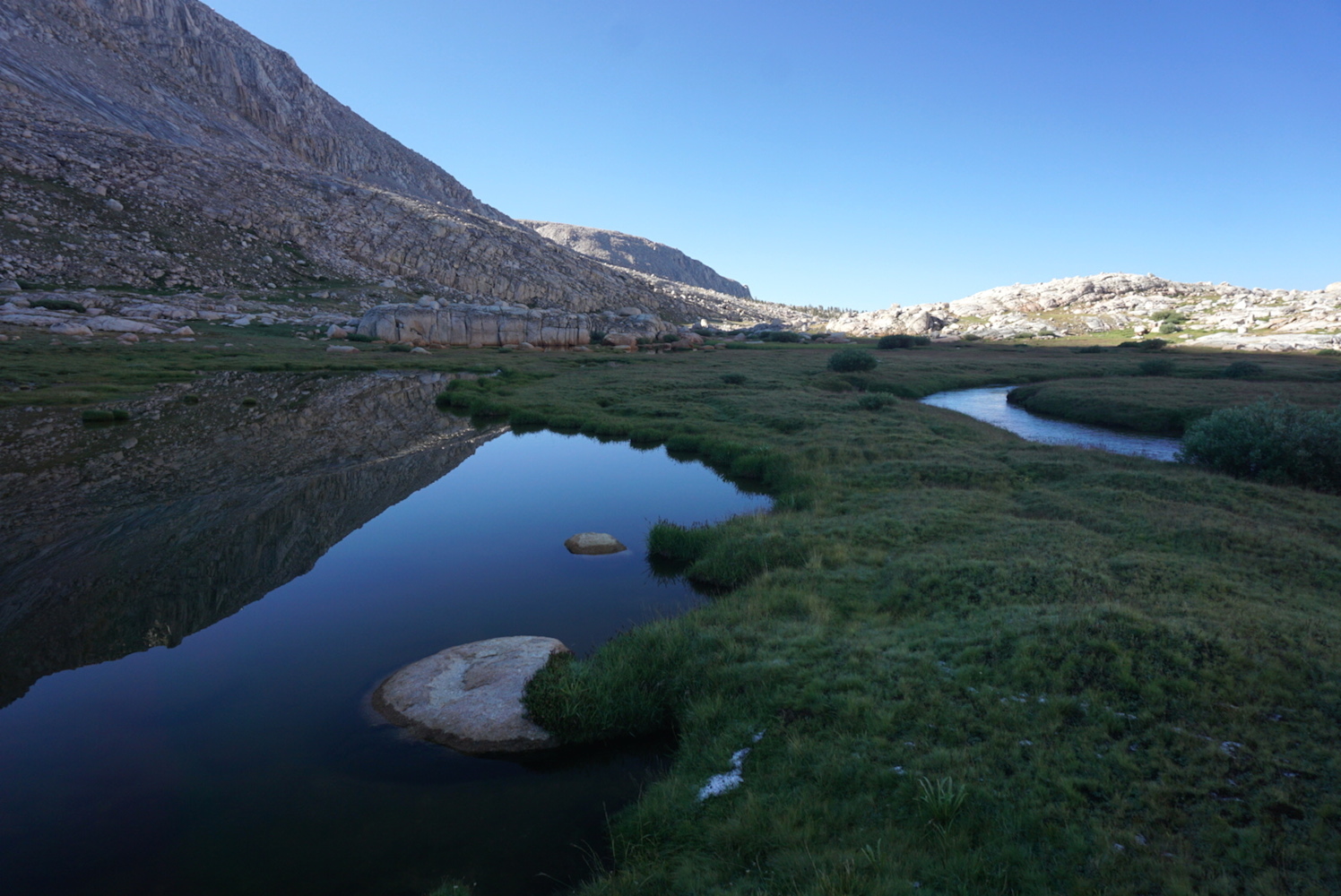
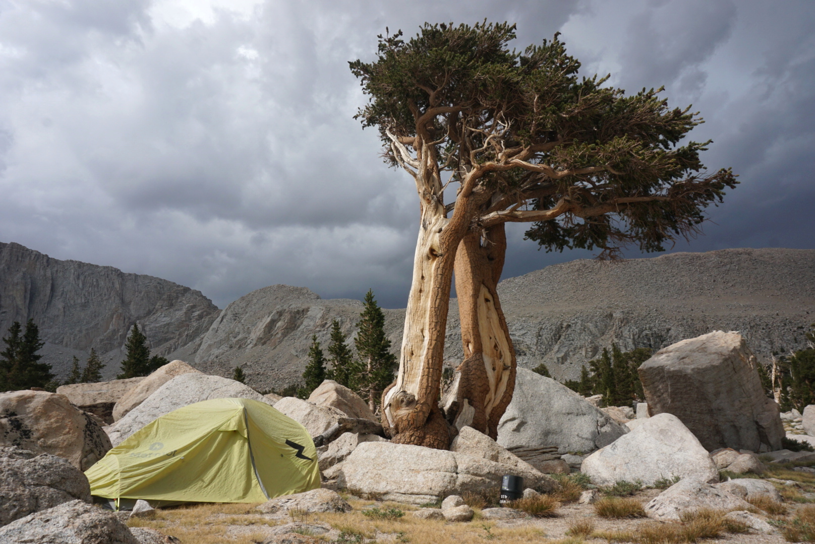
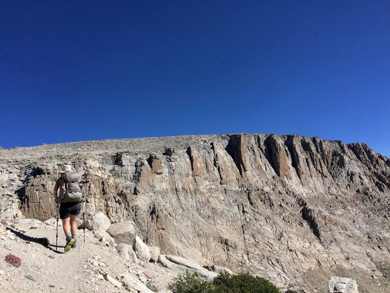
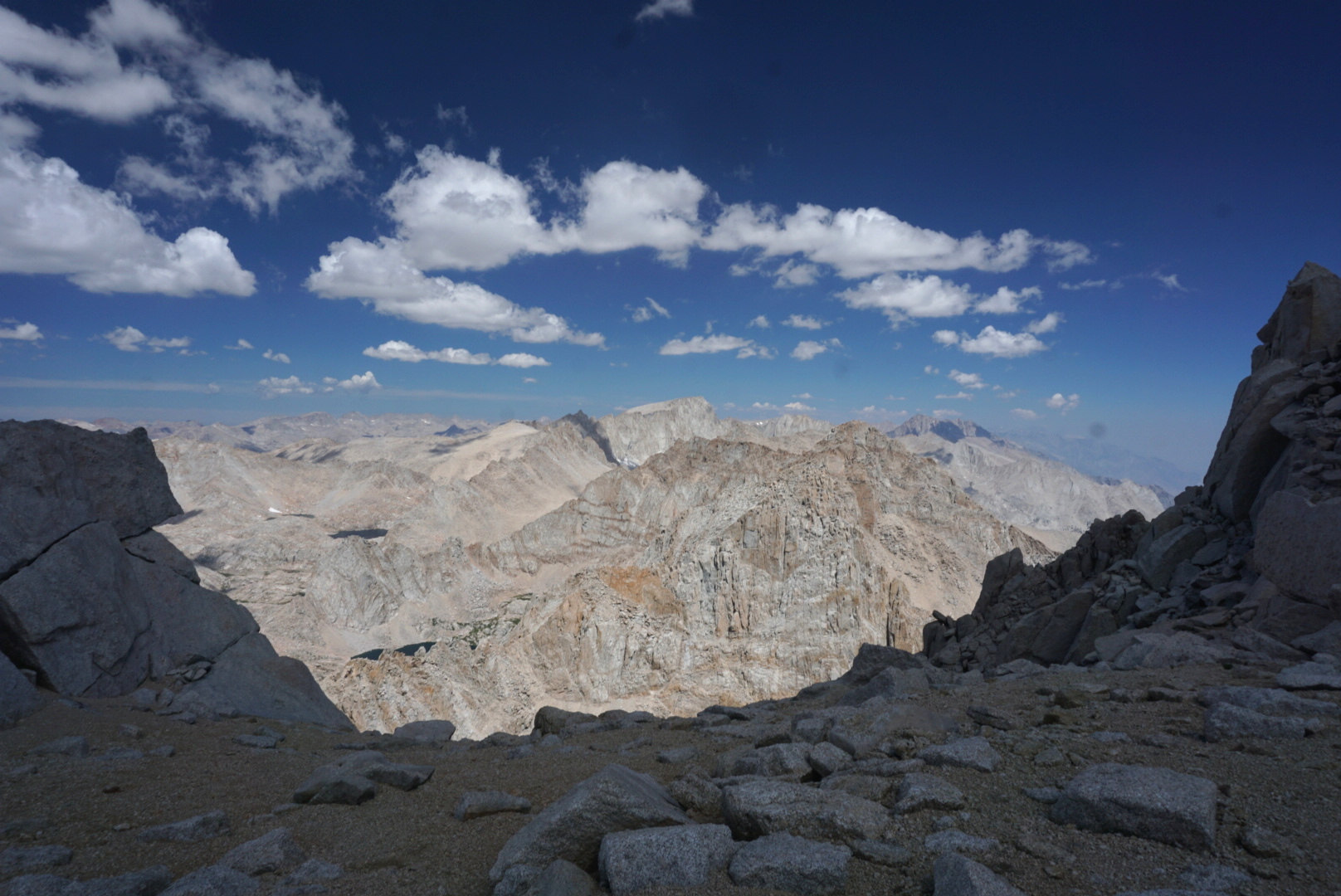
Day 3 started with a sunrise hike to Miter Basin, accessed via a scramble of a few hundred feet up the cascades of Rock Creek. Miter Basin is exquisite and did not disappoint in the least (which matched our experience with every single Sierra basin we have ever visited). Views open up immediately after reaching the top of the scramble and cross-country options abound for exploring this stunning area. With the prospect of more afternoon thunderstorms and another pass to go over, we came back to camp by mid-morning to pack up and start our hike toward Army Pass and Cottonwood Lakes. Once more, thunder and lightning started just as we were going nearing the pass, but we made it safely and found a lovely spot to call home on a boulder-strewn, lightly forested shelf above Cottonwood Lakes 4 and 5. The area is home to an impressively large population of marmots, and we were treated to our first of two sightings of the rare white-tailed jackrabbit. Despite the presence of quite a few other hikers camped near the lakes' shores (including a large group of Boy Scouts), our camp was sufficiently tucked away to give us a feeling of solitude while also shielding us from the cold, damp winds coming off the lakes (read: camping closer than 100' from a lake or other water body is not only against regulations in this part of the Sierra, but also a bad idea if you wish to sleep warmly and dryly).
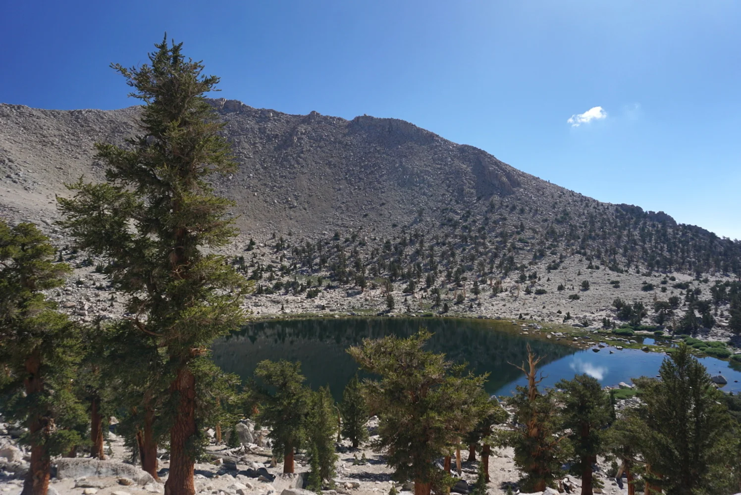
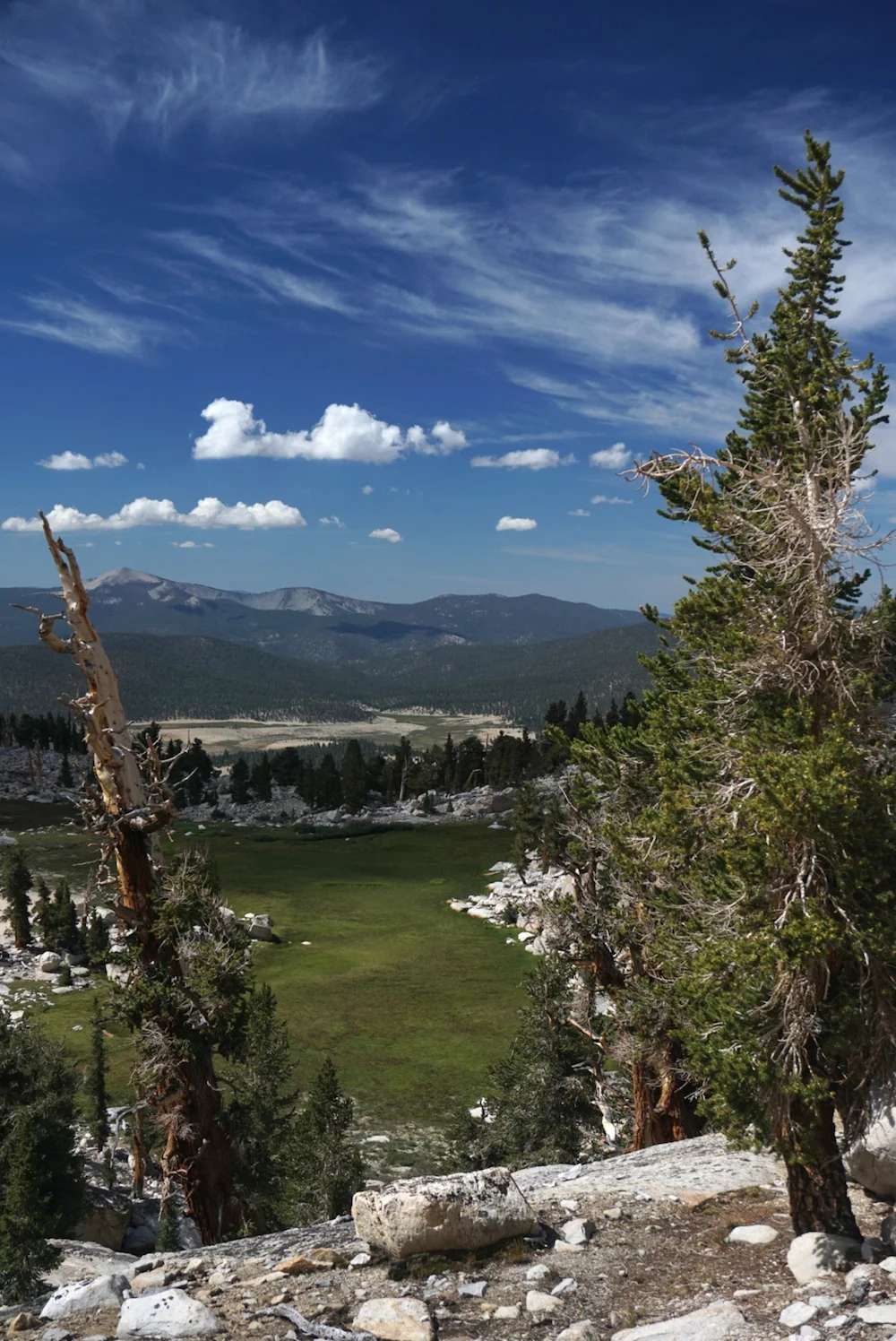
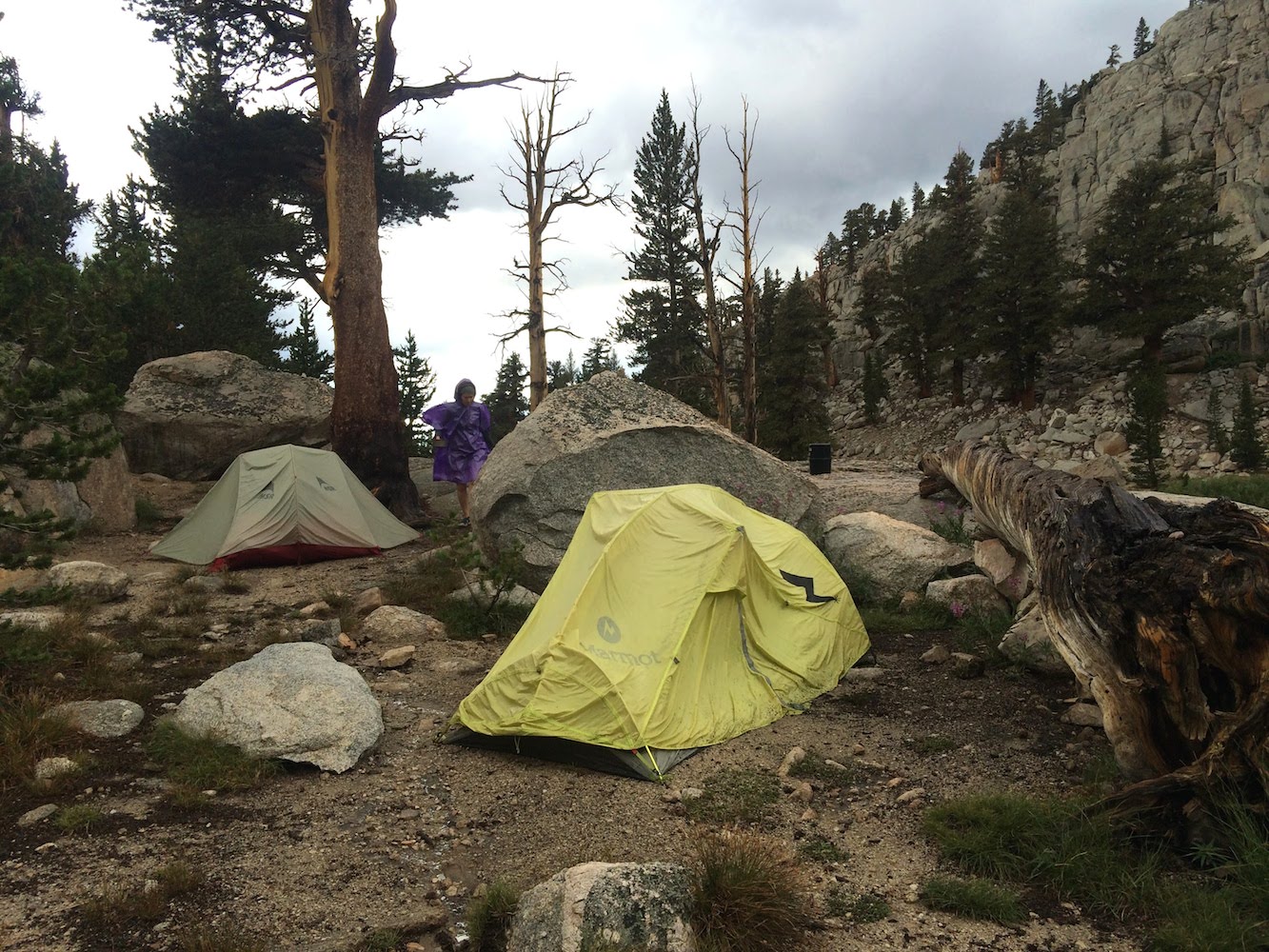
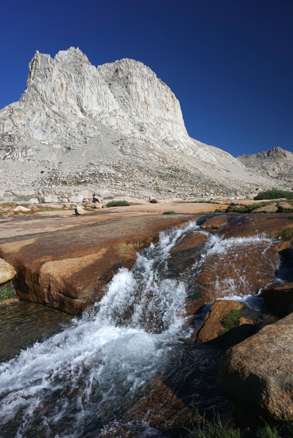
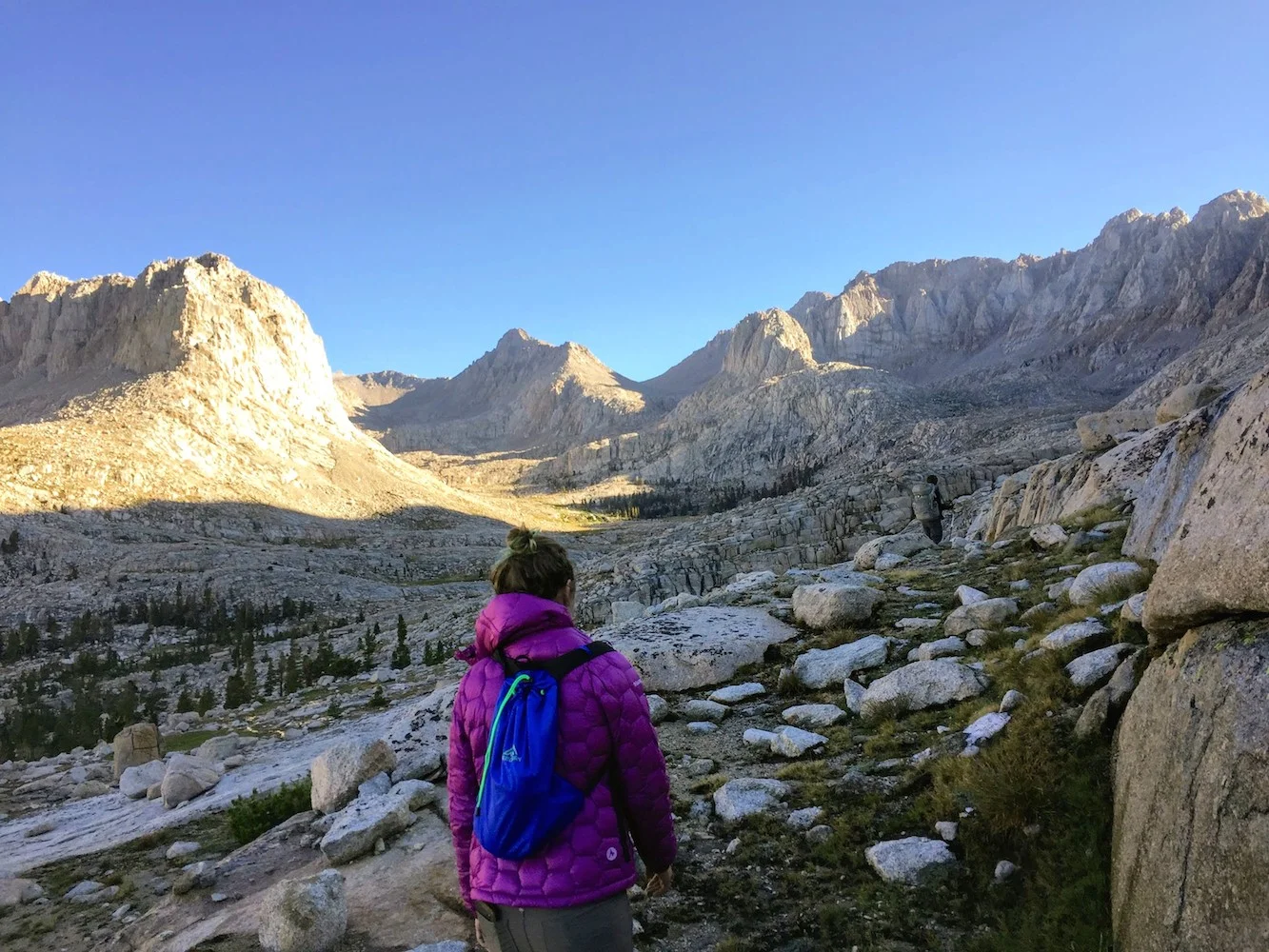
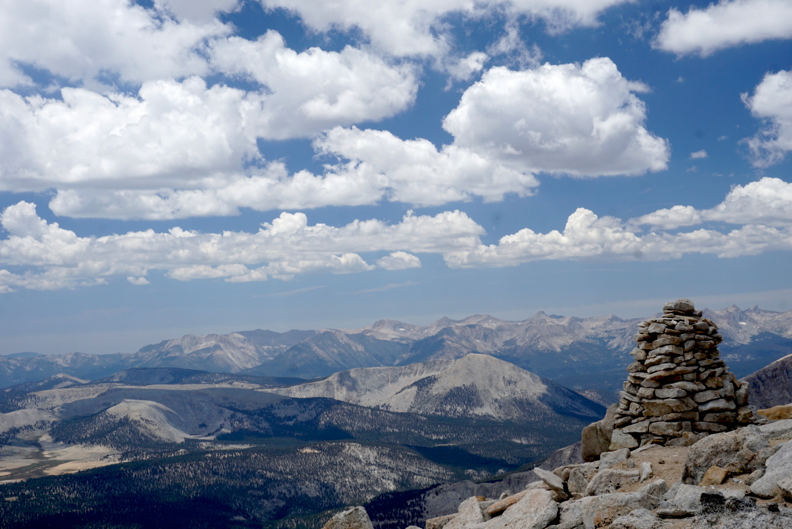
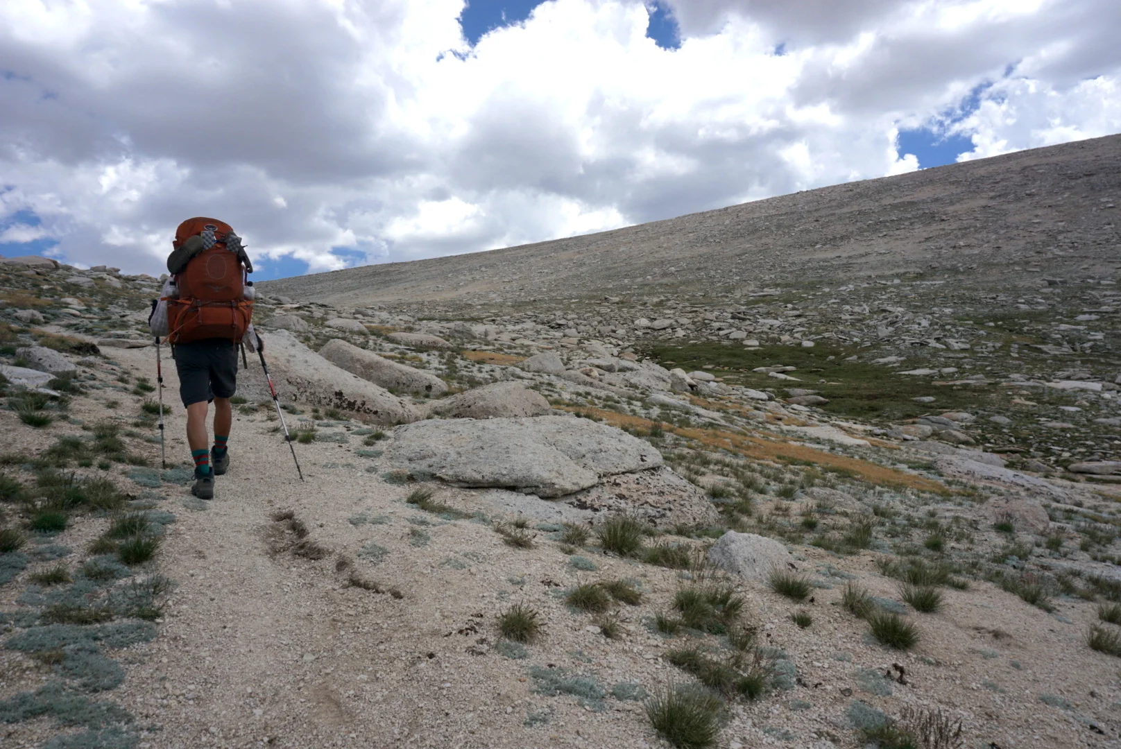
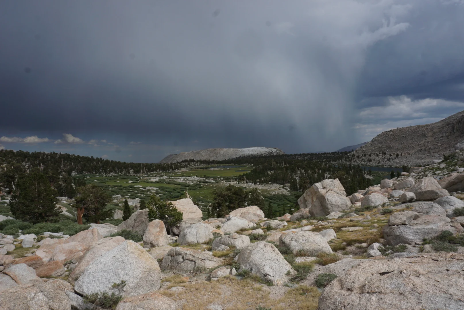
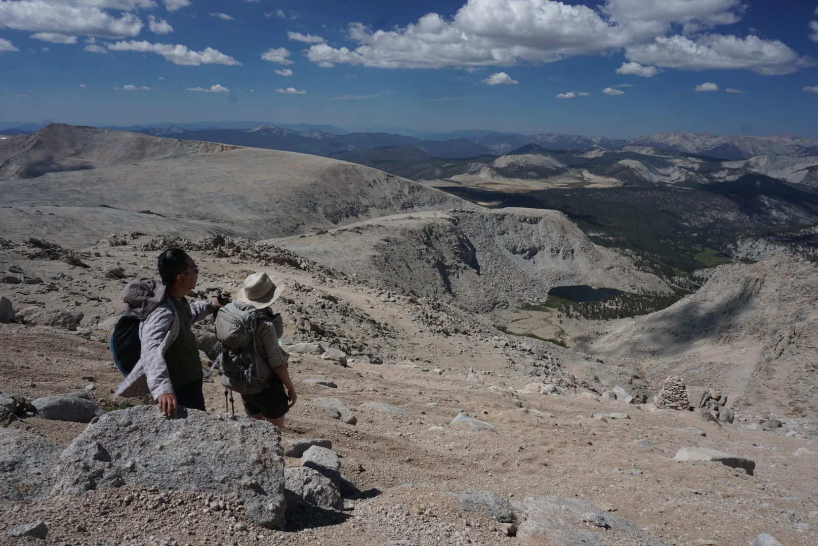
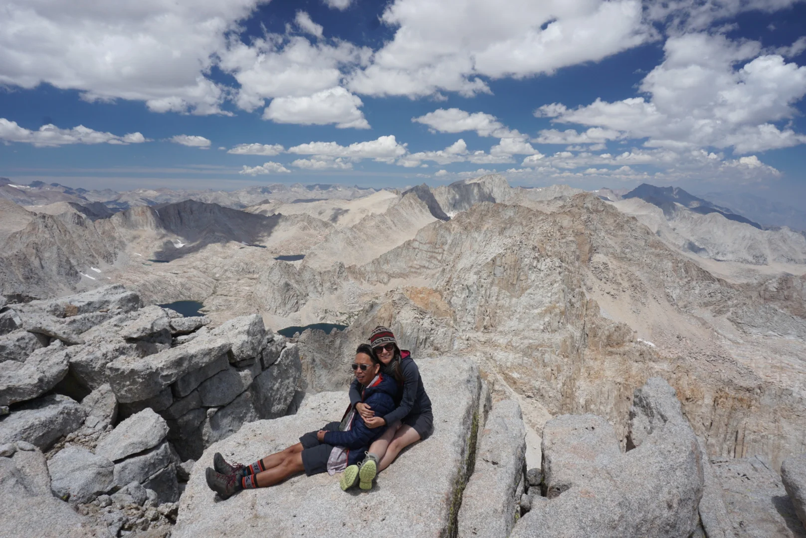
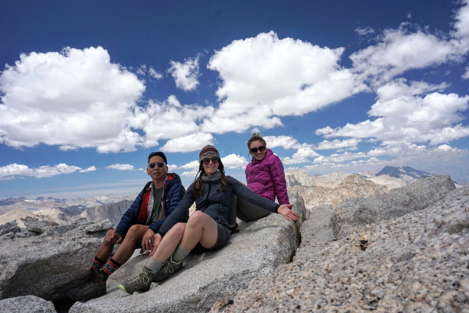
Day 4's weather looked good for a summit of Mt. Langley, number 9 among California's dozen 14ers (peaks above 14,000' with at least 300' of prominence). At 14,042', Mt. Langley is a 4.5-mile hike with about a 3,000-foot ascent from Cottonwood Lakes. The steepest section involves the 800-foot ascent toward Army Pass (which we had descended the prior day), but as the air thins above 13,000 feet, even the gentler slopes near the peak can seem challenging. A primitive trail is marked by a series of impressively-constructed cairns, and unless you lose the path, involves very minimal (if any) scrambling or bouldering. We packed our stove to enjoy a hot lunch at the top and took in the expansive 360-degree views, including of Mt. Whitney to the north. We descended just as the clouds rolled in and thunder began. Back safely at camp, we took a stroll down to some of the other lakes in the soft rain and were treated to our second sighting of a white-tailed jackrabbit.
Day 5 started out with clear skies, but by mid-morning the threat of thunder and rain was imminent. We packed out early, took a dip in Cottonwood Lake 1, then followed Cottonwood Creek about 5 miles as it descends toward the trailhead. The rain started to come down steadily just as we reached Cottonwood Lakes trailhead. The damage from the storms of the past days was obvious along the road leading down the mountain -- mud and rocks were being cleared by road crews. Back in Lone Pine, we arrived to Alabama Hills Cafe in time for a satisfying brunch. Finally, on Jenna's excellent suggestion, on the way home we stopped to visit Lancaster's Civic Musical Road, which we enjoyed tremendously.
Days: 5
Mileage: 38.5 mi. (including hikes to Miter Basin and Mt. Langley)
Elevations: Cottonwood Pass trailhead 9,960'; Cottonwood Pass 11,160'; Army Pass 11,900'; Mt. Langley 14,042'; Cottonwood Lakes trailhead 10,040'.
Camp locations: Chicken Spring Lake (11,242'); Soldier Lake (10,440'); above Cottonwood Lakes 4 and 5 (11,186'; 2 nights).
Miscellaneous Details and Recommendations
Permits: Forty percent of permits for most trailheads in this part of the Sierra are available on a walk-in basis starting at 11am the day before the start of your hike, while 60 percent are reservable in advance. We had no problem getting a permit. Walk-in permits are free.
Weather: Be ready for all weather, anytime of year. Though there was little snow to speak of this year (see our South Lake to North Lake post to compare what the end of July looked like last year), monsoonal moisture made for dramatic afternoon thunderstorms every day of our trip. Half the days it was mostly bark and very little bite, with thunder and lightning but limited moisture falling. But about half the time we were caught in biblical deluges of hail, sleet, rain and wind that lasted anywhere between an hour and 5 hours.
Maps: Tom Harrison's Mt. Whitney High Country and Mt. Whitney Zone maps both cover this loop well. We used the former. USGS Quads for Mt. Langley, Mt. Whitney, Cirque Peak and Johnson Peak also cover this area. Free PDFs are available for download through National Geographic.
Bears: Hiking in bear country means that use of bear canisters is mandatory. You can rent or buy canisters in at the Eastern Sierra Interagency Visitor Center or many of the outfitters in Lone Pine.
Campfires: This is a high-country loop that travels through multiple jurisdictions including Sequoia National Park, John Muir Wilderness, and Golden Trout Wilderness. Each jurisdiction has its own specific regulations, but in all cases, campfires are not allowed above 10,000' -- so layer properly and don't even think about having a campfire.
Leave No Trace: This leads to a good reminder to practice Leave No Trace principles whenever you find yourself exploring wildernesses near and far, especially in this age of increased wilderness usage and easy social media sharing and finding of pristine destinations. With a shared stewardship ethic, we'll be fortunate to continue enjoying our public lands and leave them better than we find them for future generations.
Cottonwood Lakes