• blog
  • gallery
  • shop
  • archive
  • about
Menu

dearantler

  • blog
  • gallery
  • shop
  • archive
  • about
Featured
IMG_3004 2.JPG
Travel
Hooves on the Ground: Onion Valley to Sixty Lake Basin and Col
Travel
Travel
IMG_8926.JPG
Travel
Hooves on the Ground: Grand Canyon's Clear Creek Trail and Cheyava Falls
Travel
Travel
IMG_6880.jpg
Travel
Hooves on the Ground: Miter Basin
Travel
Travel
IMG_6422.jpg
Travel
Hooves on the Ground: Tyee/Midnight/Hungry Packer Lakes, John Muir Wilderness
Travel
Travel
IMG_5896.jpg
Travel
Hooves on the Ground: Yosemite's Murphy Creek to Tuolumne Crest in the early season
Travel
Travel
IMG_5334 2.jpg
Travel
Hooves on the Ground: Grand Canyon's Tanner Trail and Escalante Route
Travel
Travel
IMG_3418.JPG
Travel
Hooves on the Ground: Mineral King Loop via Timber Gap and Lost Canyon
Travel
Travel
Hooves on the Ground: Darwin, Evolution, and Piute Canyons via Lamarck Col and Piute Pass
Travel
Hooves on the Ground: Darwin, Evolution, and Piute Canyons via Lamarck Col and Piute Pass
Travel
Travel
ThousandIsland.jpg
Travel
Hooves on the Ground: Thousand Island Lake via Rush Creek
Travel
Travel
IMG_3348.JPG
Travel
Hooves on the Ground: Grand Canyon's Hermit-Boucher Loop
Travel
Travel
DEARANTLER-SLIDER-2-1.png
Art
Elements of Existence
Art
Art
spellbound banner.png
Art
Spellbound | Wanderings Through the Witching Hour
Art
Art
IMG_0889.jpg
Travel
Hooves on the Ground: Yosemite's Grand Canyon of the Tuolumne and Old Big Oak Flat Road to El Capitan
Travel
Travel
psyche.jpg
Art
Psyche | Introspections In an Era of Uncertainty
Art
Art
LRG_DSC06553.JPG
Travel
Hooves on the Ground: Death Valley Albatross Plane Crash Site
Travel
Travel
HST map illustration.JPG
Travel
Hooves on the Ground: High Sierra Trail
Travel
Travel
Suspension.png
Art
Suspension
Art
Art
Hooves on the Ground: Nepal
Travel
Hooves on the Ground: Nepal
Travel
Travel
Hooves on the Ground: Cottonwood Pass and Lakes Loop (Miter Basin and Mt. Langley)
Travel
Hooves on the Ground: Cottonwood Pass and Lakes Loop (Miter Basin and Mt. Langley)
Travel
Travel
The Troubles We Carry
Art
The Troubles We Carry
Art
Art
Hooves on the Ground: South Lake to North Lake (Evolution Loop)
Travel
Hooves on the Ground: South Lake to North Lake (Evolution Loop)
Travel
Travel
Travel
Hooves on the Ground: Grand Canyon
Travel
Travel
Wanderlust: Hiking on Legendary Trails
Travel
Wanderlust: Hiking on Legendary Trails
Travel
Travel
Peru+Map.jpg
Travel
Hooves on the Ground: Perú
Travel
Travel
Art
Notorious/Glorious
Art
Art
Art
dearantler turns 3!
Art
Art
Art
Music Video for Sara Lov's 'Rain Up'
Art
Art
Travel
Hooves on the Ground: The Palisades
Travel
Travel
Travel
Hooves on the Ground: Tahoe to Yosemite Along the Pacific Crest Trail
Travel
Travel
Art
Strangers On A Trail
Art
Art

Sunrise at Sixty Lake Basin

Hooves on the Ground: Onion Valley to Sixty Lake Basin and Col

August 2, 2024

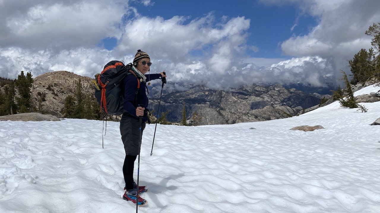
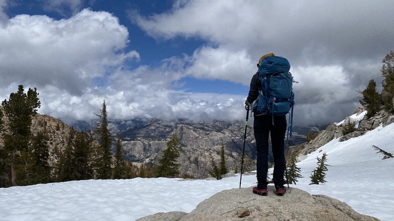
It had been a few years since we last visited this part of the Sierra and it was time to pay this photogenic landscape a return visit. We started with a night at Onion Valley campground to help these sea-level dwellers acclimate. We were catching the tail end of a week of challenging weather in this region and we caught some afternoon rain, but nothing too intense.


Day 1

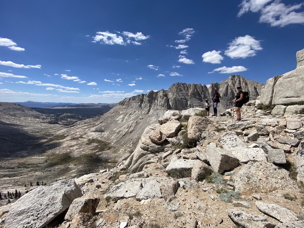
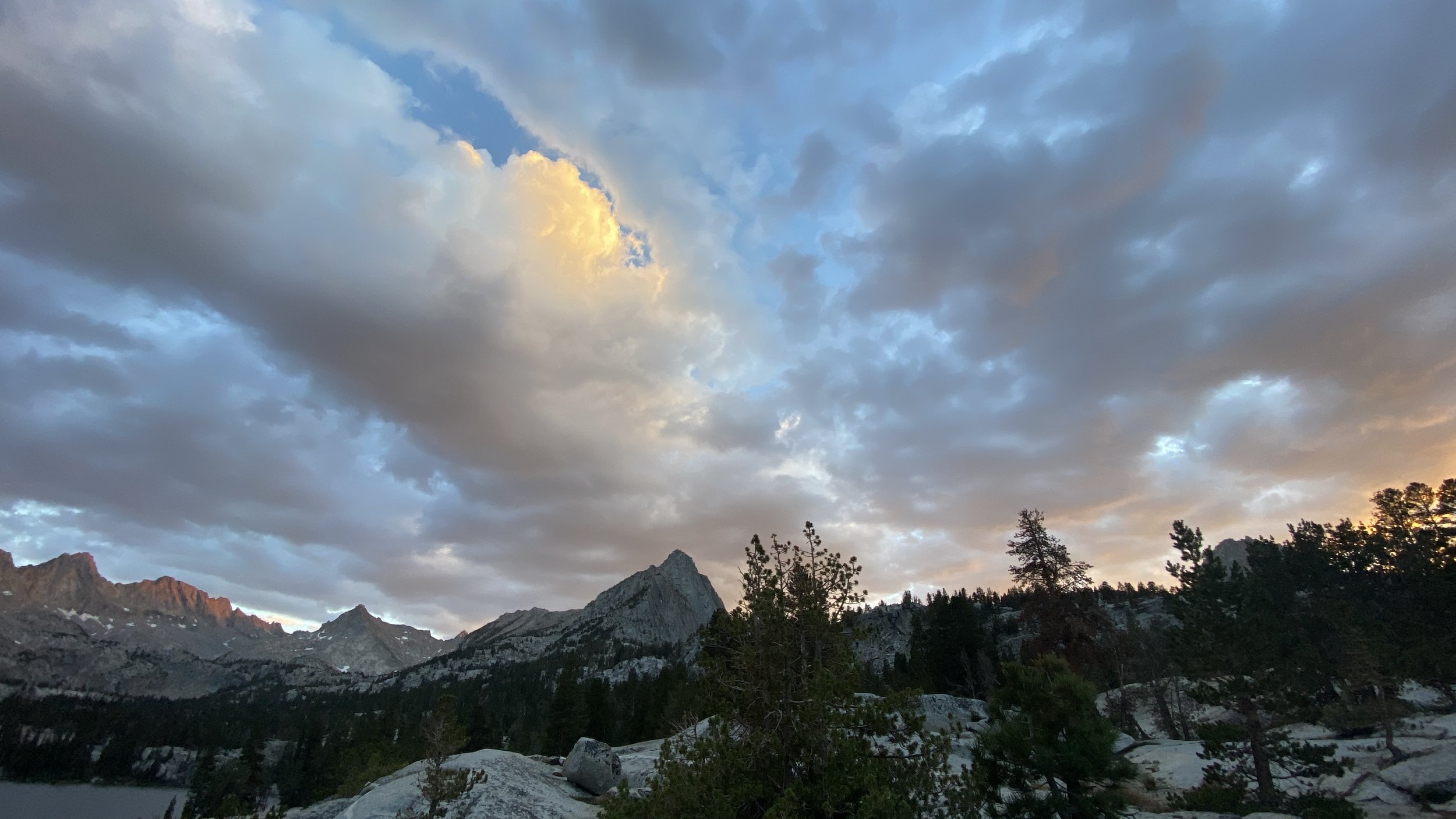
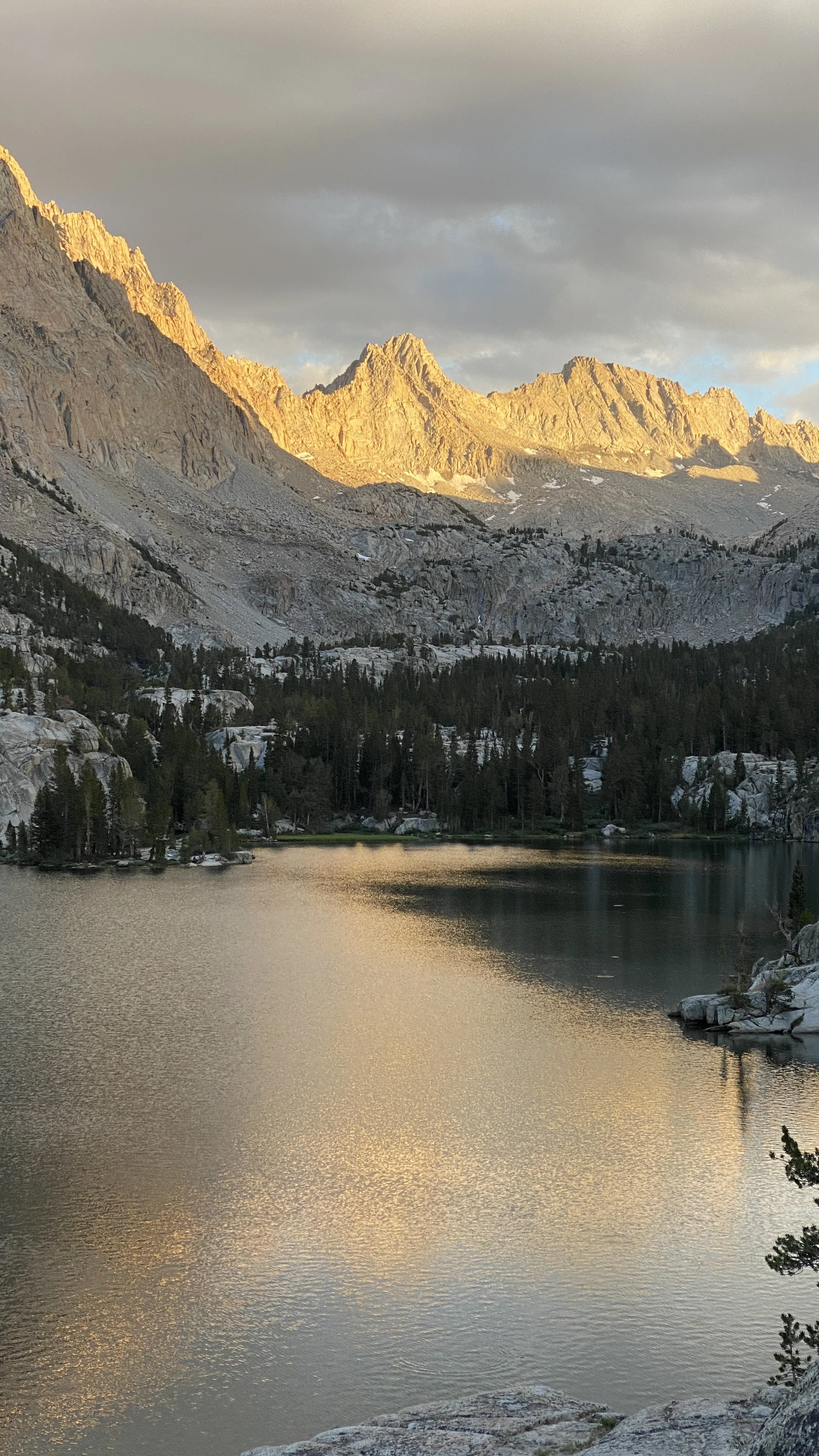
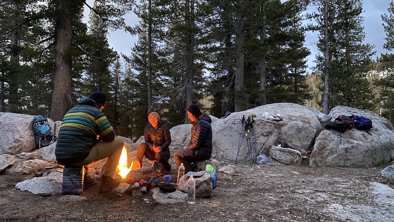
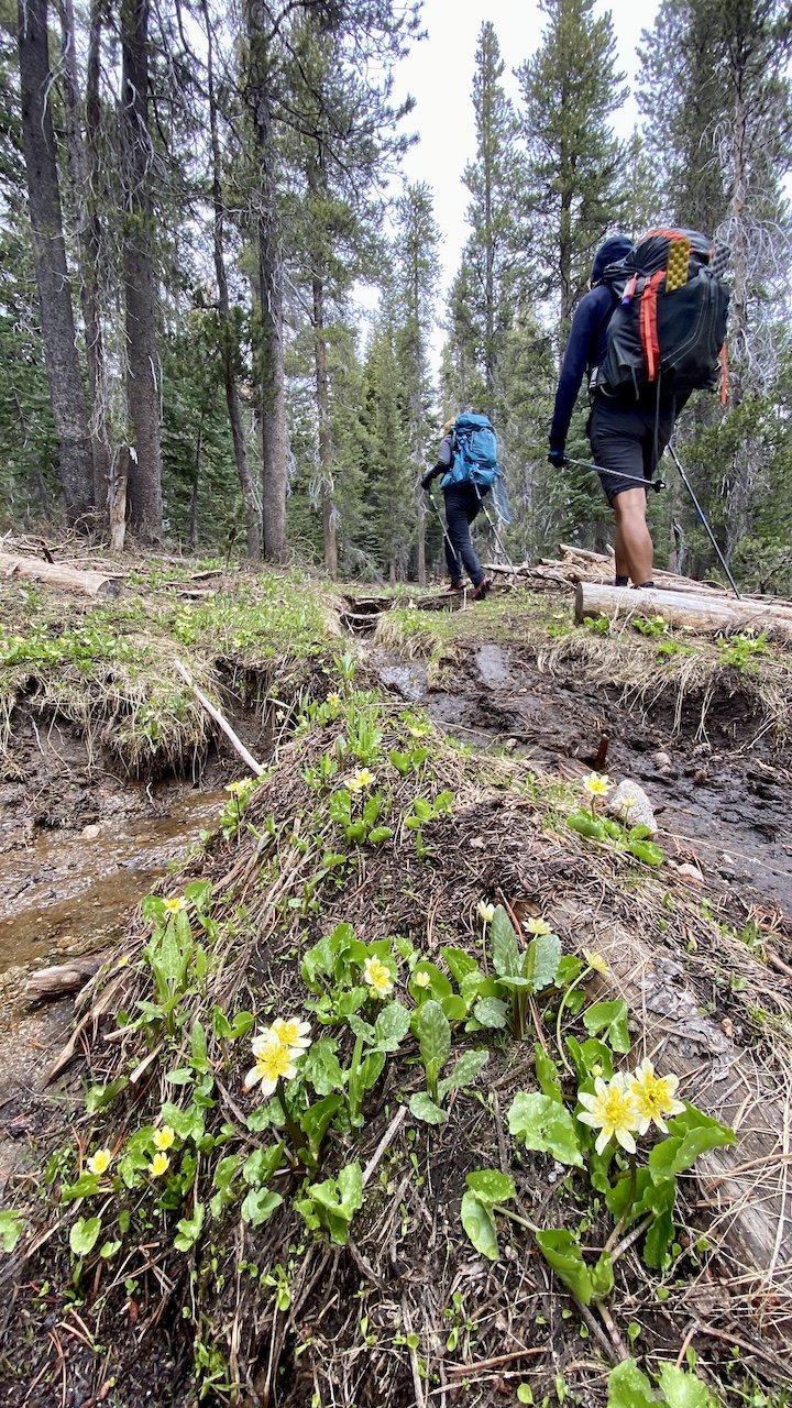
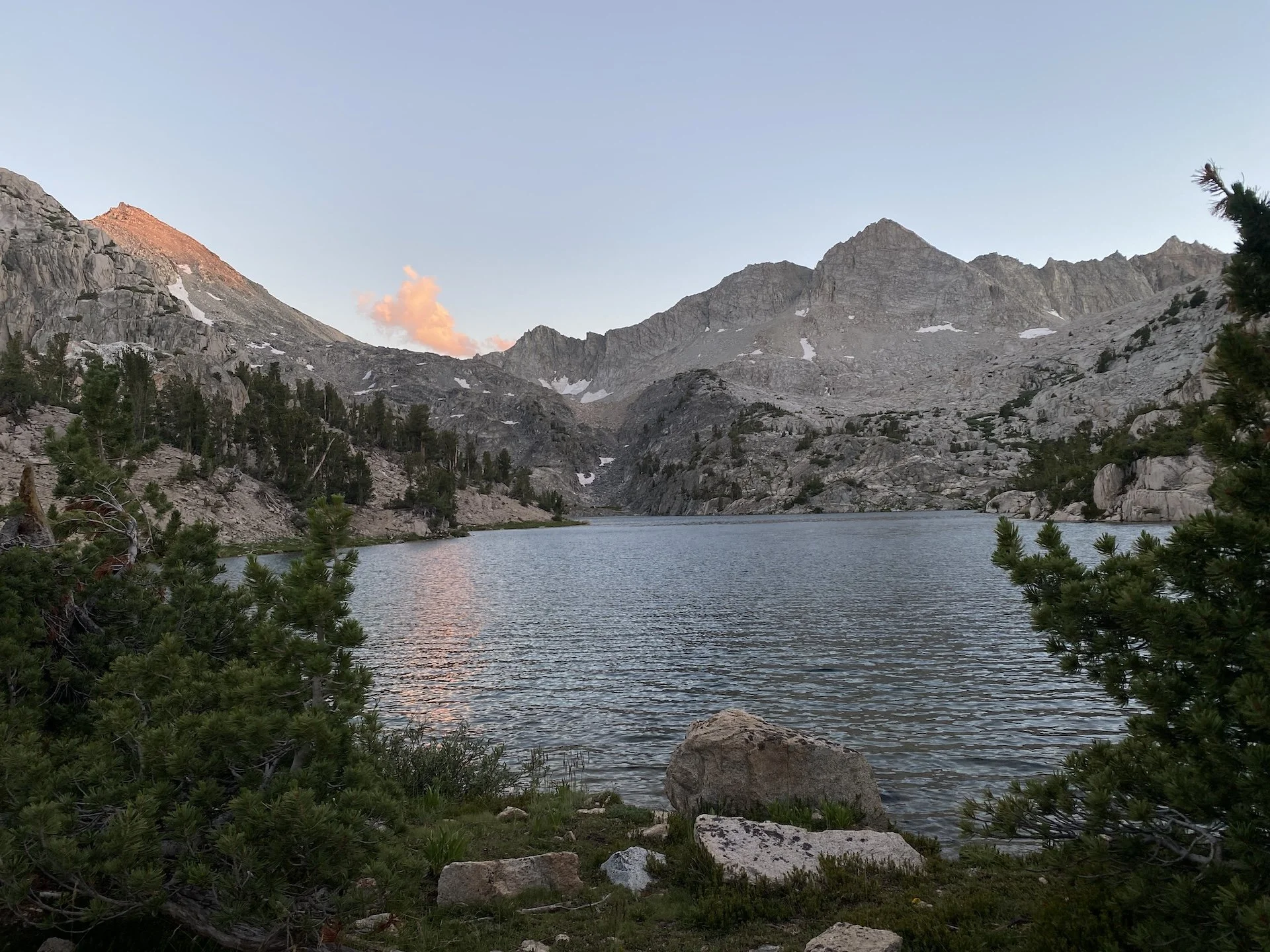
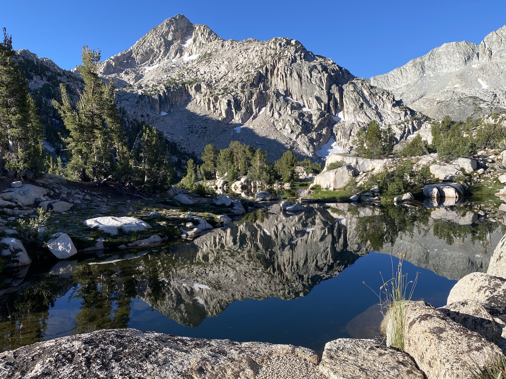
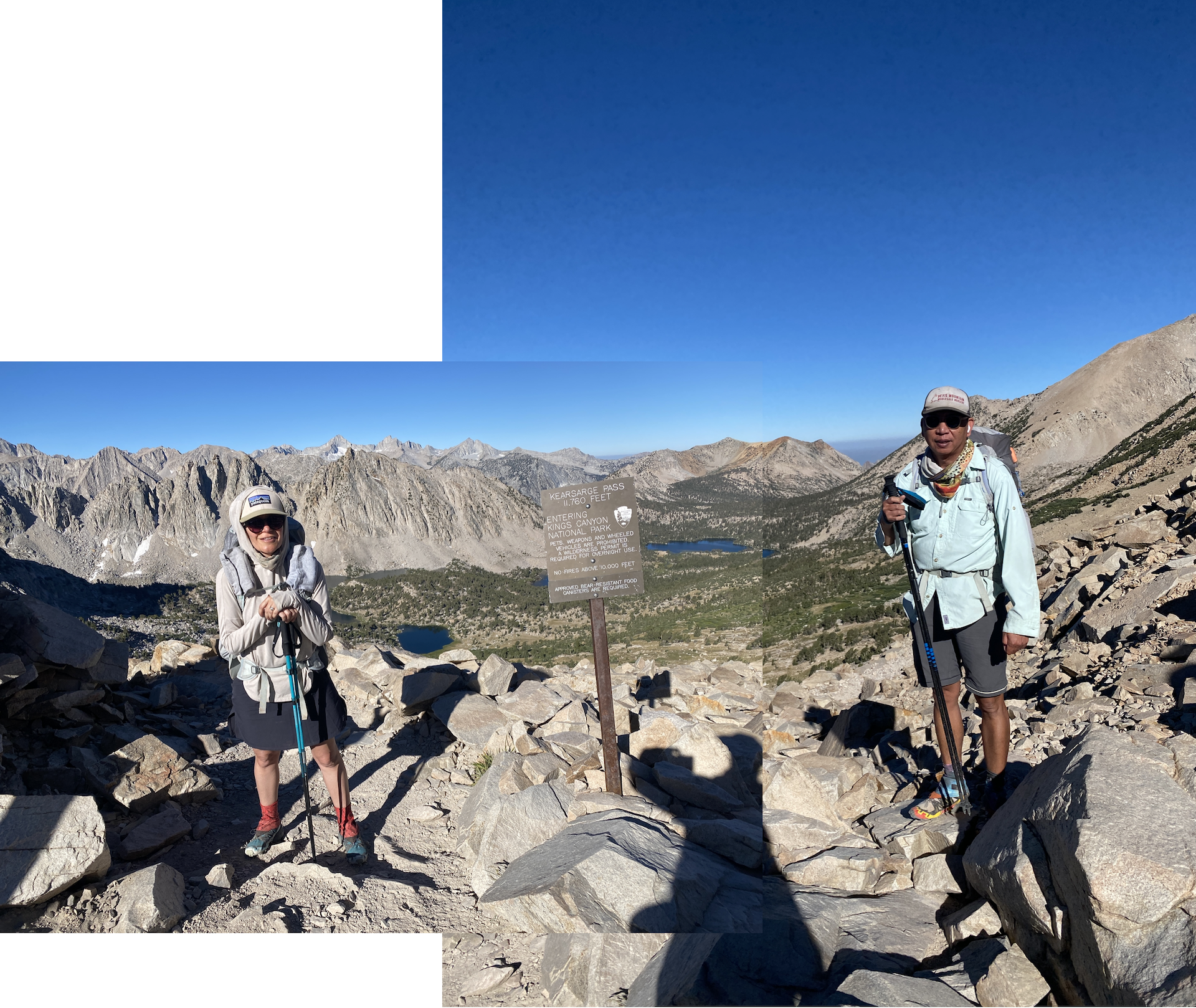
We started at Onion Valley trailhead and went over Kearsarge Pass by late morning, then continued on the high trail, rather than the low trail that leads down toward Kearsarge Lakes and Charlotte Lake. Clouds had been forming, and by mid-afternoon rain and some thunder arrived. We set up camp about 0.75 mi south of Glen Pass, nearish one of the tarns that dot this part of the trail.

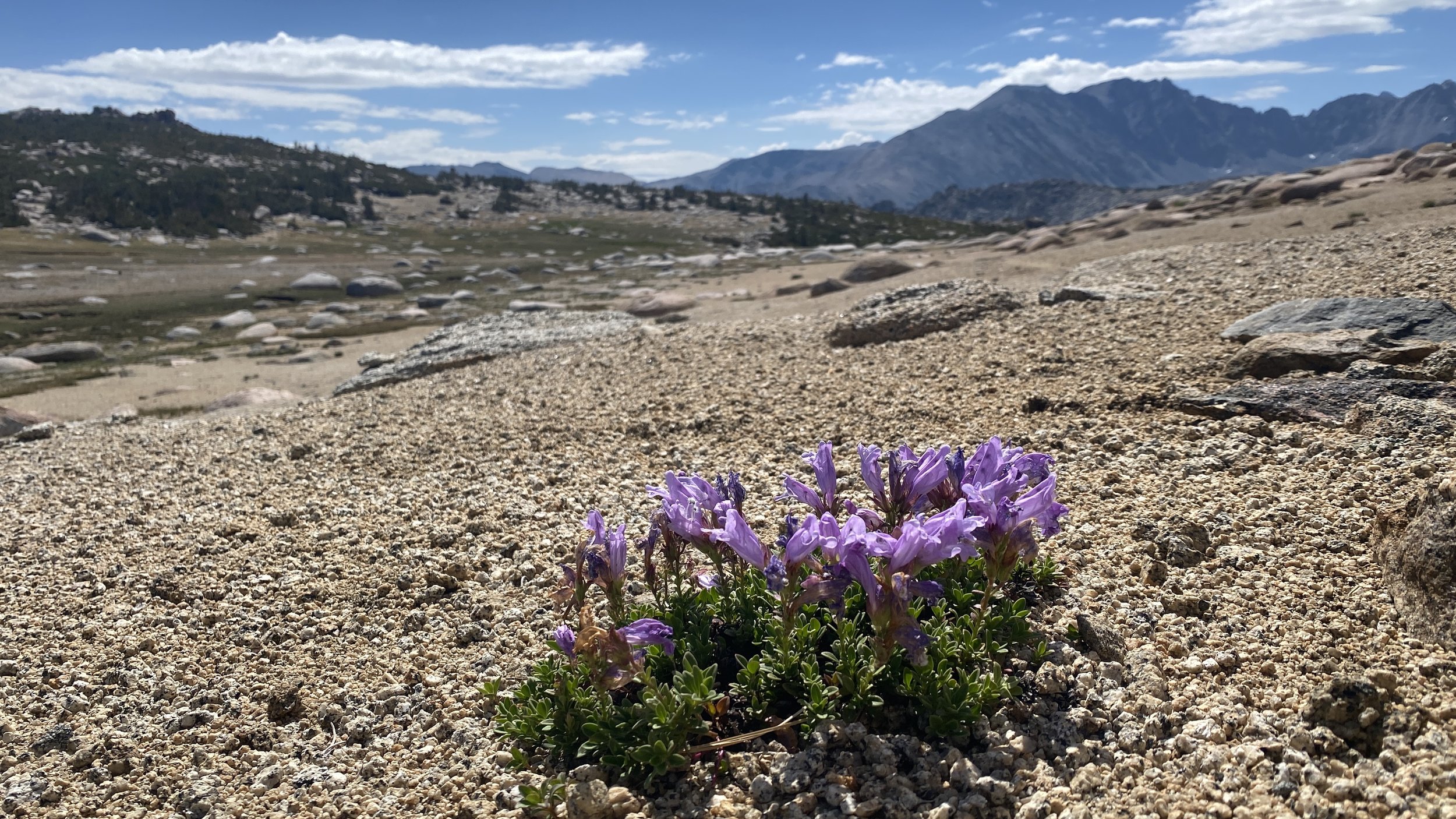
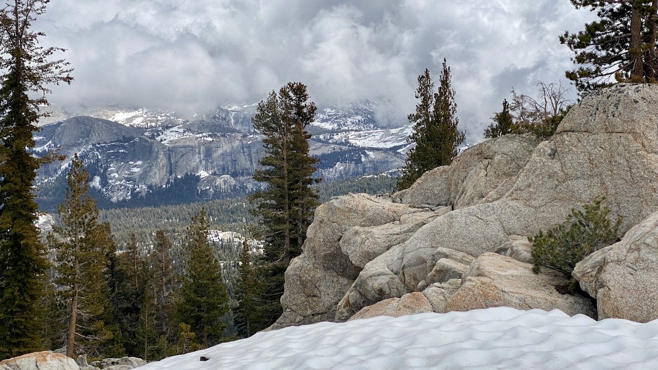
Conditions were drier than we expected given the winter had brought average snowpack in the Sierra. Already, many creeks and streams were down to a trickle or totally dry, and many of the tarns had visibly shrunk, likely to be gone by early fall.

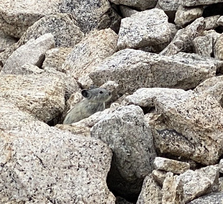
What was truly delightful about this side of Glen Pass was that the pika population was alive and well, with many critters (so many we lost count!) industriously skipping from rock to rock to gather their stockpiles of vegetation for the winter. From this camping location, we were treated to a 360-degree sound bath of syncopated pika screeches — to our right, the left, behind us, in front of us! The only other place we had seen so many pikas was near Tuolumne Peak in Yosemite (see The Pika Diaries!). It was a big treat to see these hardy little non-hibernating vegetarians doing their thing.


Day 2

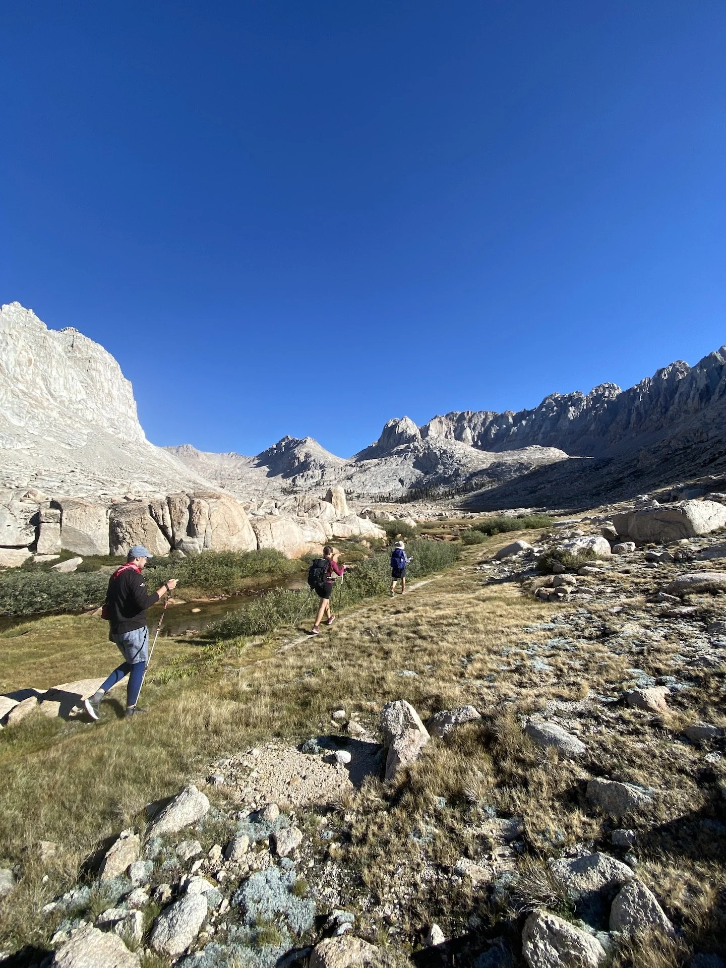
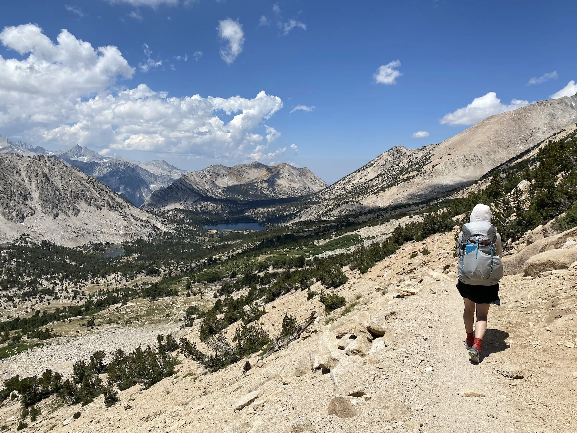
We went over Glen Pass early and descended toward Rae Lakes, chatting with a steady stream of JMTers and a few weekenders. Some were visiting from far-flung states — a solo hiker from Florida, a family from Maryland — and were just discovering the incredible magic of the Sierra for the first time. Seeing them in awe was a pleasant reminder of just how lucky we are to live in proximity to the Range of Light.

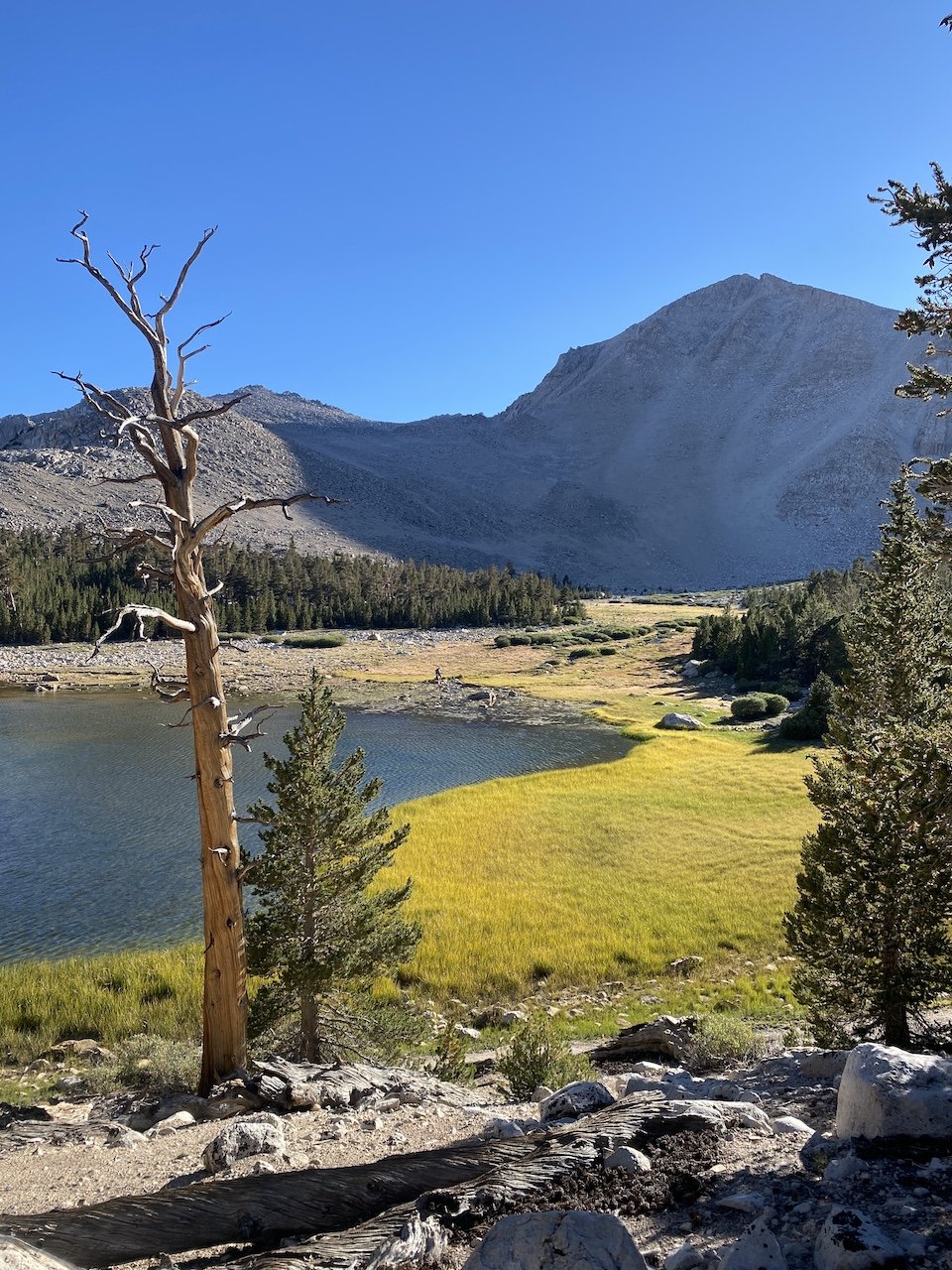
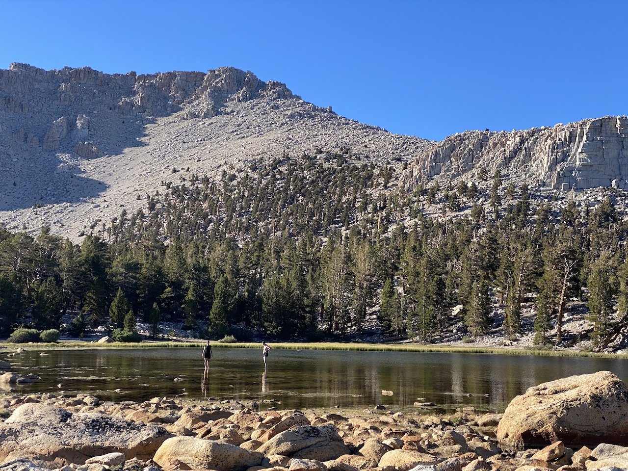
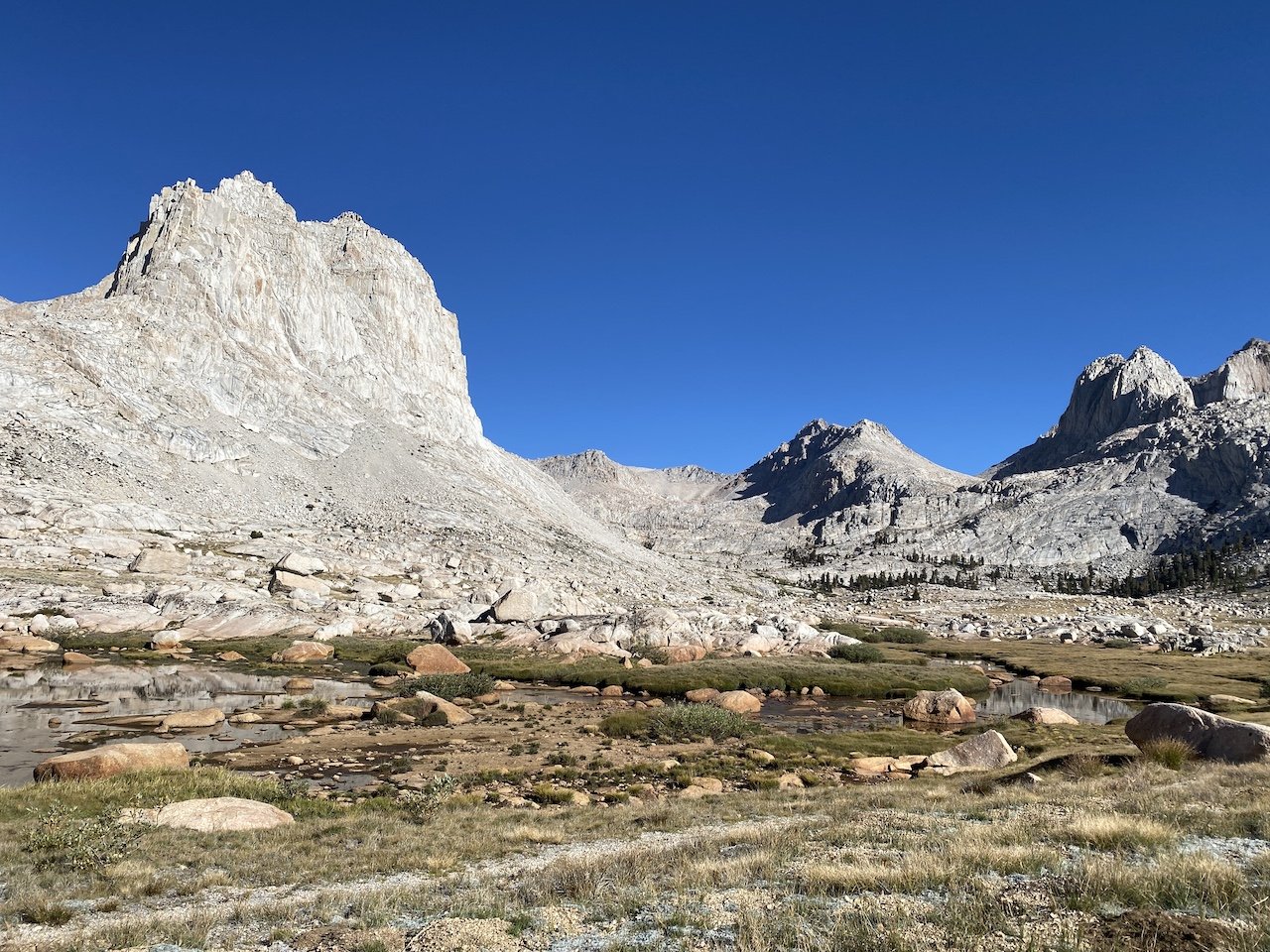
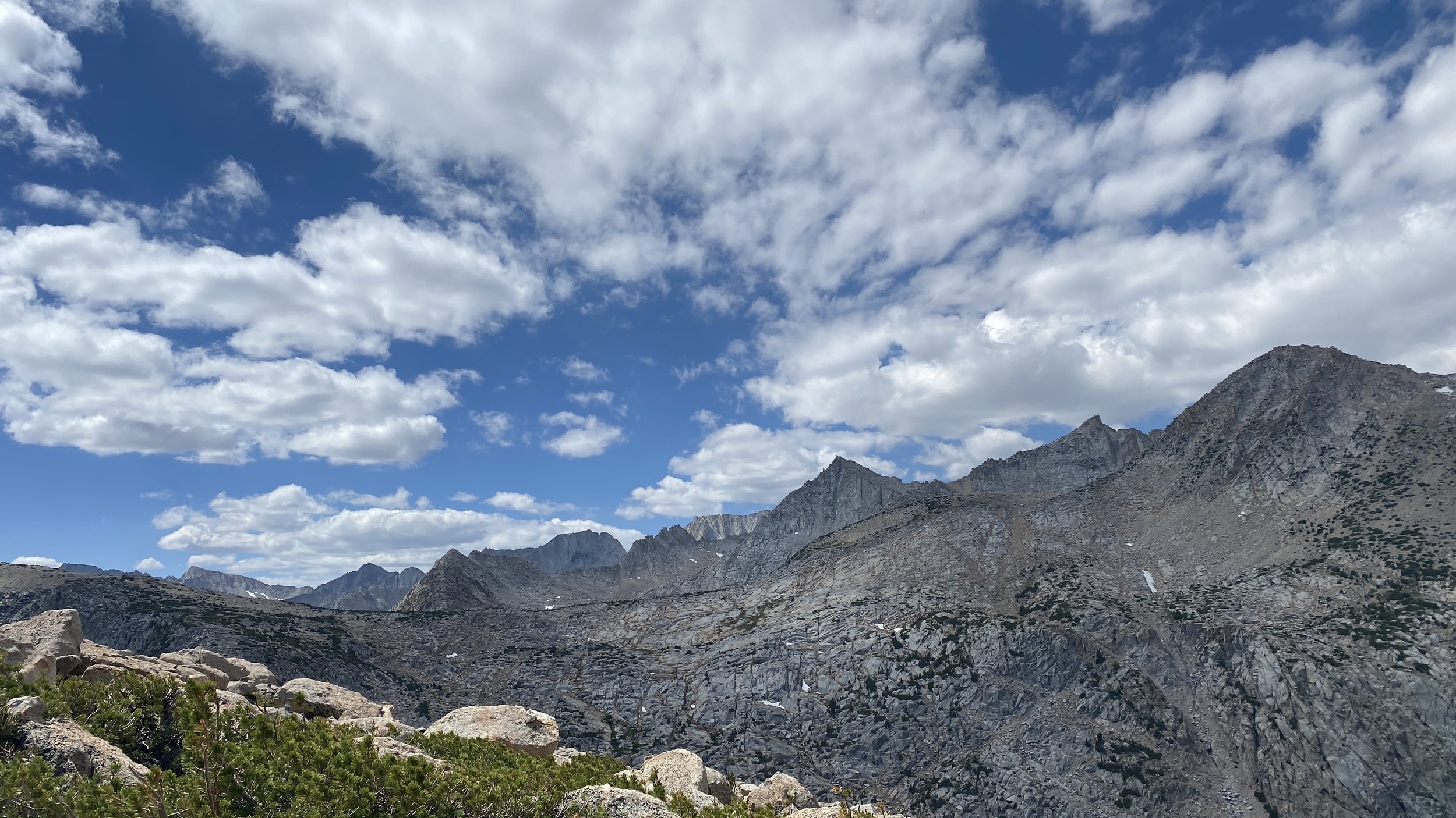
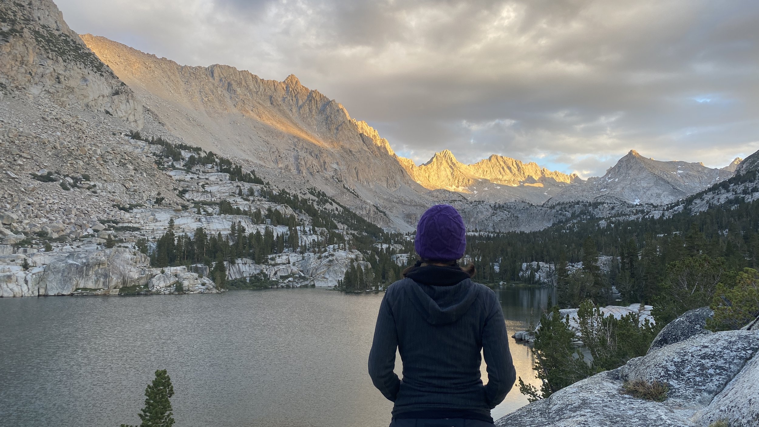
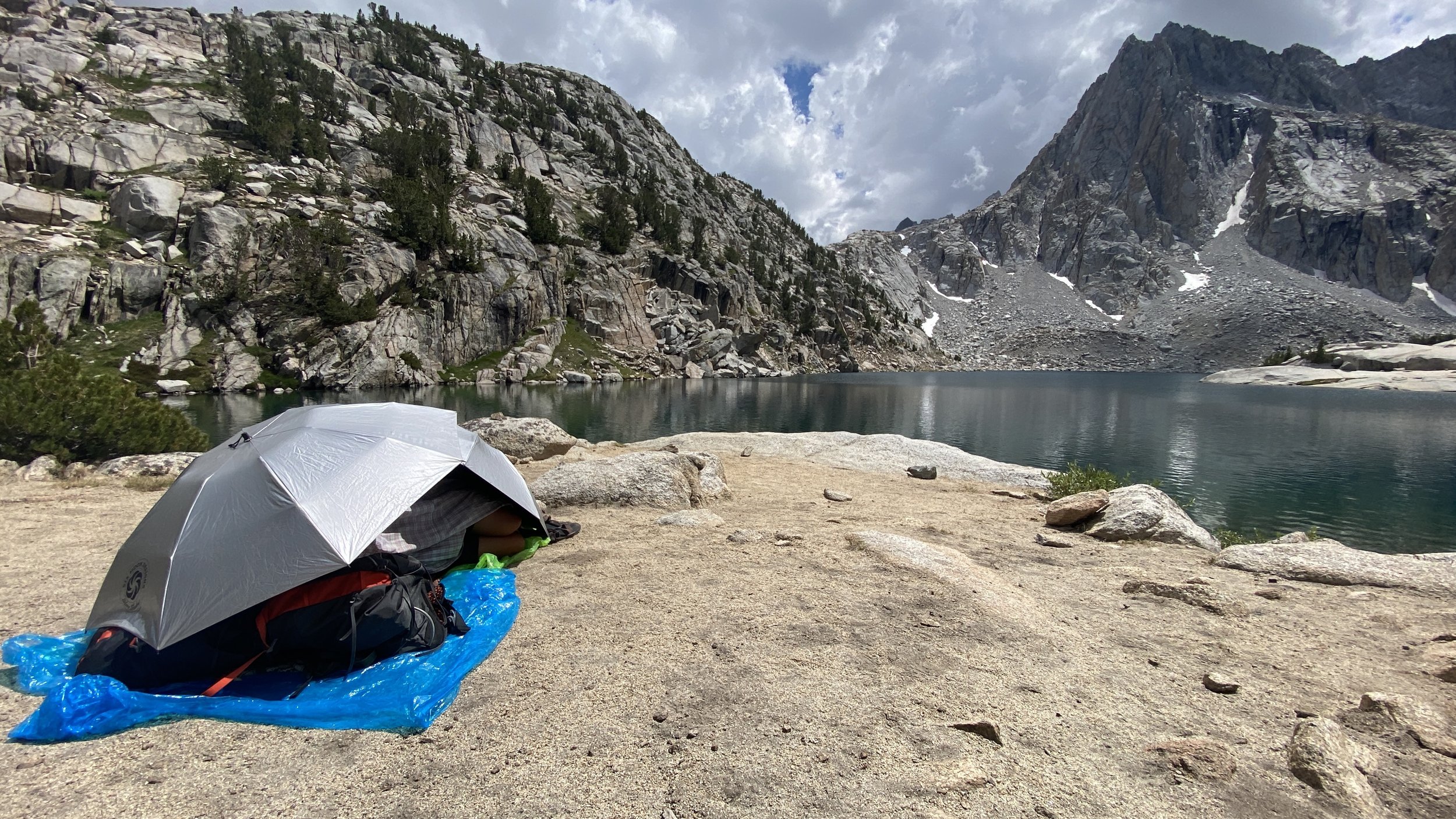
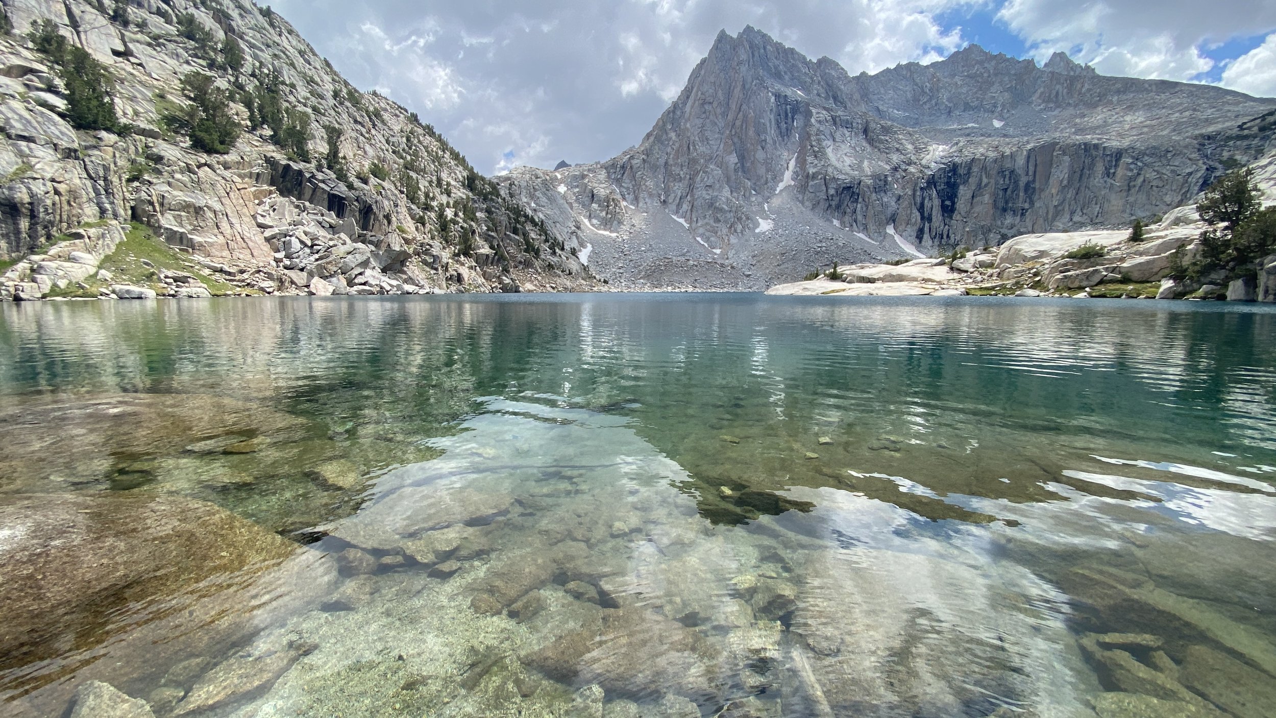
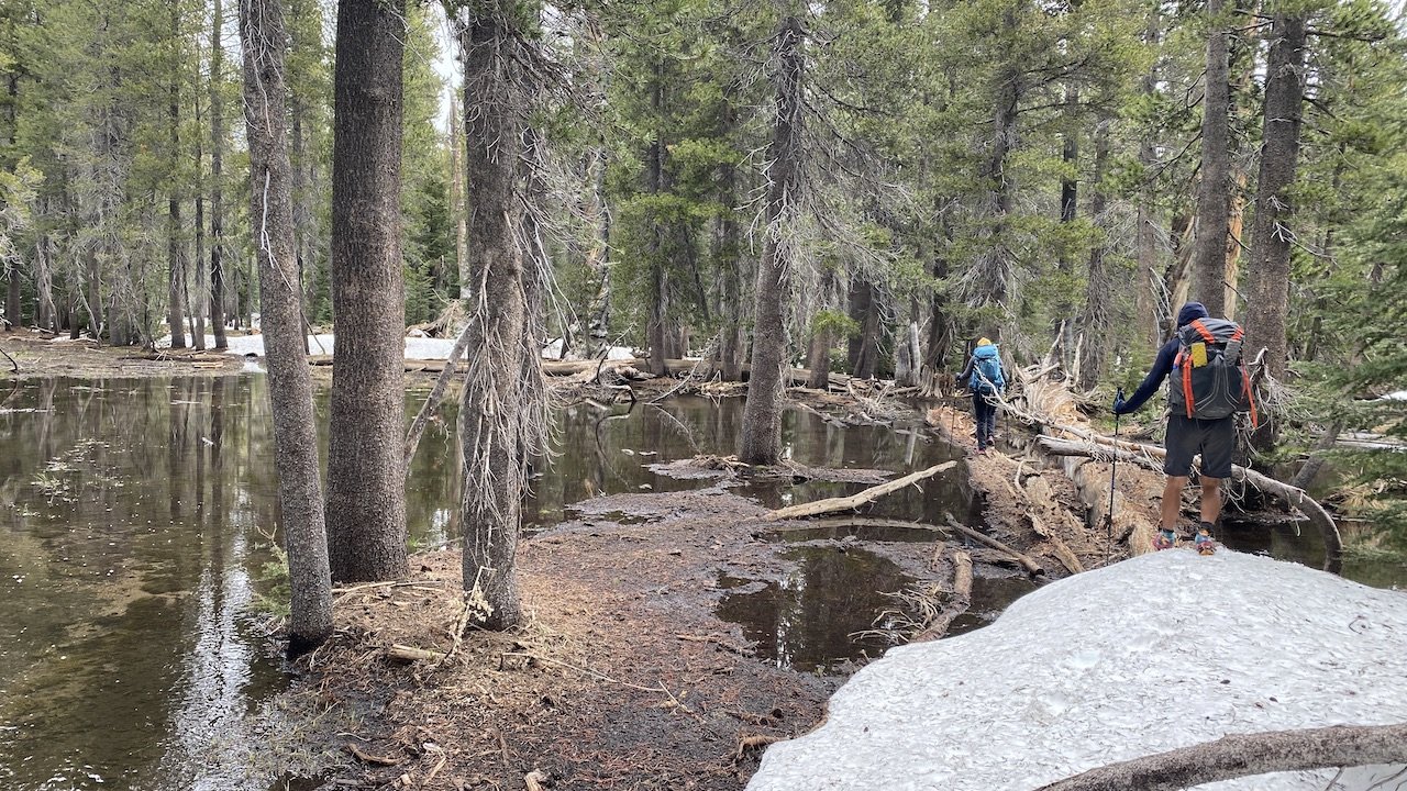
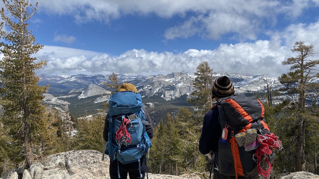
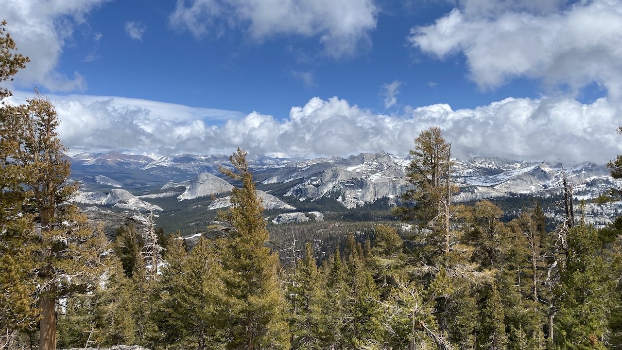
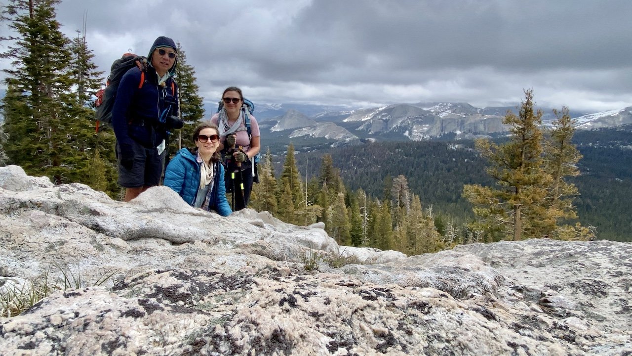
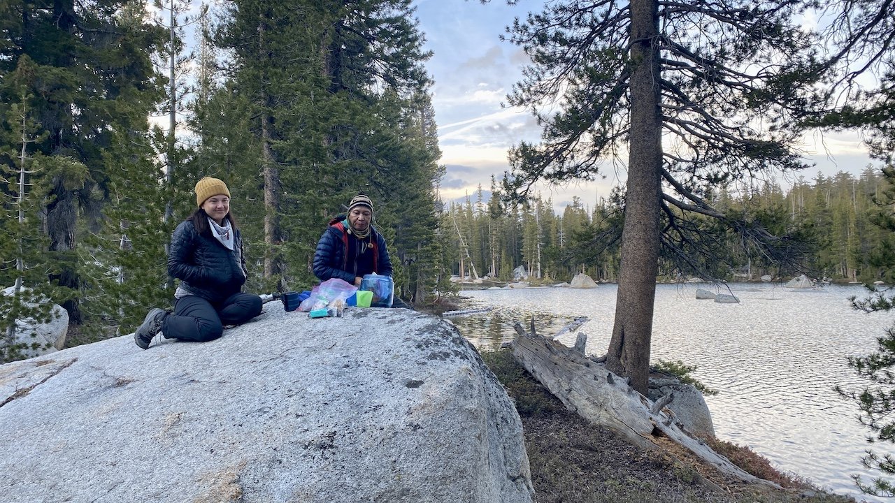
At Rae Lakes we left the JMT and picked up the trail toward Sixty Lake Basin. As we ascended, the trail afforded beautiful views of Rae Lakes, the Painted Lady, and eventually Fin Dome. It is an easy trail to follow, and as it ascends and then summits to drop into Sixty Lakes Basin, the intimacy of this basin becomes apparent. It feels smaller in scale than many Sierra basins, with each of the many lakes in its own bite-sized, forested valley. We found a great spot to camp on the north end of the long, unnamed lake locally referred to as Finger Lake, just east of Mount Cotter. It is at this spot that the grander views up into the high basin above treeline really open up. We typically don’t camp so close to a lake — it brings colder temperatures, more condensation, and often more wind — but it was a jaw-dropping spot. We stayed two nights.

Impressive trailwork above Kearsarge Lakes
IMG_2902.jpg
Pothole Lake near Kearsarge Pass
IMG_2909.JPG
Rae Lakes from Sixty Lake Trail
IMG_2955.JPG
Not a bad place to call home
IMG_2963.JPG
The col is in the center of the photo
IMG_2968.JPG
IMG_2971.JPG
Scouting the cross-country route
Gardiner Basin
Gardiner Basin
Gardiner Basin (ooohhh!)
Trail-finding toward the col
Shaded trail happy hour
Alpenglow starting over Bullfrog Lake
IMG_4236 2.JPG
IMG_4231.JPG
A lake of one's own (60 Lake Basin)
Above Bullfrog Lake
Above Bullfrog Lake
IMG_4134.JPG
Kearsarge Pass.png
Impressive trailwork above Kearsarge Lakes IMG_2902.jpg Pothole Lake near Kearsarge Pass IMG_2909.JPG Rae Lakes from Sixty Lake Trail IMG_2955.JPG Not a bad place to call home IMG_2963.JPG The col is in the center of the photo IMG_2968.JPG IMG_2971.JPG Scouting the cross-country route Gardiner Basin Gardiner Basin (ooohhh!) Trail-finding toward the col Shaded trail happy hour Alpenglow starting over Bullfrog Lake IMG_4236 2.JPG IMG_4231.JPG A lake of one's own (60 Lake Basin) Above Bullfrog Lake IMG_4134.JPG Kearsarge Pass.png


Day 3

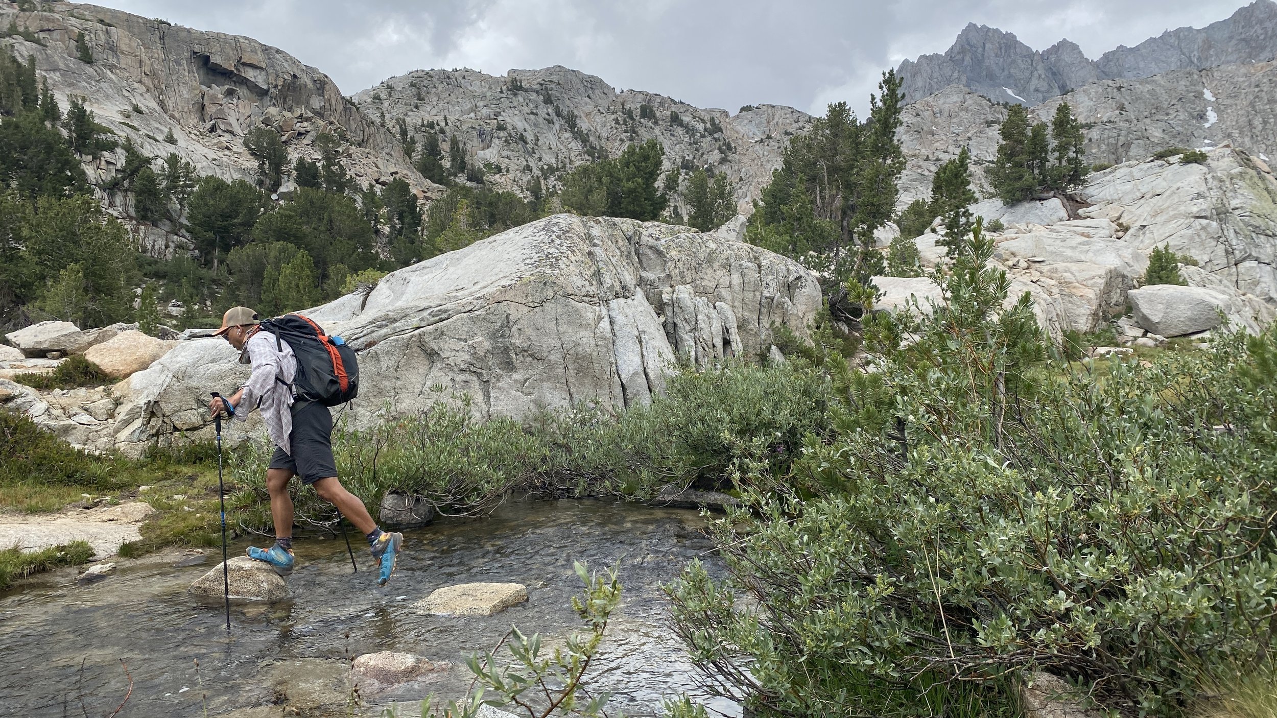
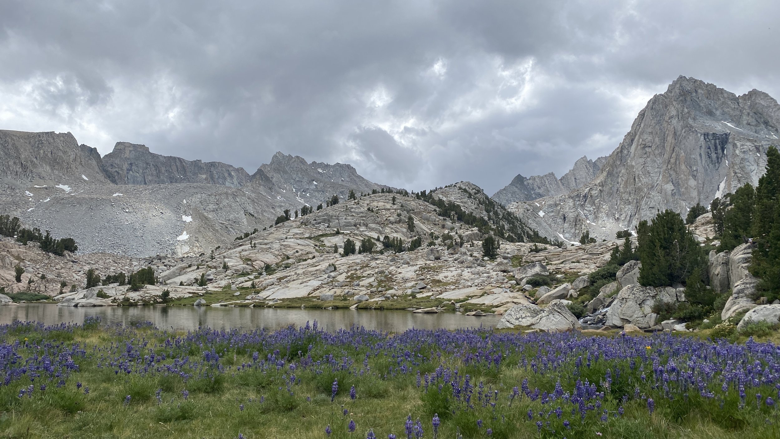
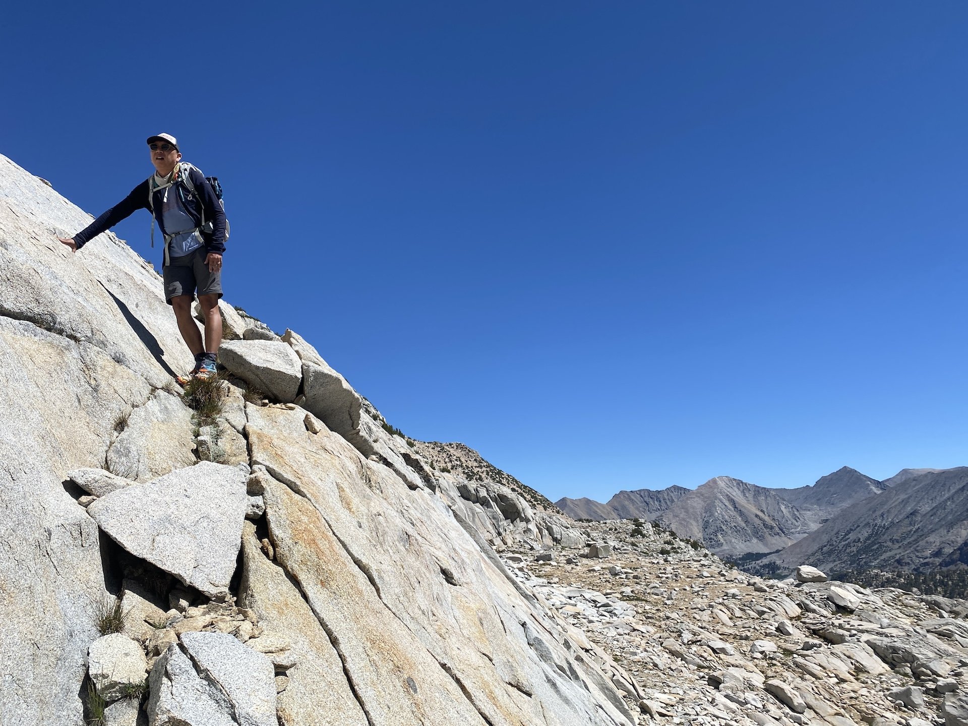
We day hiked cross-country up the basin. This can be accomplished by staying on the west side of Finger Lake. We went high almost immediately to avoid the steep drop-offs encountered along the ledges closer to the lake, alternately following and then ignoring some cairns along the way. The brief description in Secor’s High Sierra was helpful.

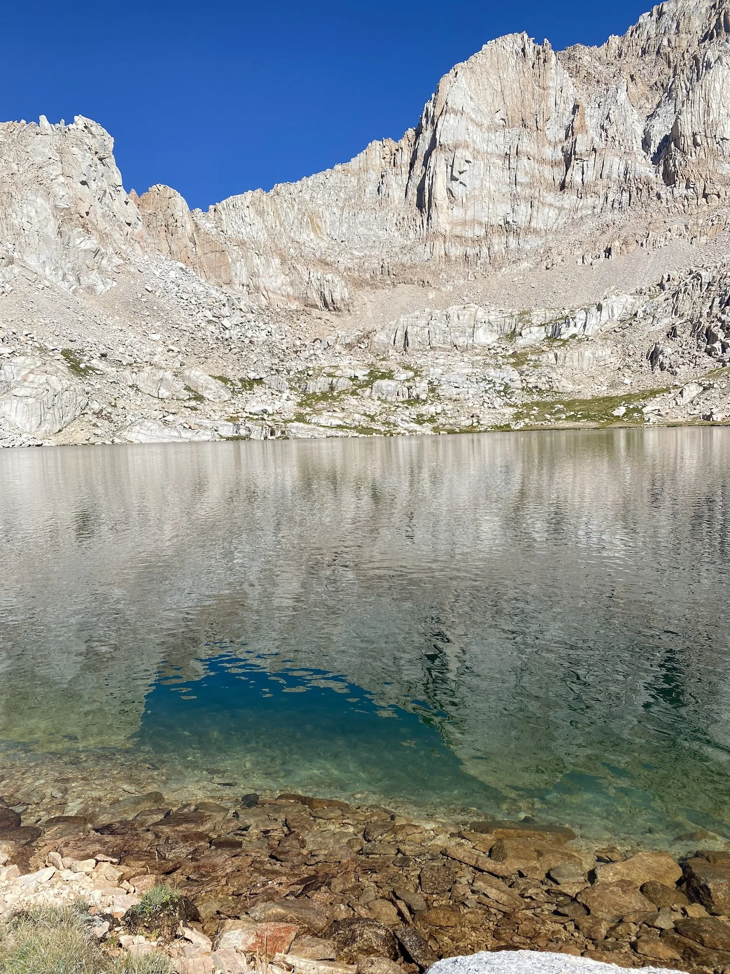
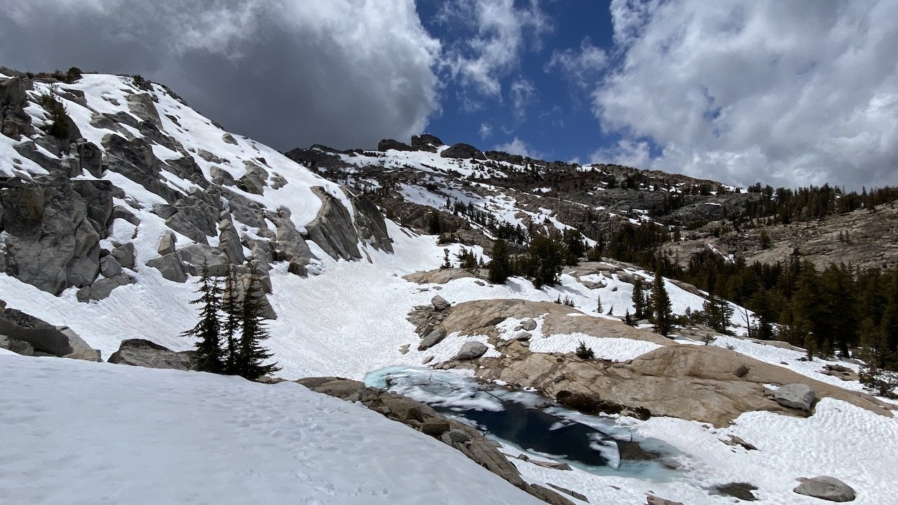
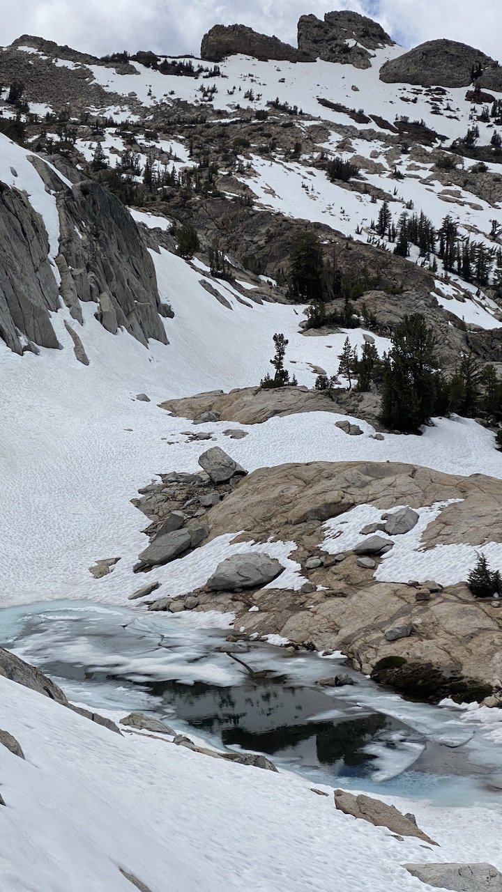
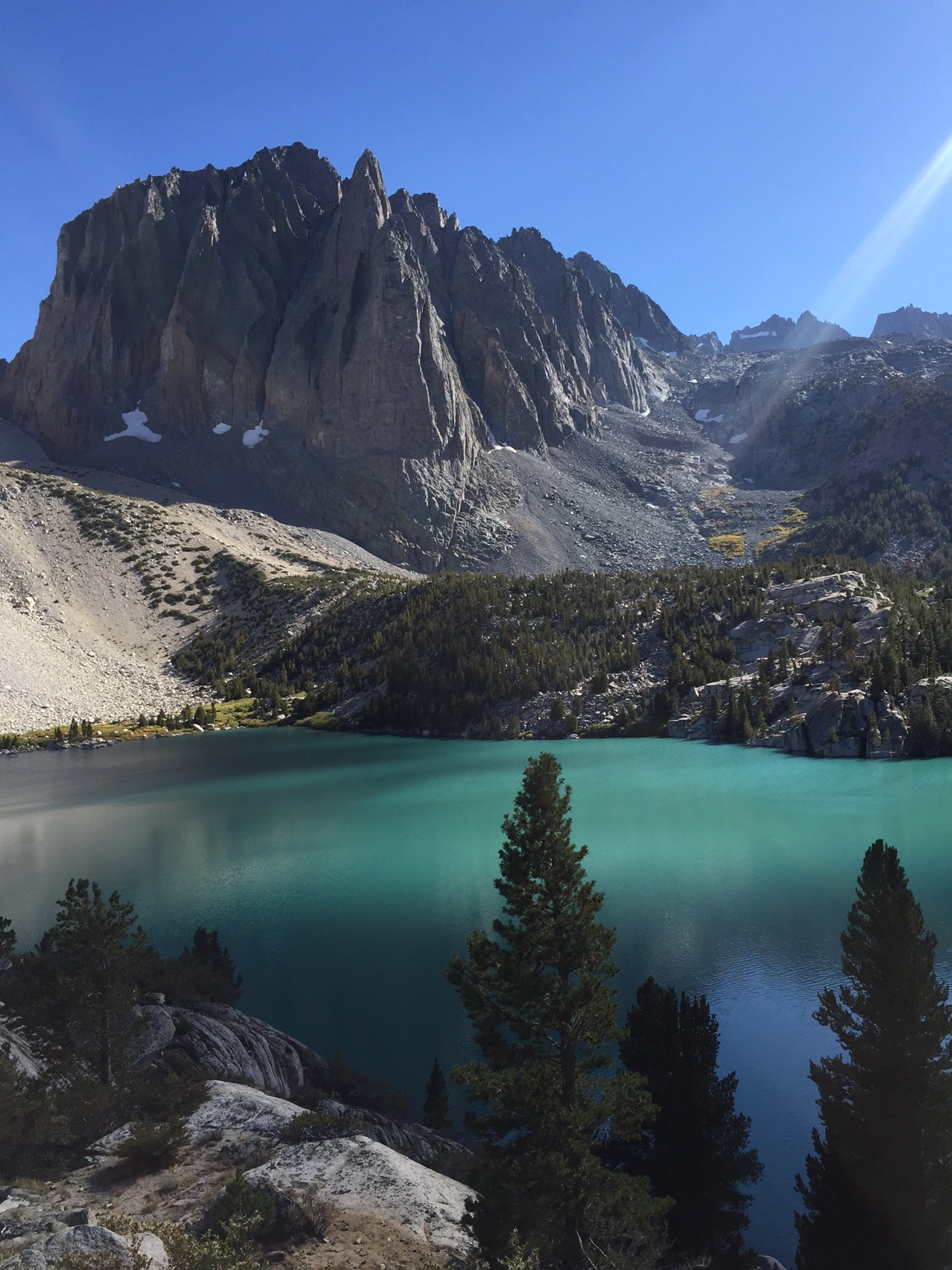
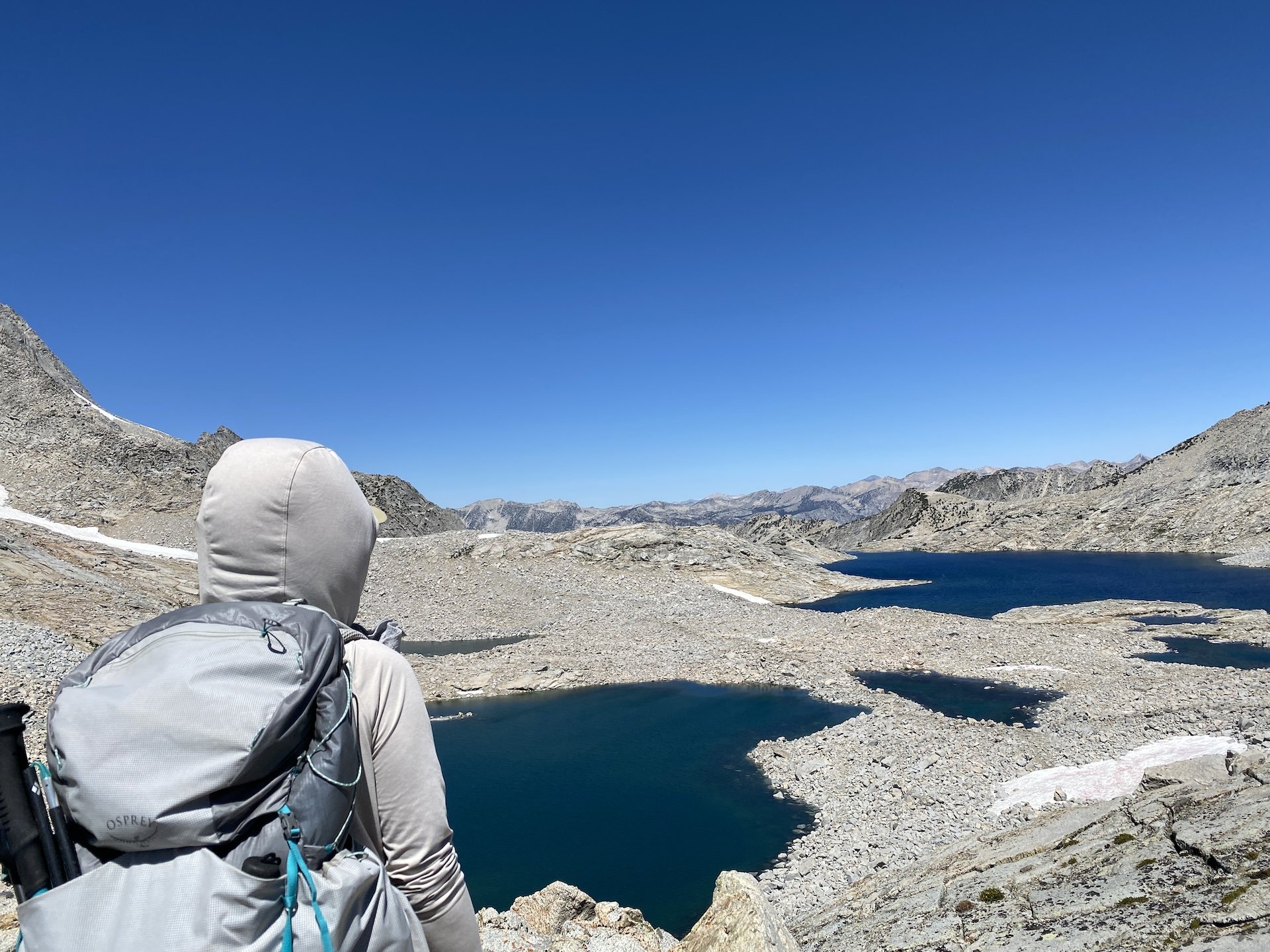
We meandered our way up, encountering some class 2 talus and boulder sections. We stayed due south for much of the route, aiming for the tarns and lake before turning west and zigzagging up ledges to the top. A nice surprise was seeing the last lake before reaching the col come into view to the east with each step, which has a beautiful turquoise blue color owing to the glacial melt that feeds it. It was a treat to see this vibrant hue — there are very few Sierra lakes this color.

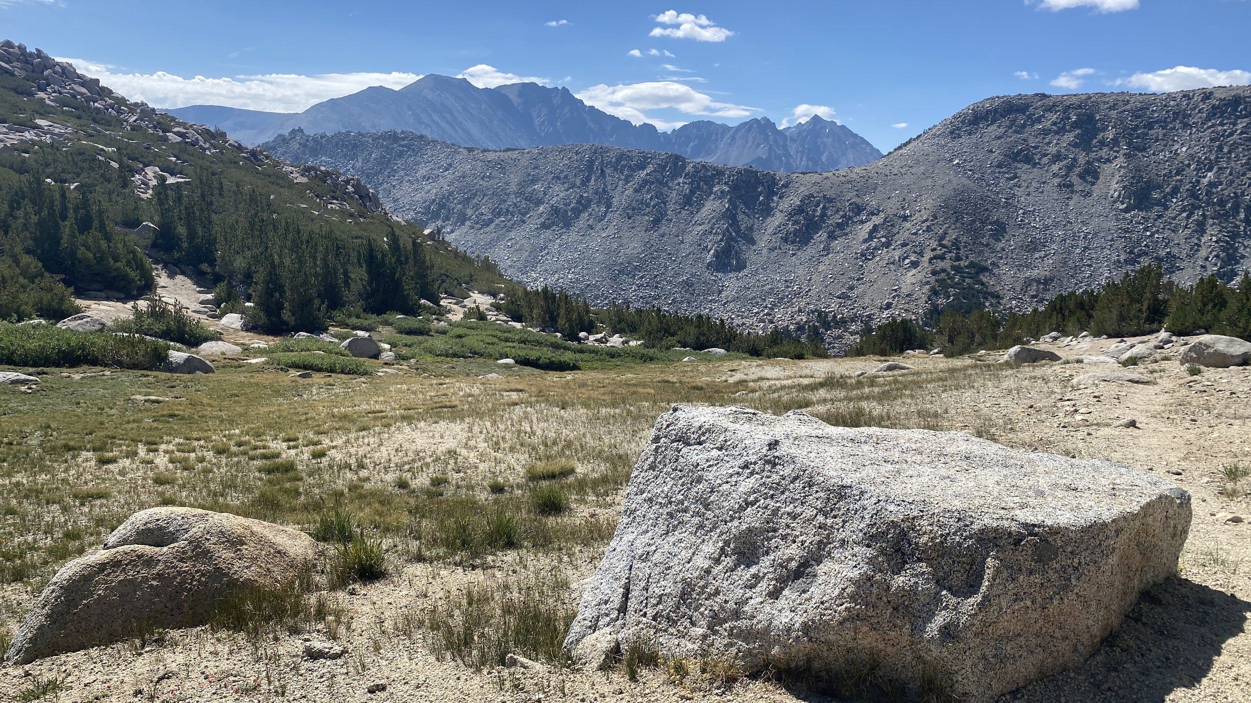
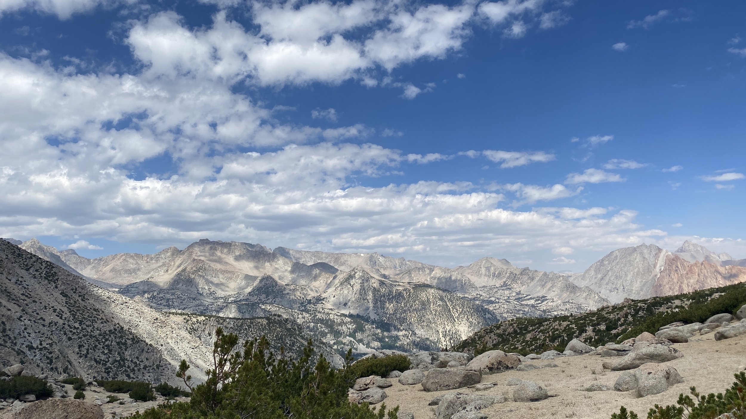
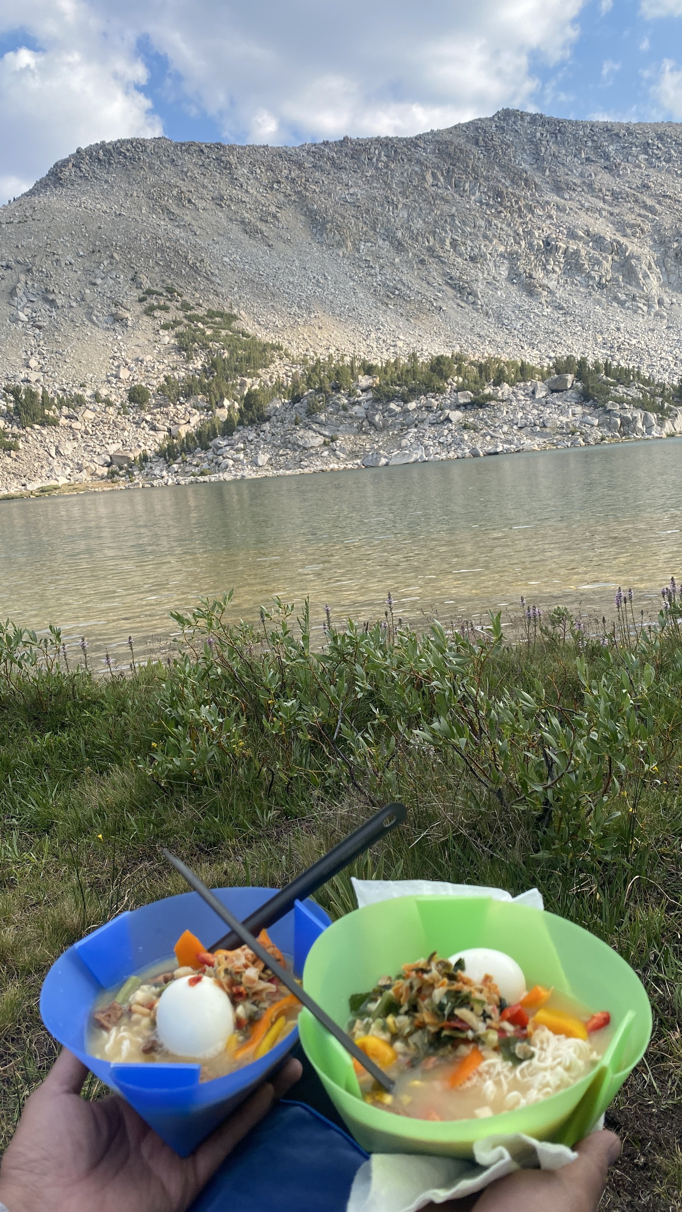
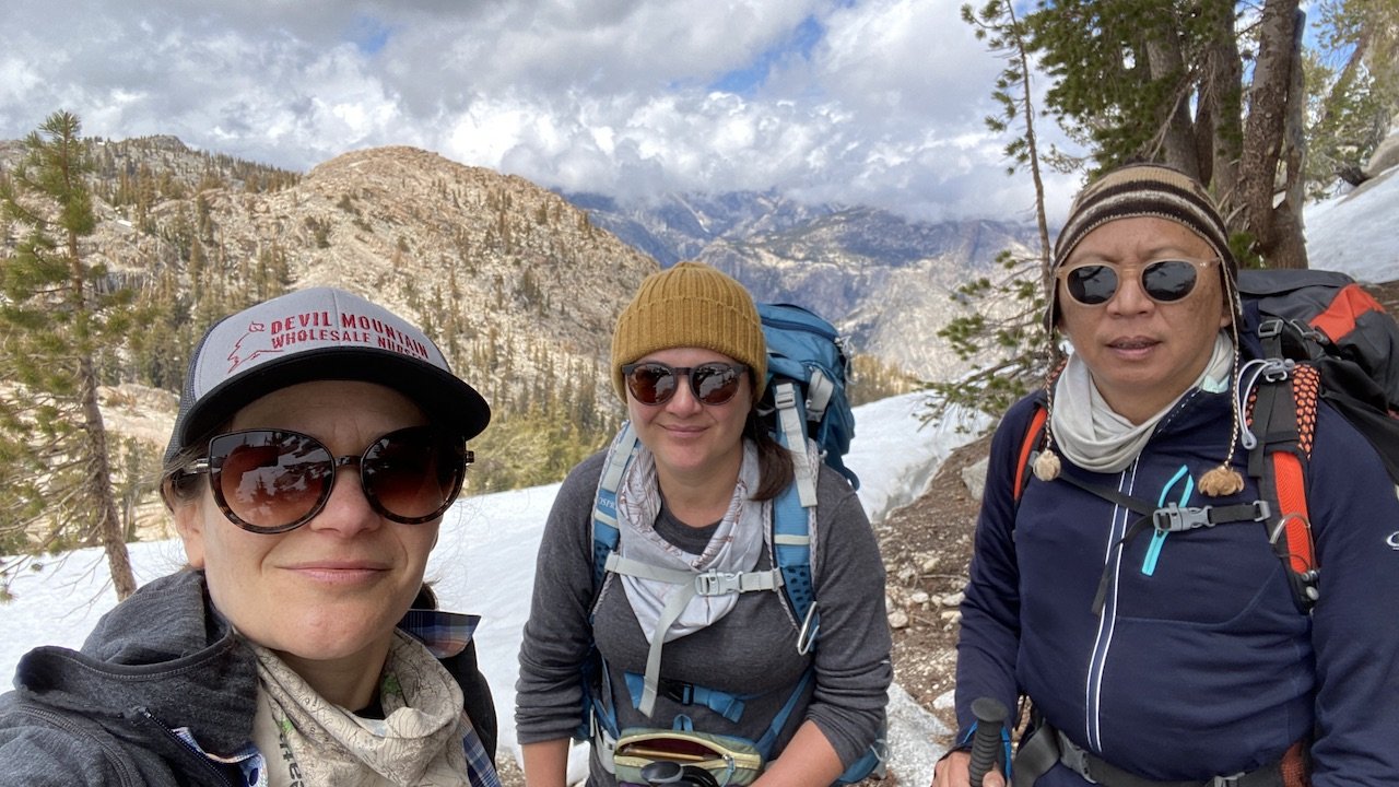
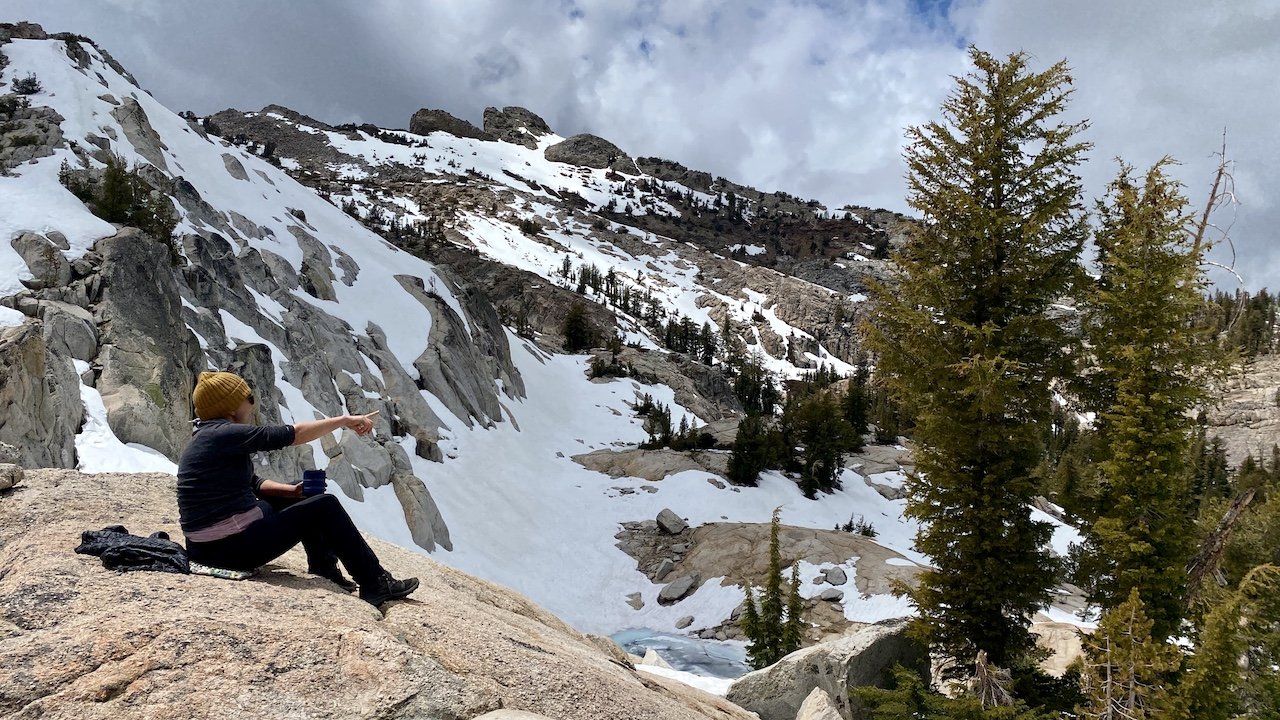
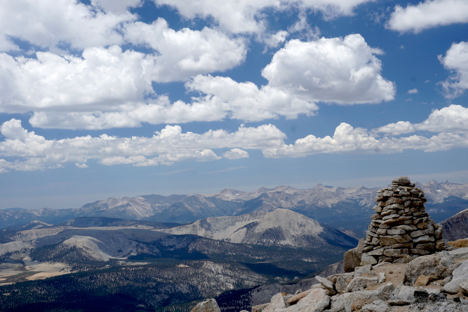
Eventually, after about 2 slow miles we made it up to Sixty Lake Col, which offers awesome views into Gardiner Basin and its sparse moonscape. Here we lingered over a lazy lunch, watching a group of about 10 hikers on the Gardiner side crossing their way precariously along what looked to us like the wrong (read: exceedingly steep and eroded) side of the lake nearest the col. At the col we spoke with a solo hiker, Carl from Richmond, CA, who was doing a multiday off-the-beaten-path route starting at Baxter Pass. For having the reputation of being a seldom-visited basin, Gardiner sure seemed busy the day we were there! We opted not to go down into Gardiner Basin, and instead headed back and past camp to explore other parts of Sixty Lake Basin, where we picked up the visible trail once more.

Gardiner Basin from Sixty Lake Col


Day 4

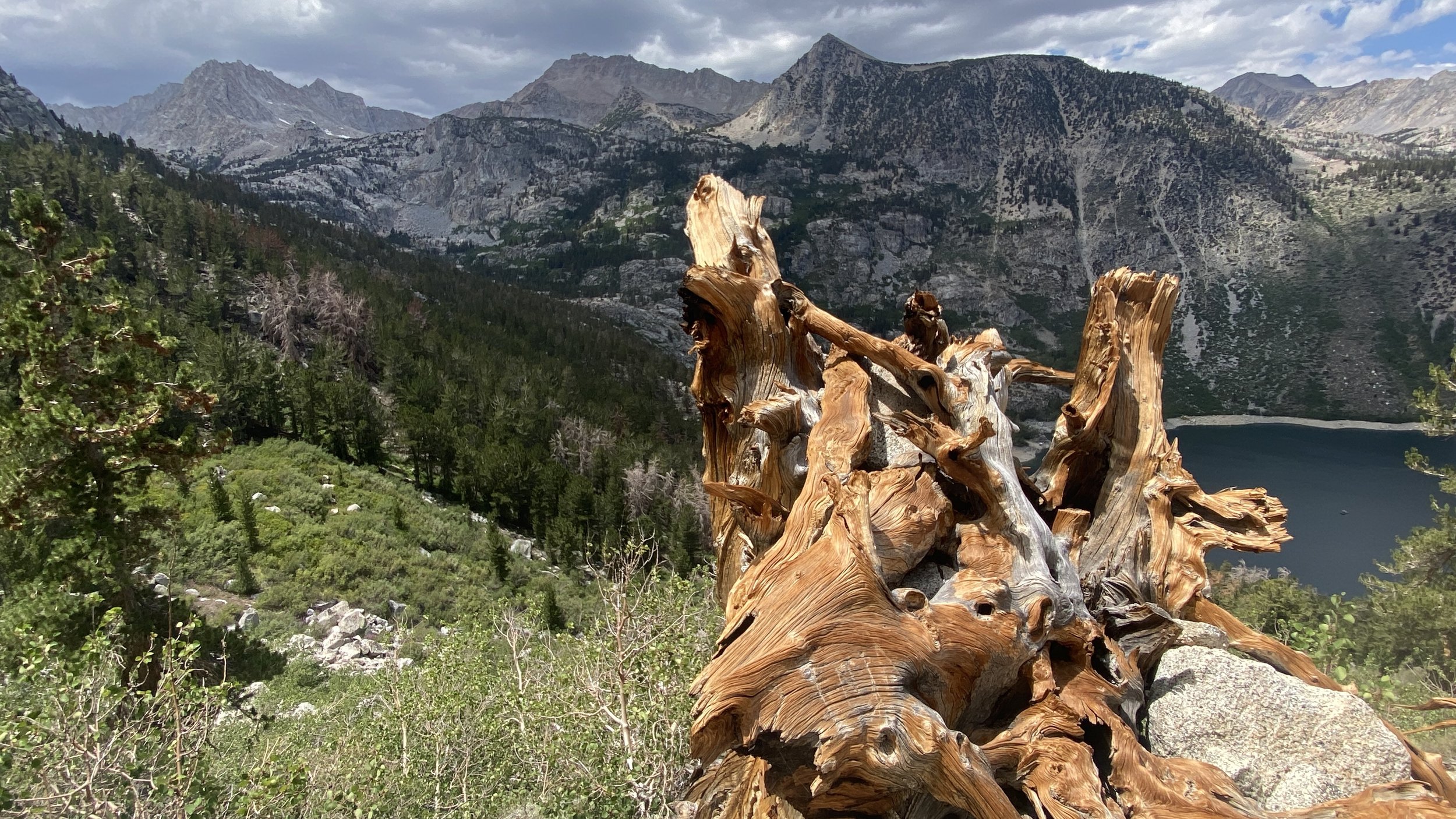
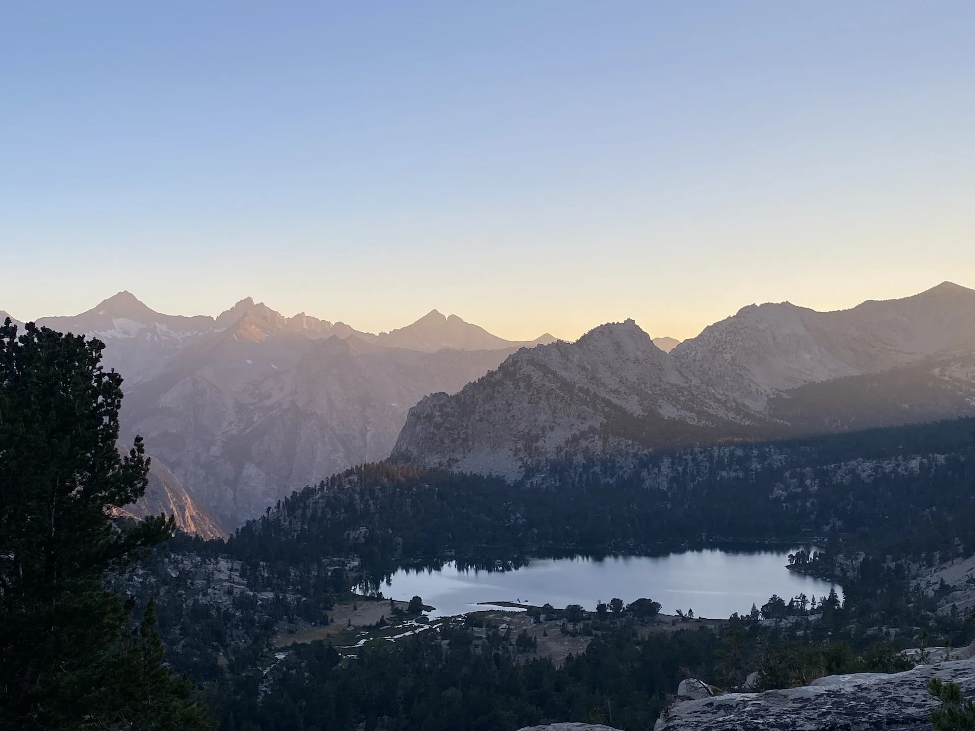
We hiked back the way we came, going back down toward Rae Lakes and over Glen Pass. Once again, we spoke to many hikers along this fairly busy path. We opted to dry camp along the high trail to enjoy one more quiet night on the trail. We found a delightful spot a little over a mile west of Kearsarge Pass, on a promontory ledge with gorgeous views of Bullfrog Lake and the Kearsarge Pinnacles, where we soaked in the afternoon sun and enjoyed a trail happy hour before an early dinner.


Day 5

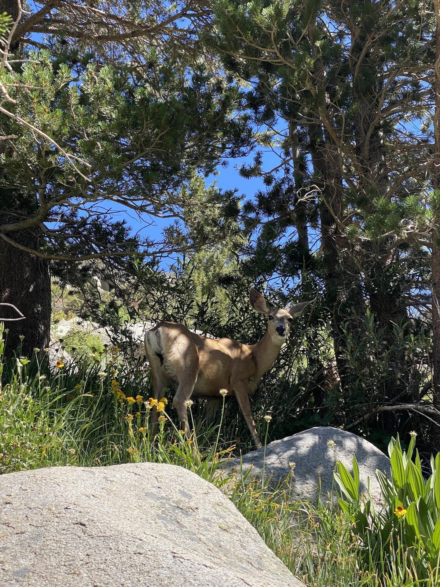
Enticed by the promise of a hearty meal in Lone Pine, we hiked down at a steady pace. We saw a pair of rather large and healthy-looking sooty grouse foraging near the trail. It was already fairly hot at these lower elevations by the time we reached the trailhead by mid-morning, and we were glad not to be among the hikers just starting their uphill trek!

This area holds a special place in my heart. Onion Valley is it is the first place I ever camped. In preparation for my first night in a tent, I did a great deal of reading about camping in bear country, acclimating to being at altitude, having the right gear etc. Despite my over-preparation, on the morning after my first night I reached into my jacket pocket to find two single-serve packets of honey that I had forgotten to take out of the tent. I thought myself lucky not have been visited by Winnie the Pooh or any other honey-loving ursine!

View fullsize IMG_2908.JPG
View fullsize Look at that pretty moon
Look at that pretty moon
View fullsize IMG_2919.JPG
View fullsize The first of many pikas we'd see
The first of many pikas we'd see
View fullsize IMG_4144.jpg
View fullsize The first of the 60(ish?) lakes
The first of the 60(ish?) lakes
View fullsize IMG_2964.jpg
View fullsize Studying the cross-country options
Studying the cross-country options
View fullsize Negotiating talus
Negotiating talus
View fullsize Did someone say snack?
Did someone say snack?
View fullsize Turquoise lake near Sixty Lake Col
Turquoise lake near Sixty Lake Col
View fullsize Oh deer!
Oh deer!
View fullsize IMG_4243 2.JPG
View fullsize IMG_4237.JPG
View fullsize IMG_4230.JPG
View fullsize A pair of sooty grouse
A pair of sooty grouse
View fullsize Mother Nature's art
Mother Nature's art
View fullsize IMG_4147.JPG
View fullsize Above Kearsarge Lakes
Above Kearsarge Lakes
View fullsize Hot afternoon, cool shade
Hot afternoon, cool shade
View fullsize Trail happy hour
Trail happy hour


Days: 5 (July 2024)

Mileage: 37 mi.

Elevations: Onion Valley trailhead 9,200’; Kearsarge Pass 11,700'; Glen Pass 11,969’; Sixty Lake Col 11,700’. Total elevation gain 9,678’.

Camp locations: tarn south of Glen Pass; Sixty Lake Basin (2 nights); High Trail ~1 mi west of Kearsarge Pass.

In Travel Tags Backpacking, Sierra Nevada, Sierra, Eastern Sierra, Kearsarge, Sixty Lake, Onion Valley

Tree ghost mimicking the rocky peaks of Miter Basin

Hooves on the Ground: Miter Basin

July 19, 2023

A five-day Sierra trek with beautiful weather, no wildfire smoke, and no mosquitoes? Sometimes you get lucky. This time, we were in the John Muir and Golden Trout Wildernesses and in Sequoia National Park, maximizing our time enjoying a cross-country jaunt of Miter Basin.

We’ve never met a Sierra basin we didn’t like, and Miter is one we’ve been meaning to return to for some time. Our first visit to Miter was brief — a scramble from Soldier Lake for a few hours, as part of a loop of Cottonwood Lakes and Pass that included summiting Mt. Langley. What an indescribably transcendent place, we thought to ourselves. We knew we had to go back.

Sky Blue Lake with the imposing formation of The Miter dominating on the right

On this trip, we were joined by our Czech pals Jana and Marek, who were interested in a “Wild West wilderness experience,” as they put it. We met Jana in the Himalaya in 2018 while hiking the Annapurna Circuit.

We sometimes forget how fortunate we are to experience nature as we do in the American West, and hiking with Jana and Marek helped remind us. Having large swaths of land protected from development means we have the freedom to roam for days or weeks without stepping into a modern building or crossing an asphalt-covered road. Returning to the comforts of modernity means experiencing them with new eyes and appreciation — which, for us, over the years has tended to be one of the longer-lasting effects of wilderness travel.

View fullsize IMG_6757.jpg
View fullsize Ascending New Army Pass
Ascending New Army Pass
View fullsize Geology of New Army Pass
Geology of New Army Pass
View fullsize A zipper tree, perhaps?
A zipper tree, perhaps?
View fullsize Trail nap
Trail nap
View fullsize IMG_6782.jpg
View fullsize Miter Basin grandeur
Miter Basin grandeur
View fullsize IMG_6763.jpg
View fullsize Underwater rock garden
Underwater rock garden
View fullsize IMG_6745.jpg
View fullsize IMG_6853.jpg
View fullsize IMG_6849.jpg
View fullsize Napping at 12k'
Napping at 12k'
View fullsize Iridescent Lake
Iridescent Lake
View fullsize IMG_7561.JPG
View fullsize IMG_6879.jpg

Our route began at Cottonwood Lakes trailhead (10,040’) — a thin-aired start for sea-level dwellers. To help us acclimatize, the night before the hike we camped at the walk-in backpackers’ campground near the trailhead (which was virtually empty when we arrived in the afternoon and very full by the evening).

Day 1

From Cottonwood Lakes trailhead, the trail first leads west and then north as it passes through equestrian areas, before entering into Golden Trout Wilderness. Passing on the edge of a meadow near Cottonwood Creek, it climbs up and heads west once more. Here we enjoyed expansive views from just south of Cottownwood Lakes #1 and 2. We lunched in the shade of some lodgepole pines and chatted with passing hikers as we soaked in gorgeous vistas of Cottonwood Basin and Mt. Langley.

We proceeded another mile or so to camp at South Fork Lakes (11,000’) and stopped there for the night to let ourselves further acclimatize before attempting New Army Pass the following morning. We had the westernmost South Fork Lake to ourselves and enjoyed its unique and picturesque underwater rock gardens and how the changing light shifted the scenery surrounding the lakes throughout the evening.

Day 2

Picking up the trail westward, we started the day by passing Long Lake before a switchback ascent to New Army Pass (12,310’), entering into Sequoia National Park. We were greeted by several resident marmots who begged unsuccessfully for a snack. After taking in the views and exchanging high-fives, we descended gently into the sparse, granite landscape while spying views to the north toward (Old) Army Pass.

A couple of miles down, we lunched at timberline just below 11,000’ next to a tributary of Rock Creek. We then headed north, and later west, on Upper Rock Creek trail. Though a trail into Miter basin does not appear on the Tom Harrison Mount Whitney High Country map, there is a use trail heading north from the east side of the meadow at Lower Rock Creek Lake. We followed this use trail as it faded and reappeared. Route-finding is sometimes necessary, but we nevertheless found this to be a pleasant route up into Miter Basin and less of a scramble than the bushwhack up from Soldier Lake we had done in the past.

Once in Miter Basin, we proceeded about a mile and a half and found a lovely place to camp near where most maps show three streams converging like a trident. This would be home for the next two nights.

Day 3

We were really looking forward to a day of putzing around the basin. Options abound, and we decided we’d start with a ramble toward Iridescent Lake. This was very much a start-and-stop day full of pauses and exclamations such as, “look at that ridiculous gorgeousness!” and “oooh, I’ve never seen such splendid combination of rock, water, and sky!”

We followed a use trail northbound along the length of the basin, and we eventually split off to head northwest along a slope to ascend nearly 1,000’ to Iridescent Lake. The landscape alternates between sparse rock and marshy meadow. Once at the lake, the color palette changes — the intense indigo of the sky reflected in the green-red-yellow-turquoise rainbow of a truly iridescent lake. We spent a couple of hours napping, taking brisk dips, and sunbathing on the lake’s south shore.

Eventually we picked ourselves up from this idyllic spot to head southwest over the saddle between Iridescent Lake and Sky Blue Lake. The saddle is immediately south of The Miter (12,770’), and it took a bit of scouting to find the best route — particularly on the descent, where some of the dropoffs on the west side are significant. While on this saddle, we looked up and saw that we were being watched by a Sierra bighorn sheep. It was our first time in our years of Sierra travel ever seeing one (though we are certain we’ve been spotted by them before!)

We spent a lazy afternoon at Sky Blue Lake, lunching and napping. Or, more accurately, most of us spent a lazy afternoon. Jana has a penchant for long-distance swimming in cold water and found Sky Blue to be irresistible. She spent a solid 20 minutes swimming shore-to-shore and back, swimming what we estimate was at least a half mile in deep, cold water. We were exhausted and breathless just watching her.

Eventually we headed south, enjoying the gardens that cropped up in between the filigree of the lake’s network of outlet streams. We stopped frequently to take in stupendous 360-degree views before returning back to camp in the early evening.

Day 4

We packed up and headed back out toward Upper Rock Creek trail, retracing our route toward a junction with Siberian Pass Trail. We filled up on water at the junction and then turned right to follow the forested trail as it climbed toward a junction with the PCT, which we joined southbound. Hiking the southwestern slopes of Cirque Peak (12,900’), we eventually left Sequoia National Park and reentered Golden Trout Wilderness. The trail loses and gains elevation until topping out at about 11,500’ before beginning a gentle switchback descent toward Chicken Spring Lake. We found good camping on the west end, quite a distance from the lake — but not before scouting for sites for a little while.

Day 5

With just a little over 5 miles to go, we packed up and headed back onto the PCT, cresting over Cottonwood Pass (11,160’) within the first mile. Leaving the PCT, we continued east through meadows, losing some 1,000’ of elevation as we neared Horseshoe Meadows. Rather than exit out Cottonwood Pass trailhead, we took a connecting trail northward through the equestrian areas which connected us back to Cottonwood Lakes trailhead, where we had started.

We drove down to Lone Pine and enjoyed a celebratory lunch, looking up at Mt. Whitney and its neighboring peaks and discussing where our next adventure might take us.

Days: 5 (Aug. 30 - Sept. 3, 2022)

Mileage: 34 mi.

Elevations: Cottonwood Lakes trailhead 10,040'; New Army Pass 12,300'; Miter Basin ~11,000’; Saddle between Iridescent and Sky Blue lakes 12,000’. Total elevation gain 5,804’.

Camp locations: westernmost South Fork Lake; Miter Basin (2 nights); Chicken Spring Lake.

View fullsize Cottonwood Lakes
Cottonwood Lakes
View fullsize IMG_6744.jpg
View fullsize IMG_6755.jpg
View fullsize IMG_6758.jpg
View fullsize Descending New Army Pass
Descending New Army Pass
View fullsize From the Miter's base
From the Miter's base
View fullsize IMG_6837.jpg
View fullsize Iridescent Lake
Iridescent Lake
View fullsize Sierra bighorn sheep
Sierra bighorn sheep
View fullsize Czech out the hikers
Czech out the hikers
View fullsize IMG_6790.jpg
View fullsize The Miter and its basin
The Miter and its basin
View fullsize IMG_6791.jpg
View fullsize IMG_6883.jpg
View fullsize IMG_6882.jpg
View fullsize IMG_6875.jpg
View fullsize IMG_6854.jpg
View fullsize IMG_6851.jpg
View fullsize Chicken Spring Lake
Chicken Spring Lake
View fullsize IMG_6890.jpg

In Travel Tags Miter, Sierra Nevada, Sierra, Eastern Sierra, Backpacking, Inyo, trip report, itinerary

Blue Lake at dusk following an afternoon rainstorm.

Hooves on the Ground: Tyee/Midnight/Hungry Packer Lakes, John Muir Wilderness

July 18, 2023

For years, we’ve celebrated J’s birthday with a Sierra backpacking trip. Almost every time, the longest and toughest climb inadvertently falls on his birthday. Case in point: summer 2017, when we found ourselves hiking up from the JMT to Piute Pass on his birthday after an epically wet winter, resulting in no less than a dozen significant and exhausting stream crossings on one day. That was just one example of a long string of birthdays spent trudging up to some elusive thin-aired destination.

We’ve tried to correct this by designing a more leisurely itinerary — at least for his actual birthday — but it appears we are not meant to embark on such walks in the park. Take the time in 2021, when rather than hike over Lamarck Col to base camp at Darwin Bench for a few days, we decided not to hike back out over Lamarck Col, instead changing our route, adding 25 or 30 miles, and replacing sluggishness with brisk exertion.

I dare say that in 2022 we accomplished our goal and achieved a low-milage, medium-effort, high-reward birthday trip. It went something like this…

We arrived a couple of days early to acclimatize to the higher elevations we’d encounter on this hike, camping a couple of nights in the Bishop Canyon area of the John Muir Wilderness and day hiking to the lovely Chocolate Lakes starting at South Lake and ascending toward Long Lake and Ruwau Lake. There were wildfires burning in the area and we were somewhat impacted by smoke on our day hike. Fortunately, by the time our backpacking trip started the smoke had shifted away from the area.

The backpacking route started at Tyee Lakes trailhead. From there, we hiked up to the largest of the namesake lakes, camping just above 11,000’.

On day 2, we hiked over Table Mountain to about 11,600’, soaking in absolutely jaw-dropping views of Evolution Valley before descending toward George Lake. From there, we followed the trail (almost) to Lake Sabrina, turning south toward Blue Lake, where we camped for two nights.

A carpet of lupine near Sailor Lake

On day 3, we headed up the middle fork of Bishop Creek and putzed around many beautiful mini lake basins under intermittent rain, visiting Midnight Lake, Hungry Packer Lake, and Sailor Lake — each with its own unique character and backdrop of scenery. In better weather we might have continued exploring the countless lakes and tarns that dot this landscape, accessed via endless out-and-backs or out-and-overs. Instead, we took this trip to be an appetizer for a future return visit.

On our final day, we hiked out to Lake Sabrina and hitchhiked back to our starting trailhead.

IMG_6435.jpg
 Table Mountain

Table Mountain

 Table Mountain

Table Mountain

IMG_6387.jpg
 Expansive views into Evolution Basin and Valley

Expansive views into Evolution Basin and Valley

IMG_6396.jpg
 Blue Lake

Blue Lake

IMG_6423.jpg
IMG_6454.jpg
IMG_6461.jpg
 Where’s Jolly? Napping under lightweight umbrellas in the hot afternoon sun

Where’s Jolly? Napping under lightweight umbrellas in the hot afternoon sun

 Crystal waters of Hungry Packer Lake

Crystal waters of Hungry Packer Lake

IMG_6435.jpg  Table Mountain  Table Mountain IMG_6387.jpg  Expansive views into Evolution Basin and Valley IMG_6396.jpg  Blue Lake IMG_6423.jpg IMG_6454.jpg IMG_6461.jpg  Where’s Jolly? Napping under lightweight umbrellas in the hot afternoon sun  Crystal waters of Hungry Packer Lake

Days: 4 (late July 2022)

Mileage: 22 mi.

Elevations: Tyee Lakes trailhead 9,112'; Table Mountain 11,588'; Lake Sabrina 9,060’. Total elevation gain 4,852’.

Camp locations: Tyee Lakes; Blue Lake.

View fullsize IMG_6366.jpg
View fullsize IMG_6367.jpg
View fullsize IMG_6378.jpg
View fullsize IMG_6383.jpg
View fullsize IMG_6392.jpg
View fullsize IMG_6413.jpg
View fullsize IMG_6415.JPG
View fullsize IMG_6430.jpg
View fullsize IMG_6467.JPG
View fullsize IMG_6491.jpg


In Travel Tags Back, Sierra Nevada, Eastern Sierra, John Muir Wilderness, itinerary, trip report

Semi-frozen tarn below Tuolumne Peak in May 2022.

Hooves on the Ground: Yosemite's Murphy Creek to Tuolumne Crest in the early season

July 10, 2023

The 2021-22 winter got a promising start, with the snowpack at year’s end registering at 160 percent of average. Unfortunately, January and February 2022 were some of the driest on record, and by April snowpack was just 38 percent of average. With no significant spring storms, many Californians braced for a dry, hot summer and had good reason to believe that Sierra wildfires would once again dominate the news. As it turned out, 2022 was not a big wildfire year — credited in large part for due to increased staffing of fire management agencies and aggressive vegetation removal.

As changes in climate have shifted the seasons, in recent years we have been motivated to jump start our backcountry jaunts as early as possible — you just don’t know what the summer will bring. So when Yosemite announced that the 2022 opening date for Tioga Road would be the Friday before Memorial Day, we were able to easily snag a wilderness permit from the list of trailheads that became available once the park made the announcement.

Tioga Road connects Yosemite to the Eastern Sierra via its namesake pass at 9,943’. Its opening date changes yearly and has historically occurred as late as July. In contrast with 2021-22, the winter of 2022-23 was one of the wettest ever recorded — with Yosemite’s snowpack in April coming in at 244 percent of normal. From the first deluge in November to the final snowstorms in April, the mountains were drenched in an unprecedented amount of precipitation. Snowfall reached record-breaking depths, transforming the Sierra Nevada into a winter wonderland into July.

As we entered the park in late May of 2022, we knew there would still be considerable snow coverage, so we opted for a route that would enable us to sleep below 10,000’ if we needed to.

We drove up the Thursday before Memorial Day with our friend Sarah and camped at Bass Lake. On Friday morning we picked up our permit at Wawona and enjoyed being among the first to drive up Tioga Road to the trailhead at Murphy Creek, near Tenaya Lake.

The first couple of trail miles were snow-free. Once we hit snow, as far as we could tell we were the first (human) hikers to lay down tracks. There were many bear and deer tracks, and as it turned out, some were quite fresh: we had a mutual startle when we encountered a cinnamon-colored black bear. Fortunately, the bear was happy to run the other way.

 Trail or lake? Both, as it turned out.

Trail or lake? Both, as it turned out.

IMG_5857.jpg
IMG_5832.jpg
IMG_5921.jpg
IMG_5919.jpg
 We could hear the croaking of yellow-legged frogs despite the frozen ground and water.

We could hear the croaking of yellow-legged frogs despite the frozen ground and water.

IMG_5916.jpg
IMG_5913.jpg
IMG_5912.jpg
IMG_5899.jpg
IMG_5893.jpg
IMG_5890.jpg
IMG_5889.jpg
IMG_5877.jpg
IMG_5867.jpg
IMG_5855.jpg
IMG_5926.jpg
 Trail or lake? Both, as it turned out. IMG_5857.jpg IMG_5832.jpg IMG_5921.jpg IMG_5919.jpg  We could hear the croaking of yellow-legged frogs despite the frozen ground and water. IMG_5916.jpg IMG_5913.jpg IMG_5912.jpg IMG_5899.jpg IMG_5893.jpg IMG_5890.jpg IMG_5889.jpg IMG_5877.jpg IMG_5867.jpg IMG_5855.jpg IMG_5926.jpg

Our intended destination for this hike was the trail crest below Tuolumne Peak in Yosemite’s high country — a magical land of pikas and yellow-legged frogs which we had previously enjoyed when hiking the Grand Canyon of the Tuolumne in 2020.

Proof of excellent pika sightings at this location in July 2020.

Much of the trail was still muddy and under water early in the season, making route-finding challenging at times. But early hiking meant no wildfire smoke to deal with, and very few mosquitoes thanks to the cold. Another advantage of early-season hiking was that campfires were permitted in existing fire rings below 9,600’. We were grateful for the warmth, and we made a new friend who was also seeking to stay toasty.

Days: 3 (May 27-29, 2022)

Mileage: 15.5 mi

Elevation: Murphy Creek trailhead 8,185'; crest below Tuolumne Peak 9,881’'. Total elevation loss/gain 2,208’.

Camp location: Polly Dome Lakes (2 nights)

View fullsize  Glacial erratics transported by glaciers and left behind after they melted.
View fullsize  Deer tracks
View fullsize  Bear track in the snow
View fullsize  Bear track (or possibly Sasquatch) in the mud
View fullsize  Human tracks!
View fullsize IMG_5895.jpg
View fullsize  Trail still very much flooded
View fullsize  Trying to keep feet semi-dry
View fullsize IMG_5917.jpg
View fullsize IMG_5911.jpg
View fullsize IMG_5892.jpg
View fullsize IMG_5865.jpg
View fullsize IMG_5863.jpg
View fullsize IMG_5837.jpg
View fullsize IMG_5860.jpg
View fullsize IMG_5859.jpg
In Travel Tags Backpacking, Yosemite, Sierra Nevada, itinerary, trip report

Camping at Darwin Bench

Hooves on the Ground: Darwin, Evolution, and Piute Canyons via Lamarck Col and Piute Pass

September 12, 2021

As a buck, I don’t much understand what the big deal about birthdays is. The way I see it, every day spent on this earth is worth celebrating because it means I didn’t get eaten by a mountain lion or hit by a car while crossing the 405 freeway. But E+J have explained to me that for humans, celebrating yearly birthdays is an important tradition, and that’s why we generally find ourselves in the Sierra Nevada each July — to celebrate J’s birthday.

Read More
In Travel Tags Sierra Nevada, Eastern Sierra, Evolution, Backpacking, wilderness, Inyo, John Muir Wilderness, Kings Canyon, trip report, itinerary
Banner Peak and Thousand Island Lake at sunrise

Banner Peak and Thousand Island Lake at sunrise

Hooves on the Ground: Thousand Island Lake via Rush Creek

June 27, 2021

Most years we don’t hit the Sierra for a backpacking trip until July, but the changing climate means the summer backpacking season too is changing. With this year’s low snow and the likelihood of wildfires growing with each passing week, we decided we would head out for a short, last-minute trip to scratch the wanderlust itch we were left with after an off-the-beaten-path trip to Grand Canyon last month. We did some research on Sierra trails that are suitable for early season exploration and settled on this one. We hiked it June 10-12, and while we had traveled the middle portion of this route when we did the John Muir trail back in 2015, the beginning and end portions were new and intriguing to us.

Read More
In Travel Tags Sierra Nevada, Eastern Sierra, High Sierra, Ansel Adams Wilderness, Inyo, June Lake, Backpacking, trip report, itinerary
Looking toward Hetch Hetchy on the descent into the Grand Canyon of the Tuolumne River

Looking toward Hetch Hetchy on the descent into the Grand Canyon of the Tuolumne River

Hooves on the Ground: Yosemite's Grand Canyon of the Tuolumne and Old Big Oak Flat Road to El Capitan

August 9, 2020

This is an unusual year for everything, including (and perhaps especially) travel. With California under stay-at-home orders for the first few months of the COVID-19 pandemic, we stuck to day hiking near home and we visited many parts of the Angeles National Forest that we had never before explored, which led us to fall in love with LA and its roomy backyard all over again.

Read More
In Travel Tags Yosemite, Grand Canyon of the Tuolumne, Backpacking, El Capitan, Pika, High Sierra, Sierra Nevada, trip report, itinerary
The final resting place of a Graumann DC-16 Albatross that crash landed during a CIA operation in 1952

The final resting place of a Graumann DC-16 Albatross that crash landed during a CIA operation in 1952

Hooves on the Ground: Death Valley Albatross Plane Crash Site

May 11, 2020

Death Valley National Park is a vast land full of surprises waiting to be discovered and explored. From the lowest point in North America at Badwater Basin (282 ft. below sea level) to Telescope Peak (11,049 ft.), Death Valley encompasses multiple mountain ranges, valleys, and countless canyons that offer a giant playground for exploring fascinating geology, jaw-dropping terrain, and interesting human and natural history. As the largest national park outside of Alaska, it offers limitless opportunities for exploration and is one of our favorite places to visit.

Read More
In Travel Tags Death Valley, plane crash, Cottonwood Mountains, hiking, camping, backpacking, California, desert, Sierra Nevada

Watercolor by E

Hooves on the Ground: High Sierra Trail

September 29, 2019

When the Sierra speaks, it’s hard to argue. The HST is a historic traverse of the Range of Light from the verdant and gentle lands at Crescent Meadow in Sequoia National Park’s Giant Forest, to the rugged, weather-beaten escarpments of majestic Mt. Whitney, the highest point in the contiguous U.S. So without further ado, we decided to hike the High Sierra Trail with our pal Torin and see this wonderful stretch of land with our own eyes.

Read More
In Travel Tags Sierra Nevada, Sierra, Eastern Sierra, Mountains, Backpacking, Mount Whitney, Sequoia, Thru-hiking, Elevation, California, Hiking, Highway 395, Watercolor, trip report, itinerary
On the trail to Mt. Langley, an impressively-constructed wayfinding cairn and the breathtaking view into Sequoia National Park.

On the trail to Mt. Langley, an impressively-constructed wayfinding cairn and the breathtaking view into Sequoia National Park.

Hooves on the Ground: Cottonwood Pass and Lakes Loop (Miter Basin and Mt. Langley)

July 29, 2018

It's a lucky thing to live in California and have an excuse to visit the High Sierra in late July. Our excuse: J's birthday is July 26 -- prime time to get into those higher elevations. Every year, we make it a point to reserve a few days (or weeks) out of the summer calendar to explore a portion of the Sierra's endless network of trails. This time around we were in the mood for a shorter trek with day hiking and cross-country options for going away from camp. This loop fit the bill perfectly.

Read More
In Travel Tags Sierra Nevada, Backpacking, Mt. Langley, 14ers, Cottonwood Lakes, Cottonwood Pass, Upper Rock Creek, Army Pass, Pacific Crest Trail, itinerary, trip report
the troubles we carry banner.png

The Troubles We Carry

January 14, 2018

In the latest dearantler show, we pay homage to nature's grandest cathedrals, its most heavenward sacred spaces: mountains. From the most inviting and verdant summits, to inhospitable thin-aired peaks far above timberline, mountains offer weary human souls a dose of the grandiose, a chance for renewal, a baptismal reconnection to our primeval roots of wandering lands high and low. 

Read More
In Art Tags Art, mixed media, collage, Etching, Mountains, Hitchcock, Andes, Sierra Nevada, Peru, Mongolia, abstract

Wanda Lake (11,426'), still largely frozen in late July of this high snow year. Situated west of Muir Pass (11,955'), it is named for one of John Muir's two daughters. Helen Lake (11,617') sits on the east side of the pass and is named for Wanda's sister.

Hooves on the Ground: South Lake to North Lake (Evolution Loop)

August 4, 2017

If the John Muir Trail is the crown jewel of the Pacific Crest Trail, then the Evolution Basin and Valley are perhaps the most strikingly-sculpted gem to be carefully placed in that jewel. One bite of the Evolution area is liable to infect any passerby, causing even the most mileage-minded thru-hiker to slow down and soak in the absurdly stunning combinations of rock, water and sky.

Read More
In Travel Tags Piute Pass, Sierra, John Muir Trail, Backpacking, Bishop, wilderness, Kings Canyon, Sierra Nevada, Eastern Sierra, Snow, John Muir Wilderness, Bishop Pass, Muir Pass, itinerary, trip report

Wanderlust: Hiking on Legendary Trails

June 29, 2017

We at dearantler are honored to have contributed to the newly-published book Wanderlust: Hiking on Legendary Trails. This beautiful coffee-table book is filled with inspiration and practical tips on hiking some of the world's most enchanting trails. The John Muir Trail chapter includes many of the photos and descriptions of our 2015 JMT trek. The book is published by Berlin-based Gestalten, which has published hundreds of books on art, architecture, design, photography and typography -- and we have been busy reading it to decide which treks to plan next!

Read More
In Travel Tags John Muir Trail, Backpacking, Gestalten, Eastern Sierra, Sierra Nevada, Wanderlust, Sierra, California, John Muir Wilderness, Yosemite, Sequoia, Kings Canyon, Inyo, National Forest, national parks

Temple Crag (12,976') towering over the milky-turquoise waters of Second Lake (10,159')

Hooves on the Ground: The Palisades

October 8, 2016

Just four hours from Los Angeles and a few miles in by trail lies a stunning landscape of 14,000-foot mountains, milky-turquoise lakes, and the largest glacier in the Sierra Nevada. We visited in mid-September and were at once humbled by the beauty, enormity and variety of features within easy reach for even a beginning backpacker.

Read More
In Travel Tags Sierra, Sierra Nevada, Eastern Sierra, Big Pine, 14ers, Glacier, Backpacking, Camping, hik, Highway 395, Hooves on the Ground, trip report, itinerary
Comment

Watercolor map by E

Hooves on the Ground: Tahoe to Yosemite Along the Pacific Crest Trail

September 10, 2016

Having successfully completed the John Muir Trail in 2015, we were looking to get back out to the Sierra Nevada for another thru-hike this summer. After some consideration of the many options the Sierra affords, we decided to tackle the next section of the Pacific Crest Trail north of the JMT (the JMT itself overlaps with the PCT for most of its length). Starting at Barker Pass, in the northwest Lake Tahoe area, this section travels nearly 200 miles to Yosemite’s Tuolumne Meadows. Along the way, it passes innumerable lakes, creeks and streams, crosses several roads and highways, climbs up and down numerous mountain passes.

Read More
In Travel Tags Backpacking, Thru-hiking, Sierra Nevada, Eastern Sierra, California, Summer, Tahoe, Lake Tahoe, Pacific Crest Trail, John Muir Trail, Desolation Wilderness, wilderness, Mokelumne, Carson-Iceberg, Yosemite, trip report, itinerary
Comment

Hooves on the Ground: John Muir Trail

November 6, 2015

Around Thanksgiving 2014 Edith + Jolly's friends, Kelley and Peter, casually threw out an idea: to hike the John Muir Trail. The JMT travels 220 miles through some of the most rugged and stunning mountain scenery in the world, gaining and losing some 50,000 feet of elevation from iconic Yosemite Valley to the top of Mt. Whitney, the highest point in the contiguous US (see previous Hooves on the Ground posts about exploring the Yosemite high country and Mt. Whitney). The JMT shares most of its route with the Pacific Crest Trail and is widely considered to be the most demanding and scenic portion of that much longer trail.

E+J were more than intrigued: they were up for the challenge. Months of preparation ensued. Permits were secured. Books were read. Maps were studied. The vast resources of the interweb were consulted. Gear was upgraded. Calories were counted. Resupply packages were assembled. Routes were planned. Bodies were trained. Minds were prepared.

Read More
In Travel Tags Backpacking, Thru-hiking, John Muir Trail, Yosemite, Eastern Sierra, Sierra Nevada, Kings Canyon, Sequoia, John Muir Wilderness, Mount Whitney, Mountains, Ansel Adams Wilderness, Inyo, Sierra, Hooves on the Ground, trip report, itinerary
2 Comments
Dear Antlerby Jedediah Cornelius Antler"The buck stops here."The advice and musings of the swankiest eight-point buck you'll ever meet.

Dear Antler

by Jedediah Cornelius Antler

"The buck stops here."

The advice and musings of the swankiest eight-point buck you'll ever meet.


See all art posts

See all travel posts

Subscribe

 Be a true "Jedhead" and sign up for our mailing list here. 

We respect your privacy. Truly

Jed says thank you!


blog
Hooves on the Ground: Onion Valley to Sixty Lake Basin and Col
about 9 months ago
Hooves on the Ground: Grand Canyon's Clear Creek Trail and Cheyava Falls
about a year ago
Hooves on the Ground: Miter Basin
about a year ago
Hooves on the Ground: Tyee/Midnight/Hungry Packer Lakes, John Muir Wilderness
about a year ago
Hooves on the Ground: Yosemite's Murphy Creek to Tuolumne Crest in the early season
about a year ago
Hooves on the Ground: Grand Canyon's Tanner Trail and Escalante Route
about 2 years ago
Hooves on the Ground: Mineral King Loop via Timber Gap and Lost Canyon
about 2 years ago
Hooves on the Ground: Darwin, Evolution, and Piute Canyons via Lamarck Col and Piute Pass
about 3 years ago
Hooves on the Ground: Thousand Island Lake via Rush Creek
about 3 years ago
Hooves on the Ground: Grand Canyon's Hermit-Boucher Loop
about 4 years ago
Elements of Existence
about 4 years ago
Spellbound | Wanderings Through the Witching Hour
about 4 years ago
Hooves on the Ground: Yosemite's Grand Canyon of the Tuolumne and Old Big Oak Flat Road to El Capitan
about 4 years ago
Psyche | Introspections In an Era of Uncertainty
about 4 years ago
Hooves on the Ground: Death Valley Albatross Plane Crash Site
about 5 years ago
Hooves on the Ground: High Sierra Trail
about 5 years ago
Suspension
about 6 years ago
Hooves on the Ground: Nepal
about 6 years ago
Hooves on the Ground: Cottonwood Pass and Lakes Loop (Miter Basin and Mt. Langley)
about 6 years ago
The Troubles We Carry
about 7 years ago

© dearantler 2013-2024. All rights reserved.