• blog
  • gallery
  • shop
  • archive
  • about
Menu

dearantler

  • blog
  • gallery
  • shop
  • archive
  • about
Featured
IMG_3004 2.JPG
Travel
Hooves on the Ground: Onion Valley to Sixty Lake Basin and Col
Travel
Travel
IMG_8926.JPG
Travel
Hooves on the Ground: Grand Canyon's Clear Creek Trail and Cheyava Falls
Travel
Travel
IMG_6880.jpg
Travel
Hooves on the Ground: Miter Basin
Travel
Travel
IMG_6422.jpg
Travel
Hooves on the Ground: Tyee/Midnight/Hungry Packer Lakes, John Muir Wilderness
Travel
Travel
IMG_5896.jpg
Travel
Hooves on the Ground: Yosemite's Murphy Creek to Tuolumne Crest in the early season
Travel
Travel
IMG_5334 2.jpg
Travel
Hooves on the Ground: Grand Canyon's Tanner Trail and Escalante Route
Travel
Travel
IMG_3418.JPG
Travel
Hooves on the Ground: Mineral King Loop via Timber Gap and Lost Canyon
Travel
Travel
Hooves on the Ground: Darwin, Evolution, and Piute Canyons via Lamarck Col and Piute Pass
Travel
Hooves on the Ground: Darwin, Evolution, and Piute Canyons via Lamarck Col and Piute Pass
Travel
Travel
ThousandIsland.jpg
Travel
Hooves on the Ground: Thousand Island Lake via Rush Creek
Travel
Travel
IMG_3348.JPG
Travel
Hooves on the Ground: Grand Canyon's Hermit-Boucher Loop
Travel
Travel
DEARANTLER-SLIDER-2-1.png
Art
Elements of Existence
Art
Art
spellbound banner.png
Art
Spellbound | Wanderings Through the Witching Hour
Art
Art
IMG_0889.jpg
Travel
Hooves on the Ground: Yosemite's Grand Canyon of the Tuolumne and Old Big Oak Flat Road to El Capitan
Travel
Travel
psyche.jpg
Art
Psyche | Introspections In an Era of Uncertainty
Art
Art
LRG_DSC06553.JPG
Travel
Hooves on the Ground: Death Valley Albatross Plane Crash Site
Travel
Travel
HST map illustration.JPG
Travel
Hooves on the Ground: High Sierra Trail
Travel
Travel
Suspension.png
Art
Suspension
Art
Art
Hooves on the Ground: Nepal
Travel
Hooves on the Ground: Nepal
Travel
Travel
Hooves on the Ground: Cottonwood Pass and Lakes Loop (Miter Basin and Mt. Langley)
Travel
Hooves on the Ground: Cottonwood Pass and Lakes Loop (Miter Basin and Mt. Langley)
Travel
Travel
The Troubles We Carry
Art
The Troubles We Carry
Art
Art
Hooves on the Ground: South Lake to North Lake (Evolution Loop)
Travel
Hooves on the Ground: South Lake to North Lake (Evolution Loop)
Travel
Travel
Travel
Hooves on the Ground: Grand Canyon
Travel
Travel
Wanderlust: Hiking on Legendary Trails
Travel
Wanderlust: Hiking on Legendary Trails
Travel
Travel
Peru+Map.jpg
Travel
Hooves on the Ground: Perú
Travel
Travel
Art
Notorious/Glorious
Art
Art
Art
dearantler turns 3!
Art
Art
Art
Music Video for Sara Lov's 'Rain Up'
Art
Art
Travel
Hooves on the Ground: The Palisades
Travel
Travel
Travel
Hooves on the Ground: Tahoe to Yosemite Along the Pacific Crest Trail
Travel
Travel
Art
Strangers On A Trail
Art
Art

Temple Crag (12,976') towering over the milky-turquoise waters of Second Lake (10,159')

Hooves on the Ground: The Palisades

October 8, 2016

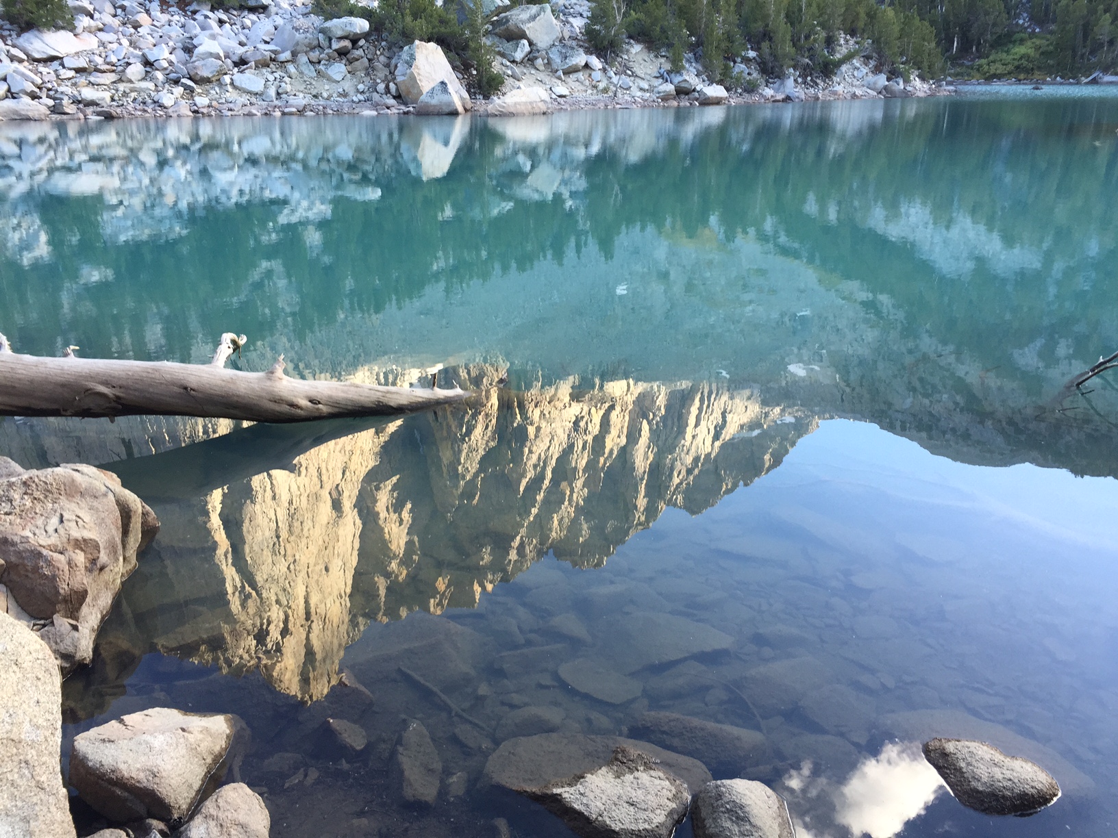
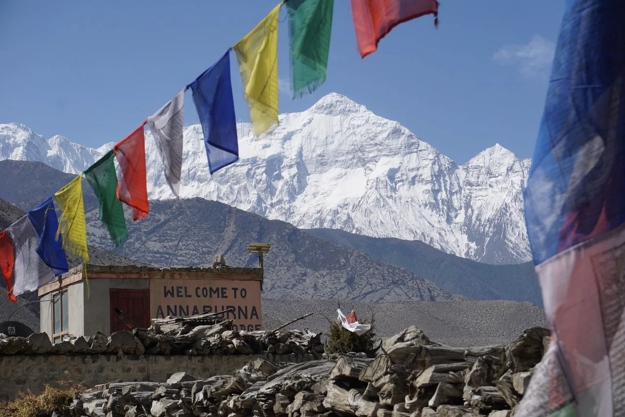
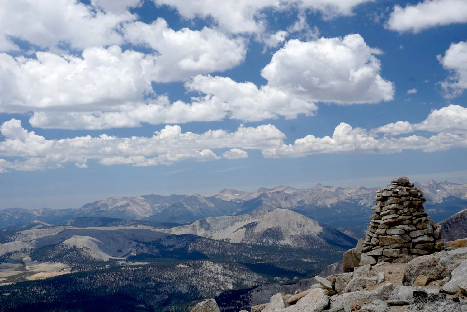
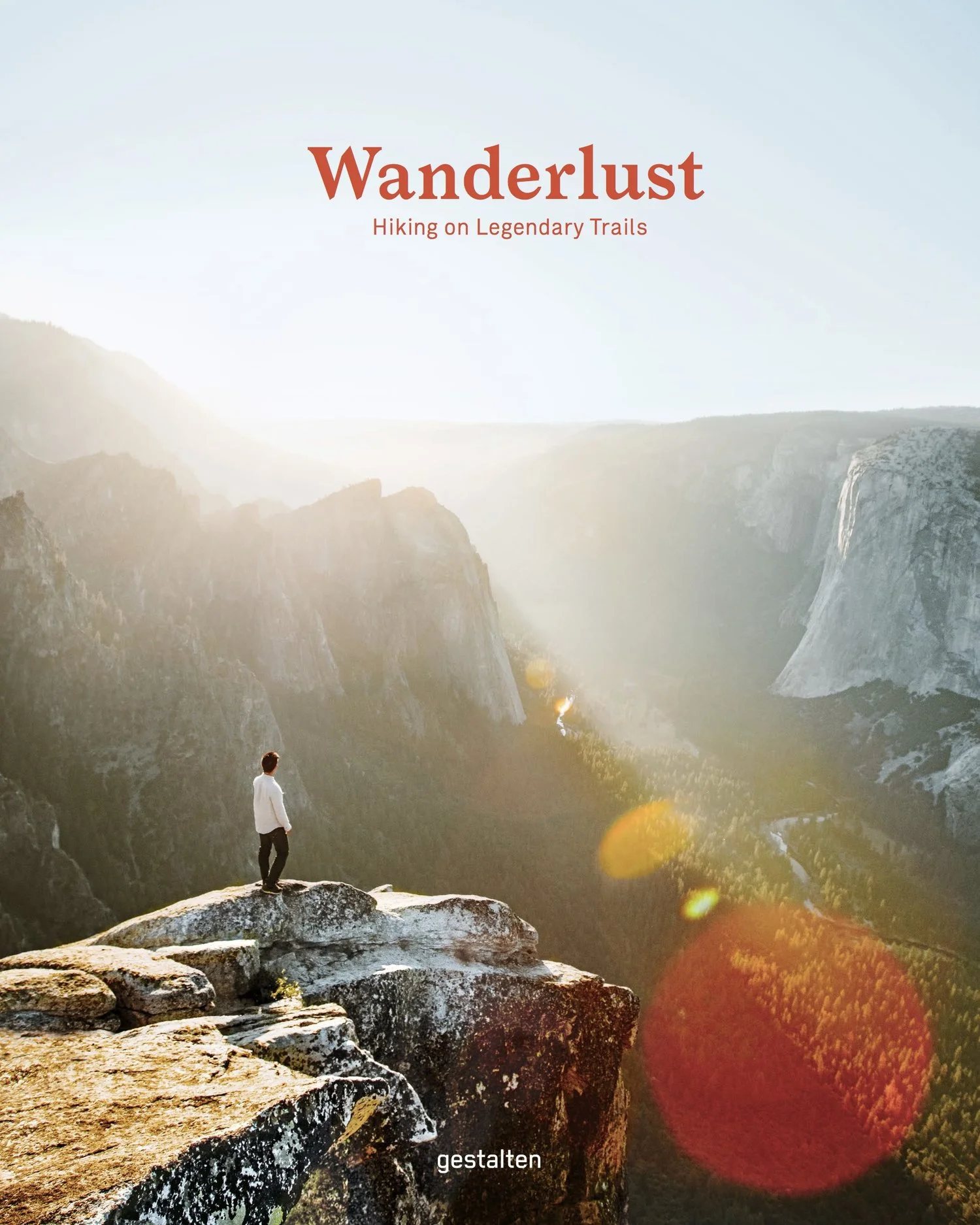
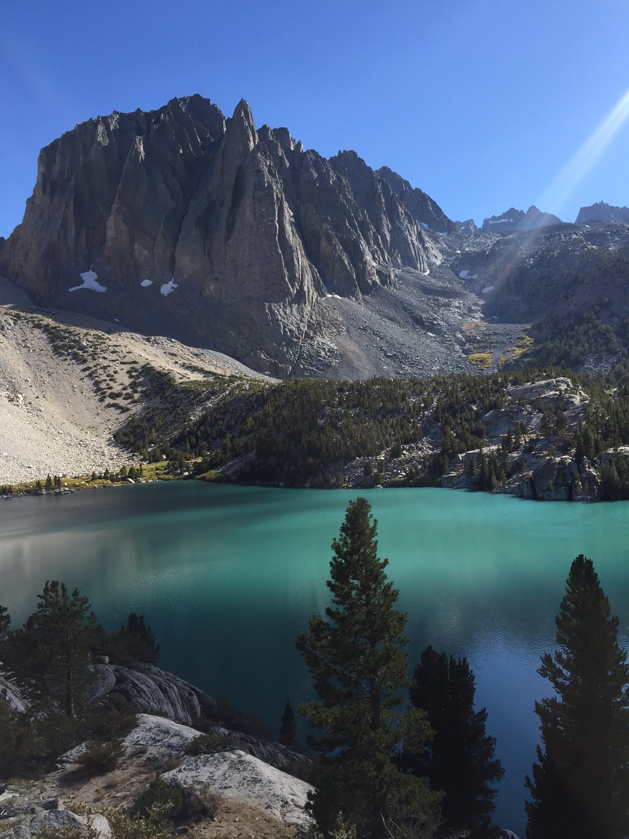
Just four hours from Los Angeles and a few miles in by trail lies a stunning landscape of 14,000-foot mountains, milky-turquoise lakes, and the largest glacier in the Sierra Nevada. We visited in mid-September and were at once humbled by the beauty, enormity and variety of features within easy reach for even a beginning backpacker.
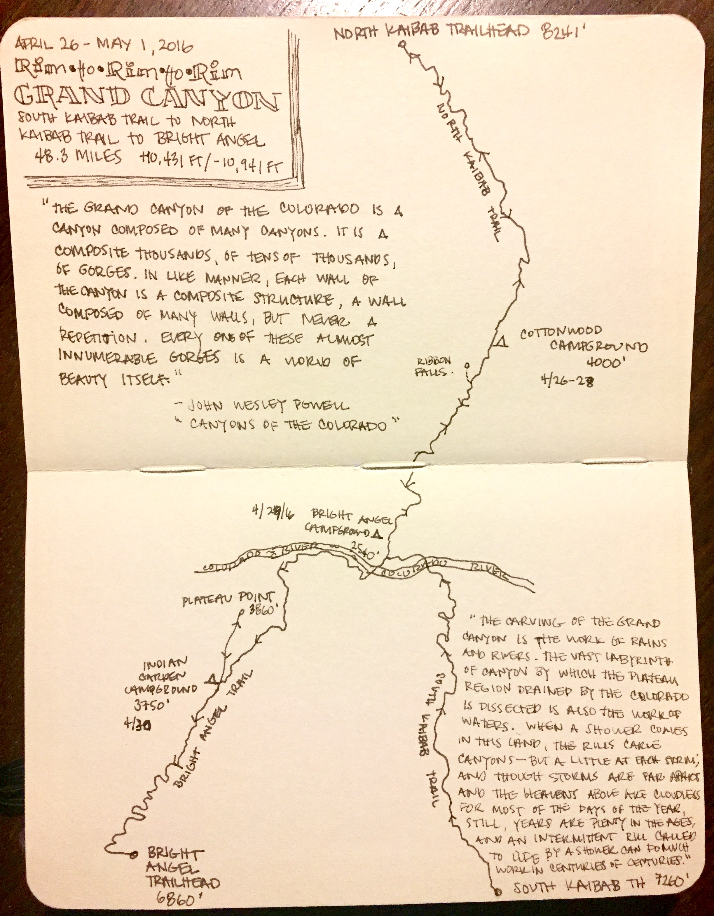
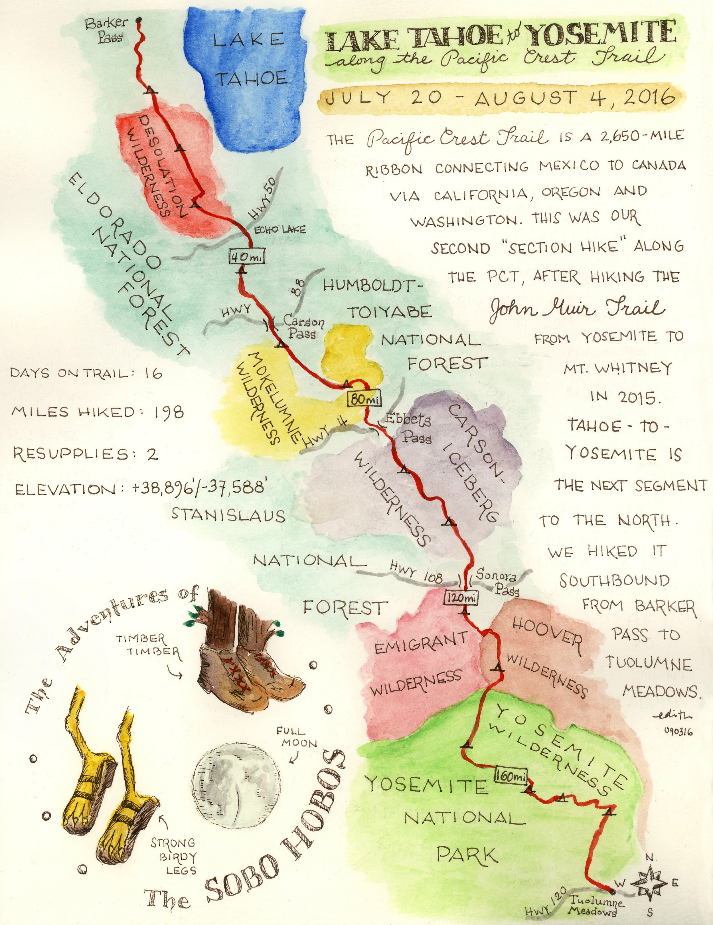
E's sketchbook map

Here's how we did it:

  • Thursday afternoon: we drove to the Eastern Sierra Interagency Center in Lone Pine for a permit for the Big Pine North Creek trailhead. As with other hikes in the Inyo National Forest, 60% are reservable in advance through recreation.gov; 40% are on a walk-in basis and are made available at 11am the day prior to the hike's start.

  • Thursday night: after a late afternoon snack at the Tacos Los Hermanos taco truck in Lone Pine, we drove up to Big Pine and followed Glacier Lodge Road nearly to its end. We camped at Sage Flat Campground, one of several front-country campgrounds in the area that operate April to October.

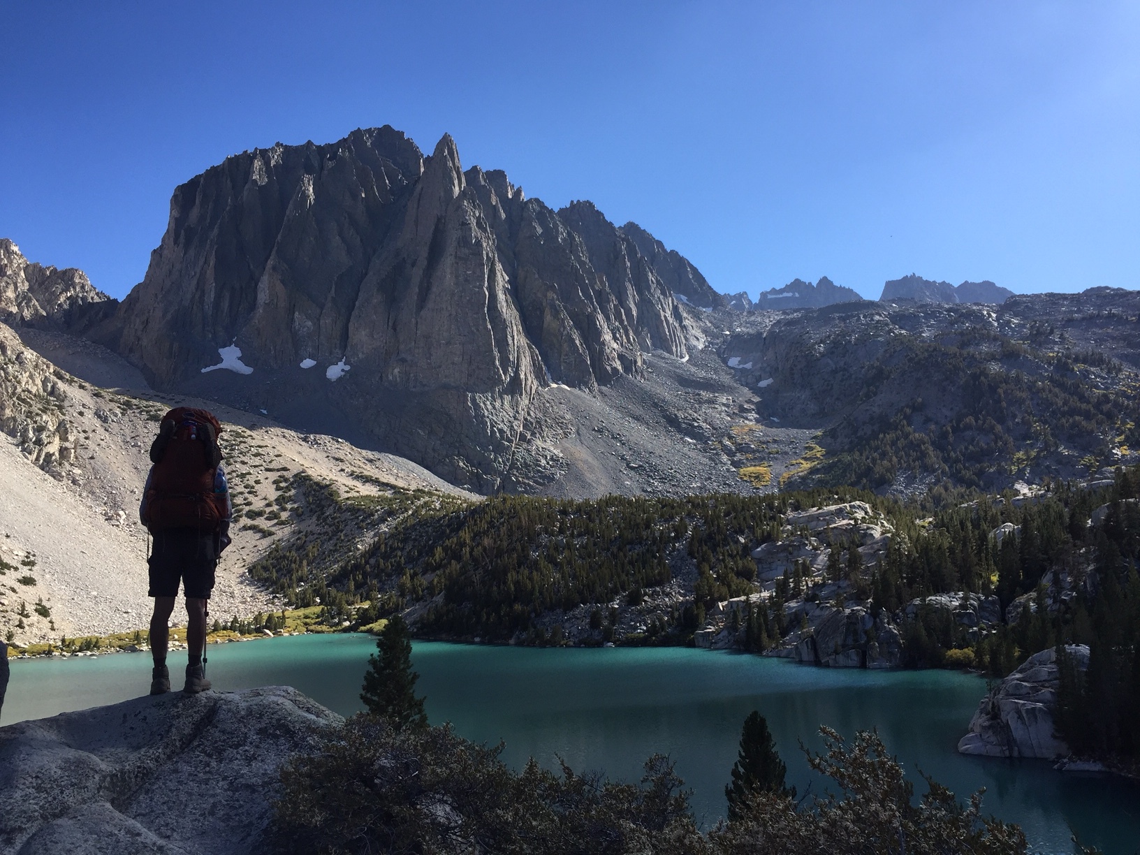
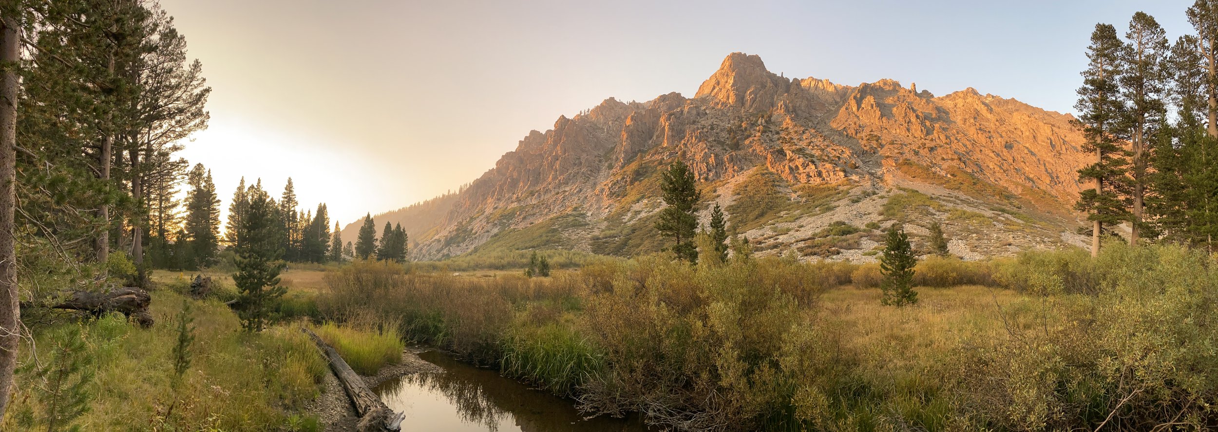
  • Friday: from the Big Pine North Creek trailhead (7,800'), we hiked in about 6 miles to Third Lake (10,249'). We set up camp on a ridge on the lake's eastern edge, with a view of Second Lake. The imposing, near-vertical Temple Crag rises above Third Lake, making for a spectacular sunset as the light changes on its sheer rock face.

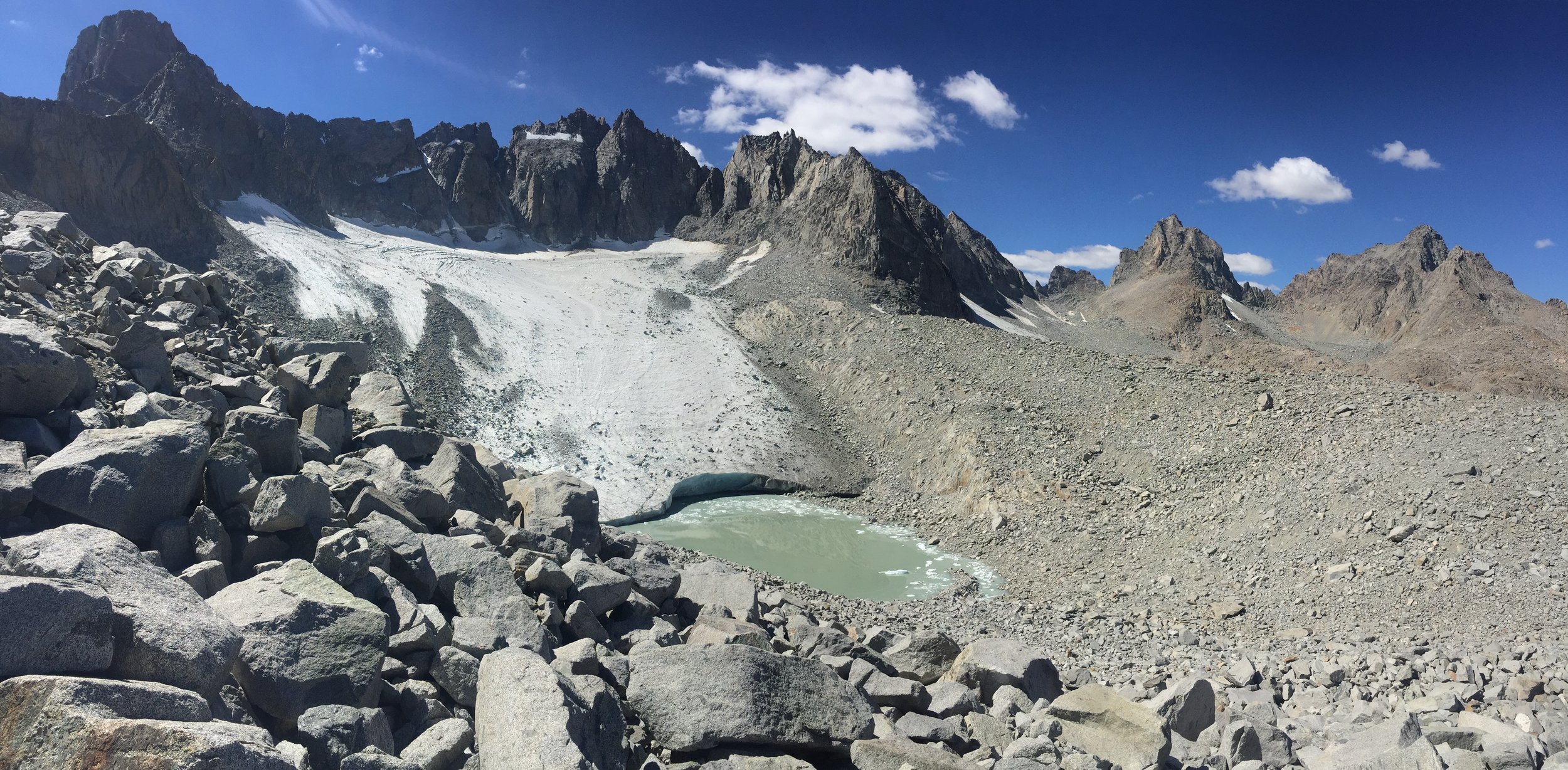
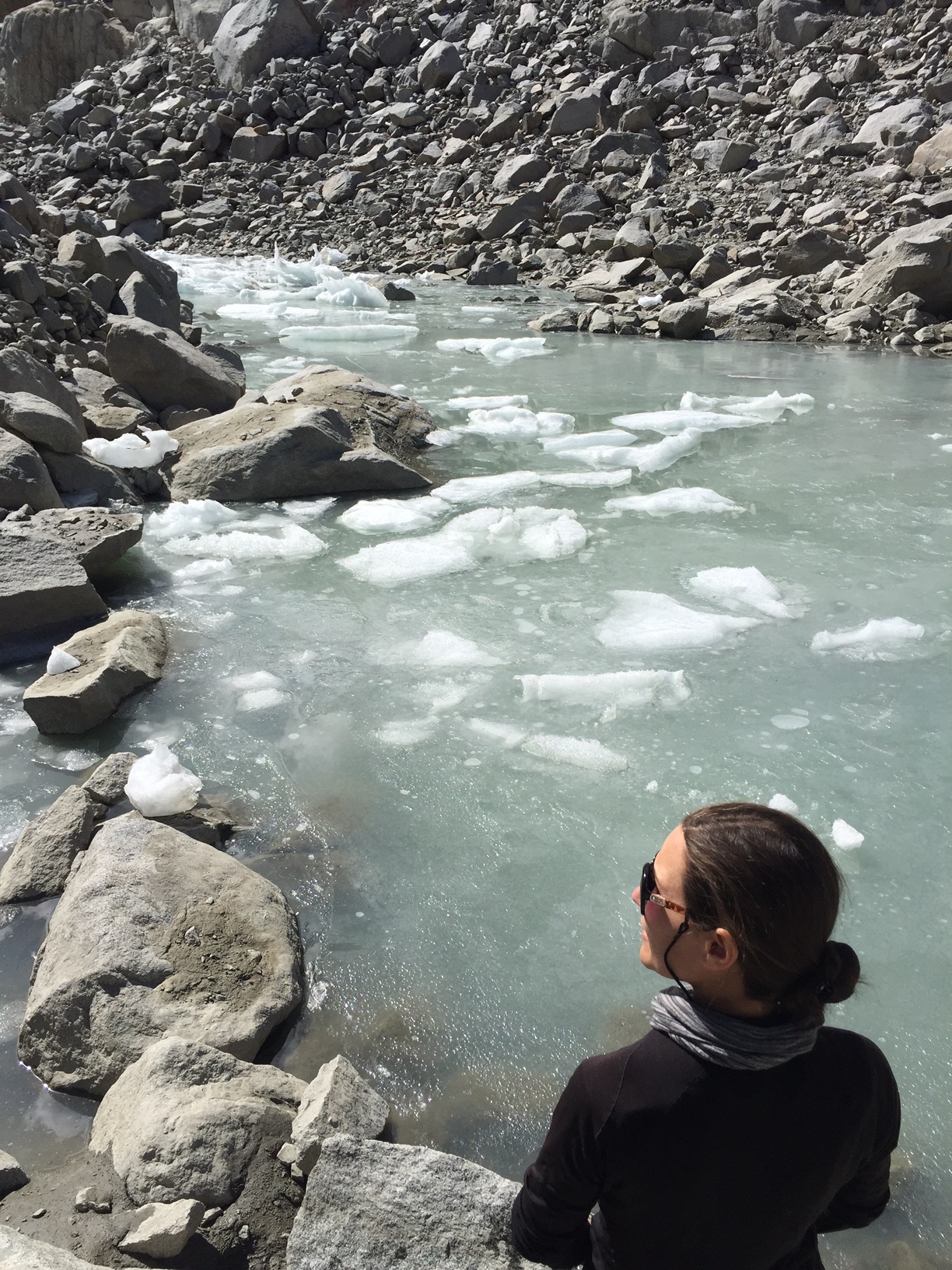
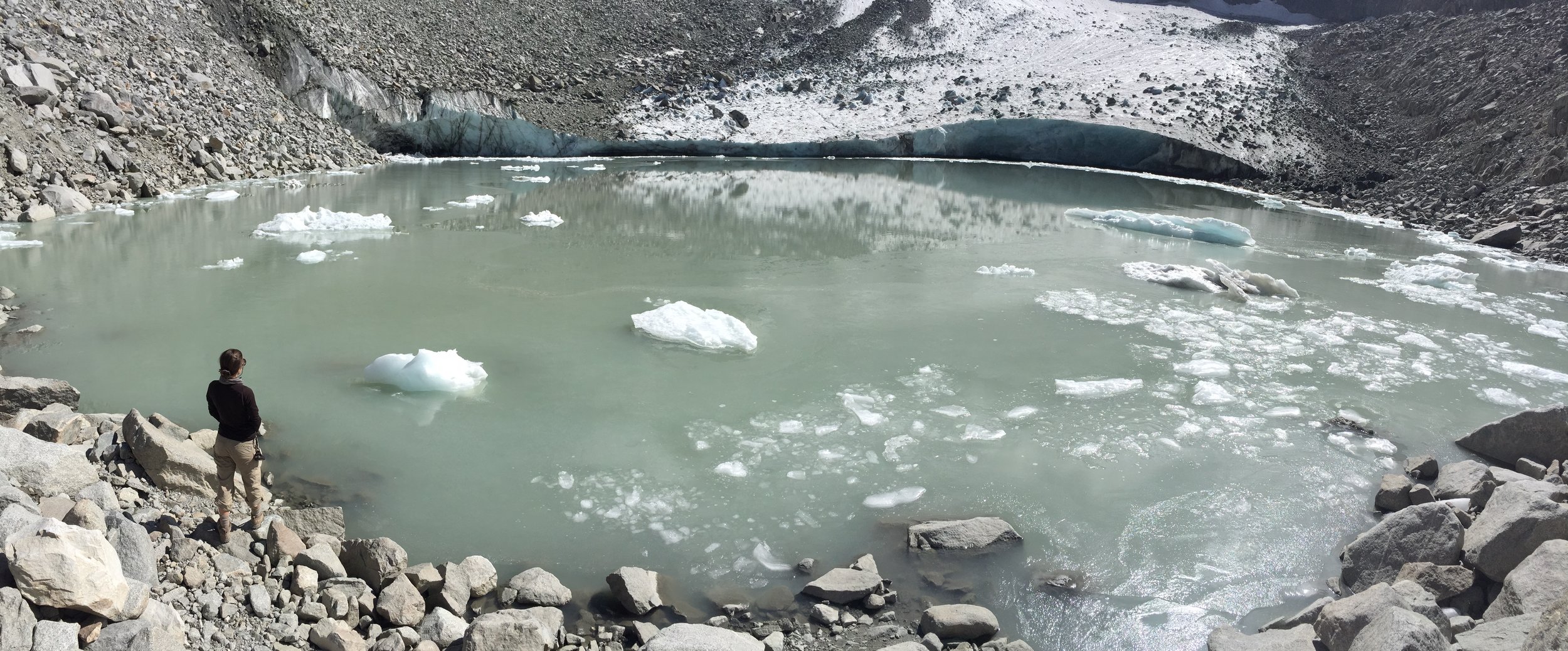
  • Saturday: we considered moving camp to one of the lakes deeper in the basin (likely Fifth or Sixth lake), but opted to stay at Third Lake since the distances along this route are short. We day hiked about seven miles roundtrip to Palisade Glacier, spending an afternoon soaking in the views and watching rocks and boulders detaching from the glacier and sliding down hundreds of feet into the lake below. To reach the glacier from the main trail, we took the junction leading south to Sam Mack Meadow; the trail is clear and easy to follow until the meadow. From the meadow, we crossed the glacial melt and headed east to join a southeast-facing ridge for another mile or so. The last half to three-quarter mile requires class 2 scrambling, topping out at 12,300' at a cirque (a glacially eroded "valley"), with Palisade Glacier flanked by North Palisade (14,242'), Thunderbolt Peak (14,003') and Mt. Sill (14,153').

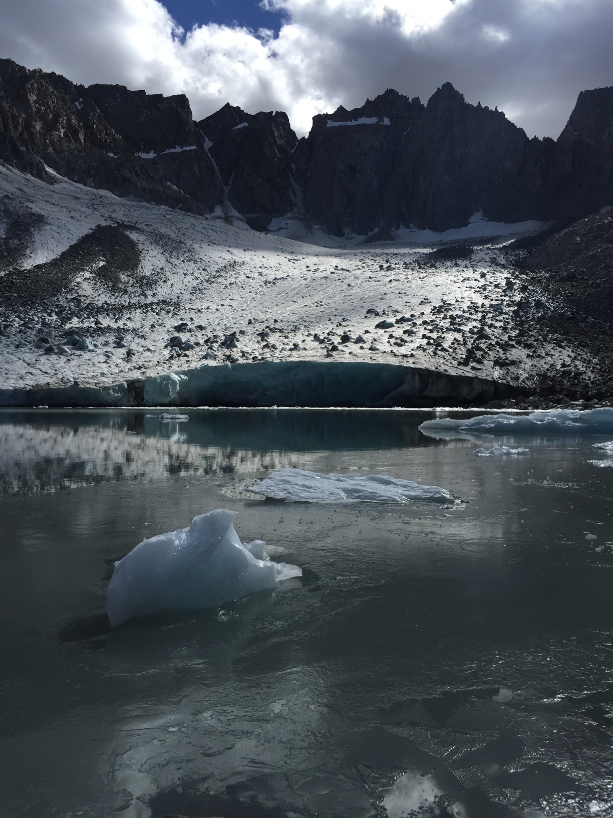
  • Sunday: we day hiked to Fourth, Fifth and Sixth lakes and spent a long, quiet lunch at the latter, taking in views of the glacier and the Palisade peaks from a different perspective than the day before. We hiked back to Third Lake, packed up and hiked out by the early evening, stopping for dinner at Still Life Cafe in Independence.

Packed with awe-inspiring features, the Big Pine Lakes/Palisades loop makes for one of the Sierras' shortest yet deeply satisfying treks. It's easily doable as a one or two-nighter, or even as a long day hike; and for those of you with four-legged pals, dogs are allowed. 

 No filter required. The glacial water of Second and Third lakes really is that color.

No filter required. The glacial water of Second and Third lakes really is that color.

 Temple Crag reflecting in Third Lake just before sunset.

Temple Crag reflecting in Third Lake just before sunset.

 Palisade glacier and cirque. This is the view you get as you top out at the talus ridge above 12,000' -- guaranteed to leave you breathless in all possible ways!

Palisade glacier and cirque. This is the view you get as you top out at the talus ridge above 12,000' -- guaranteed to leave you breathless in all possible ways!

IMG_7777.JPG
 The largest glacier in the Sierra is quickly receding. While one can expect to see annual melt peak in late summer, prolonged drought and rising temperatures cause melt rates that far exceed the rate of replenishment.

The largest glacier in the Sierra is quickly receding. While one can expect to see annual melt peak in late summer, prolonged drought and rising temperatures cause melt rates that far exceed the rate of replenishment.

 Evidence of recent calving (ice breaking off the glacier) floats on the lake. We heard and saw many smaller chunks while taking in the views.

Evidence of recent calving (ice breaking off the glacier) floats on the lake. We heard and saw many smaller chunks while taking in the views.

 No filter required. The glacial water of Second and Third lakes really is that color.  Temple Crag reflecting in Third Lake just before sunset.  Palisade glacier and cirque. This is the view you get as you top out at the talus ridge above 12,000' -- guaranteed to leave you breathless in all possible ways! IMG_7777.JPG  The largest glacier in the Sierra is quickly receding. While one can expect to see annual melt peak in late summer, prolonged drought and rising temperatures cause melt rates that far exceed the rate of replenishment.  Evidence of recent calving (ice breaking off the glacier) floats on the lake. We heard and saw many smaller chunks while taking in the views.
View fullsize Palisades 2.JPG
View fullsize Palisades 3.JPG
In Travel Tags Sierra, Sierra Nevada, Eastern Sierra, Big Pine, 14ers, Glacier, Backpacking, Camping, hik, Highway 395, Hooves on the Ground, trip report, itinerary
← Music Video for Sara Lov's 'Rain Up'Hooves on the Ground: Tahoe to Yosemite Along the Pacific Crest Trail →
Dear Antlerby Jedediah Cornelius Antler"The buck stops here."The advice and musings of the swankiest eight-point buck you'll ever meet.

Dear Antler

by Jedediah Cornelius Antler

"The buck stops here."

The advice and musings of the swankiest eight-point buck you'll ever meet.


See all art posts

See all travel posts

Subscribe

 Be a true "Jedhead" and sign up for our mailing list here. 

We respect your privacy. Truly

Jed says thank you!


blog
Hooves on the Ground: Onion Valley to Sixty Lake Basin and Col
about 9 months ago
Hooves on the Ground: Grand Canyon's Clear Creek Trail and Cheyava Falls
about a year ago
Hooves on the Ground: Miter Basin
about a year ago
Hooves on the Ground: Tyee/Midnight/Hungry Packer Lakes, John Muir Wilderness
about a year ago
Hooves on the Ground: Yosemite's Murphy Creek to Tuolumne Crest in the early season
about a year ago
Hooves on the Ground: Grand Canyon's Tanner Trail and Escalante Route
about 2 years ago
Hooves on the Ground: Mineral King Loop via Timber Gap and Lost Canyon
about 2 years ago
Hooves on the Ground: Darwin, Evolution, and Piute Canyons via Lamarck Col and Piute Pass
about 3 years ago
Hooves on the Ground: Thousand Island Lake via Rush Creek
about 3 years ago
Hooves on the Ground: Grand Canyon's Hermit-Boucher Loop
about 4 years ago
Elements of Existence
about 4 years ago
Spellbound | Wanderings Through the Witching Hour
about 4 years ago
Hooves on the Ground: Yosemite's Grand Canyon of the Tuolumne and Old Big Oak Flat Road to El Capitan
about 4 years ago
Psyche | Introspections In an Era of Uncertainty
about 5 years ago
Hooves on the Ground: Death Valley Albatross Plane Crash Site
about 5 years ago
Hooves on the Ground: High Sierra Trail
about 5 years ago
Suspension
about 6 years ago
Hooves on the Ground: Nepal
about 6 years ago
Hooves on the Ground: Cottonwood Pass and Lakes Loop (Miter Basin and Mt. Langley)
about 6 years ago
The Troubles We Carry
about 7 years ago

© dearantler 2013-2024. All rights reserved.