• blog
  • gallery
  • shop
  • archive
  • about
Menu

dearantler

  • blog
  • gallery
  • shop
  • archive
  • about
Featured
IMG_3004 2.JPG
Travel
Hooves on the Ground: Onion Valley to Sixty Lake Basin and Col
Travel
Travel
IMG_8926.JPG
Travel
Hooves on the Ground: Grand Canyon's Clear Creek Trail and Cheyava Falls
Travel
Travel
IMG_6880.jpg
Travel
Hooves on the Ground: Miter Basin
Travel
Travel
IMG_6422.jpg
Travel
Hooves on the Ground: Tyee/Midnight/Hungry Packer Lakes, John Muir Wilderness
Travel
Travel
IMG_5896.jpg
Travel
Hooves on the Ground: Yosemite's Murphy Creek to Tuolumne Crest in the early season
Travel
Travel
IMG_5334 2.jpg
Travel
Hooves on the Ground: Grand Canyon's Tanner Trail and Escalante Route
Travel
Travel
IMG_3418.JPG
Travel
Hooves on the Ground: Mineral King Loop via Timber Gap and Lost Canyon
Travel
Travel
Hooves on the Ground: Darwin, Evolution, and Piute Canyons via Lamarck Col and Piute Pass
Travel
Hooves on the Ground: Darwin, Evolution, and Piute Canyons via Lamarck Col and Piute Pass
Travel
Travel
ThousandIsland.jpg
Travel
Hooves on the Ground: Thousand Island Lake via Rush Creek
Travel
Travel
IMG_3348.JPG
Travel
Hooves on the Ground: Grand Canyon's Hermit-Boucher Loop
Travel
Travel
DEARANTLER-SLIDER-2-1.png
Art
Elements of Existence
Art
Art
spellbound banner.png
Art
Spellbound | Wanderings Through the Witching Hour
Art
Art
IMG_0889.jpg
Travel
Hooves on the Ground: Yosemite's Grand Canyon of the Tuolumne and Old Big Oak Flat Road to El Capitan
Travel
Travel
psyche.jpg
Art
Psyche | Introspections In an Era of Uncertainty
Art
Art
LRG_DSC06553.JPG
Travel
Hooves on the Ground: Death Valley Albatross Plane Crash Site
Travel
Travel
HST map illustration.JPG
Travel
Hooves on the Ground: High Sierra Trail
Travel
Travel
Suspension.png
Art
Suspension
Art
Art
Hooves on the Ground: Nepal
Travel
Hooves on the Ground: Nepal
Travel
Travel
Hooves on the Ground: Cottonwood Pass and Lakes Loop (Miter Basin and Mt. Langley)
Travel
Hooves on the Ground: Cottonwood Pass and Lakes Loop (Miter Basin and Mt. Langley)
Travel
Travel
The Troubles We Carry
Art
The Troubles We Carry
Art
Art
Hooves on the Ground: South Lake to North Lake (Evolution Loop)
Travel
Hooves on the Ground: South Lake to North Lake (Evolution Loop)
Travel
Travel
Travel
Hooves on the Ground: Grand Canyon
Travel
Travel
Wanderlust: Hiking on Legendary Trails
Travel
Wanderlust: Hiking on Legendary Trails
Travel
Travel
Peru+Map.jpg
Travel
Hooves on the Ground: Perú
Travel
Travel
Art
Notorious/Glorious
Art
Art
Art
dearantler turns 3!
Art
Art
Art
Music Video for Sara Lov's 'Rain Up'
Art
Art
Travel
Hooves on the Ground: The Palisades
Travel
Travel
Travel
Hooves on the Ground: Tahoe to Yosemite Along the Pacific Crest Trail
Travel
Travel
Art
Strangers On A Trail
Art
Art

Cresting Phantom Overlook, with the South Rim towering above

Hooves on the Ground: Grand Canyon's Clear Creek Trail and Cheyava Falls

January 5, 2024

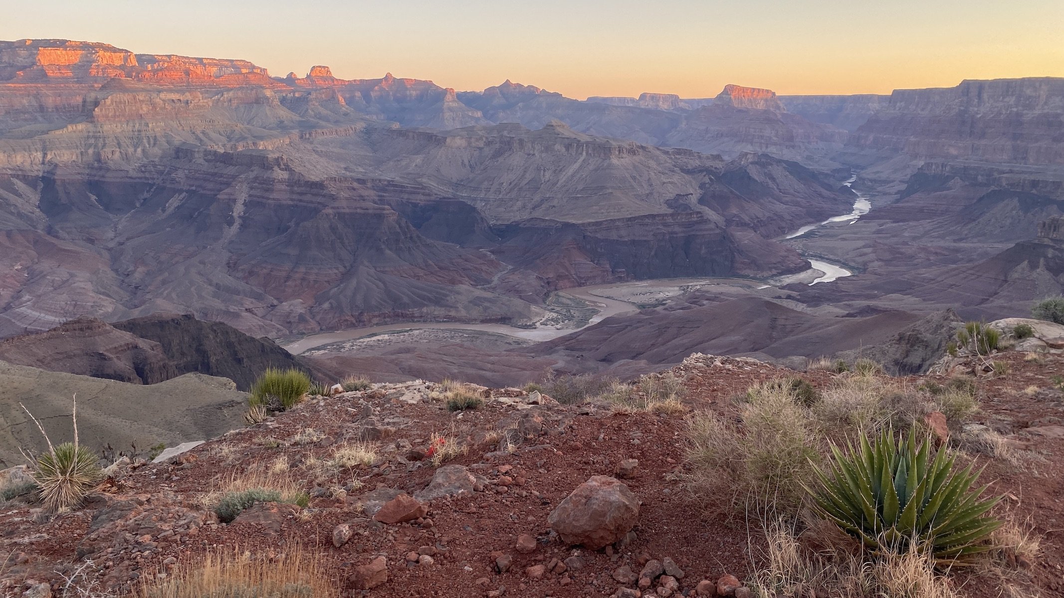
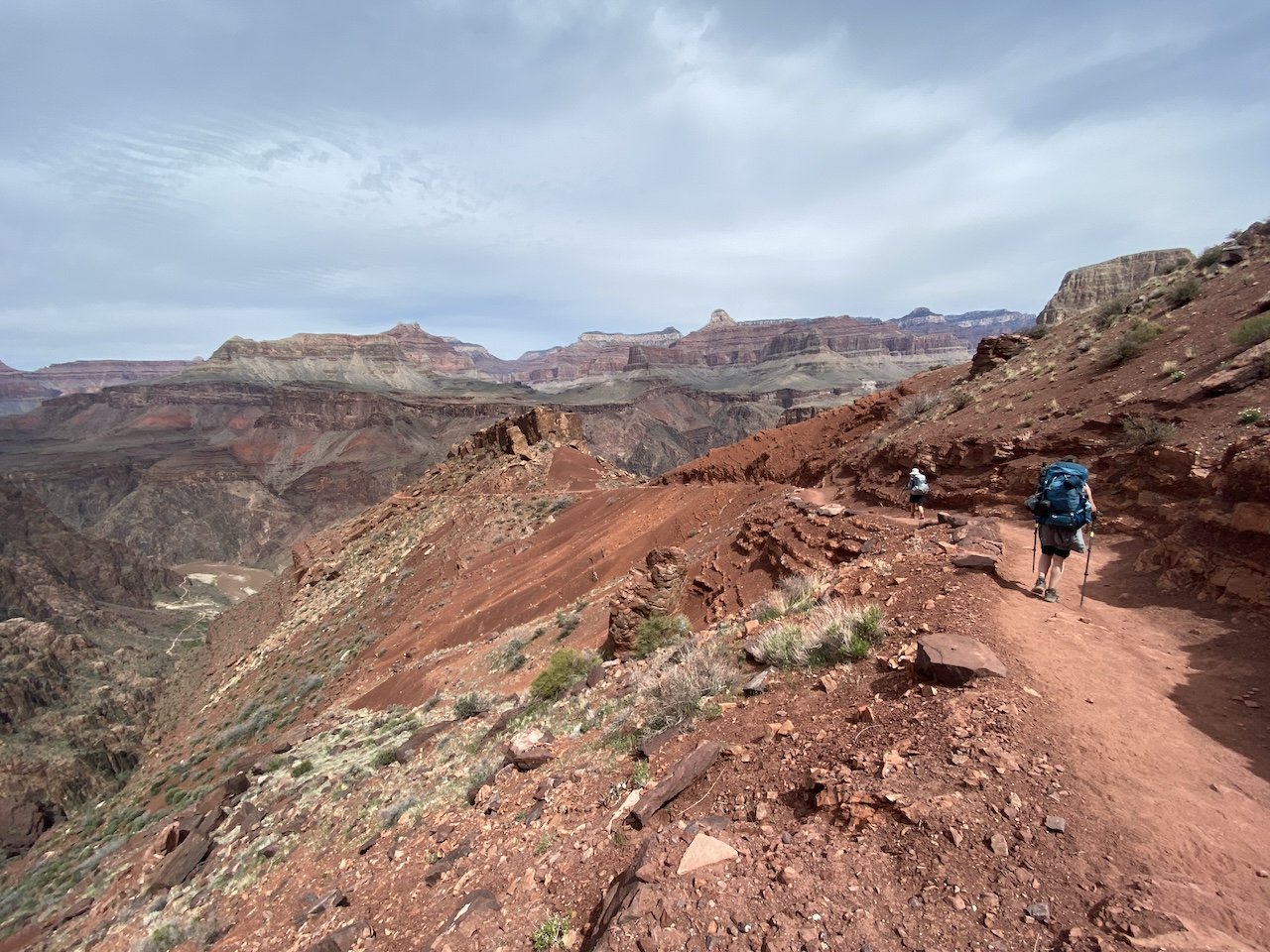
Some destinations keep tugging at your sense of wanderlust year after year. For us, Grand Canyon is one of those magical places. There are so many grand places to see that you could spend your whole life exploring its endless nooks and crannies and still have something new (and yet so very old) to experience.

Our intent this time around — our ninth time backpacking below the rim — was to visit the tallest falls in Grand Canyon, 800-foot Cheyava Falls. The falls flow only occasionally (indeed, “cheyava” means “intermittent” in Hopi), just when a significant amount of rainfall or snowmelt brings them to life.

View fullsize  along the North Kaibab just before heading east toward Clear Creek
View fullsize IMG_6732.jpg
View fullsize Clear Creek Trail
Clear Creek Trail
View fullsize IMG_9038.JPG
View fullsize pothole along Clear Creek Trail, with a snowy South Rim in the background
pothole along Clear Creek Trail, with a snowy South Rim in the background
View fullsize cottonwoods glowing in the sun, Clear Creek
cottonwoods glowing in the sun, Clear Creek
View fullsize BYOS (bring your own shade)
BYOS (bring your own shade)
View fullsize IMG_8993.JPG
View fullsize side canyon surprise!
side canyon surprise!
View fullsize canyon treefrog visiting camp (or more likely, wondering why we're camping in its home)
canyon treefrog visiting camp (or more likely, wondering why we're camping in its home)
View fullsize thar she flows! Cheyava Falls
thar she flows! Cheyava Falls
View fullsize negotiating a creek crossing
negotiating a creek crossing

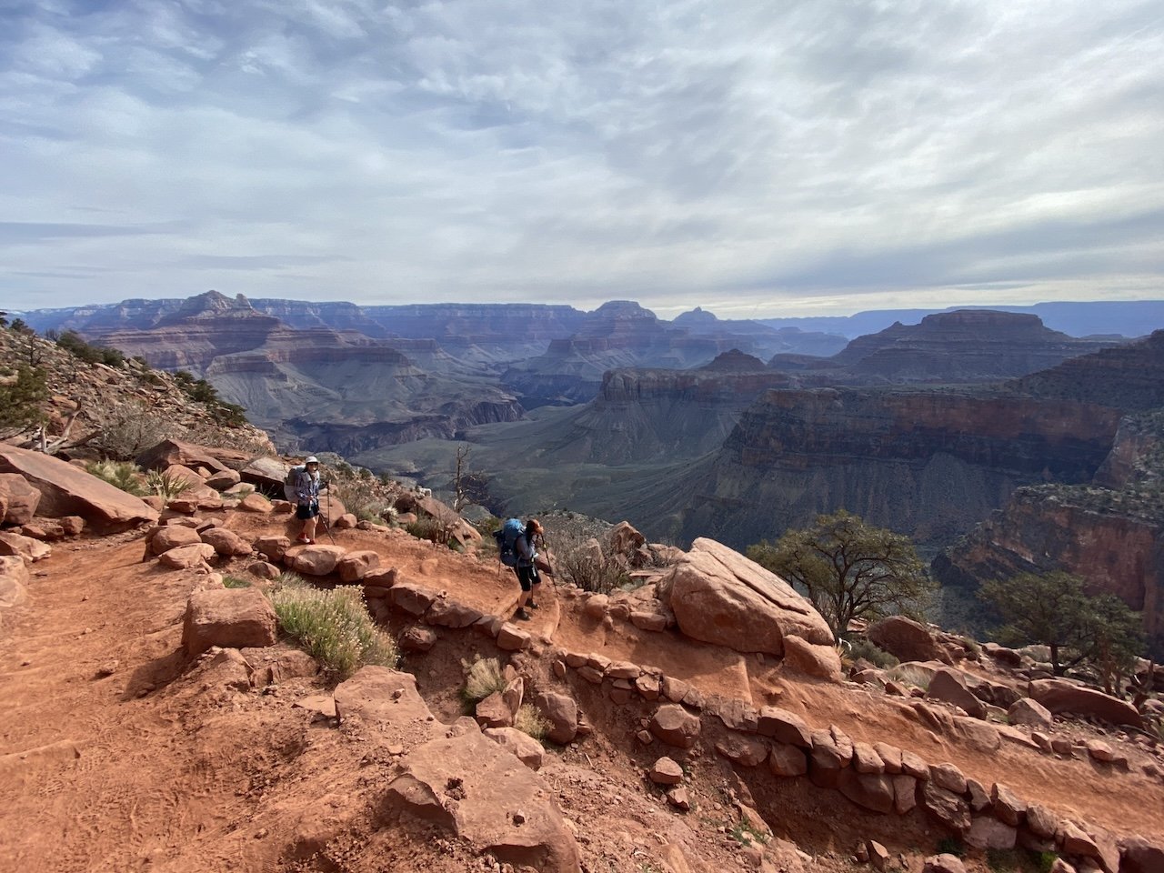
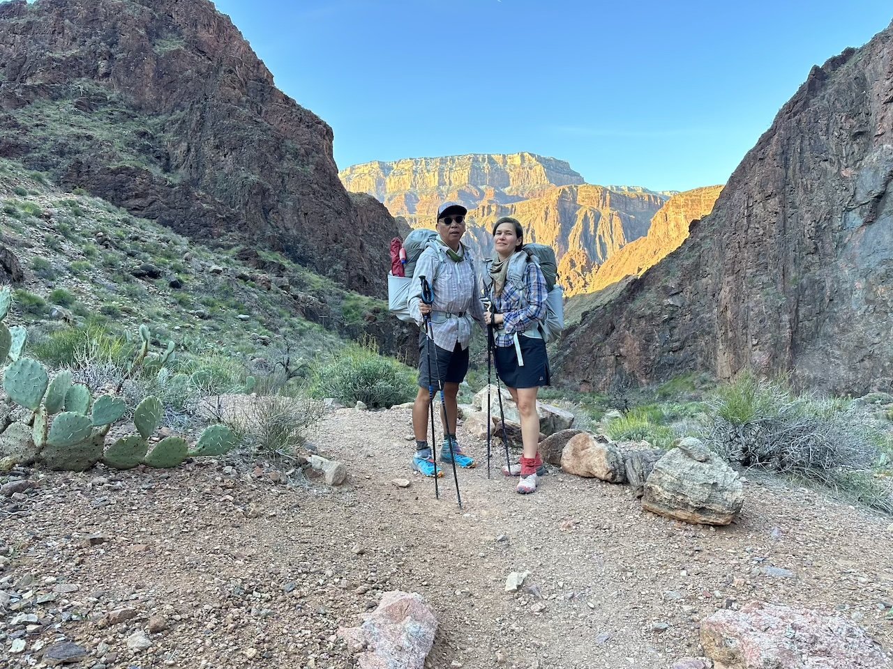
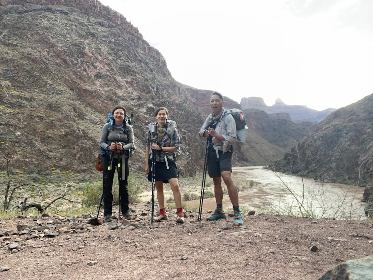
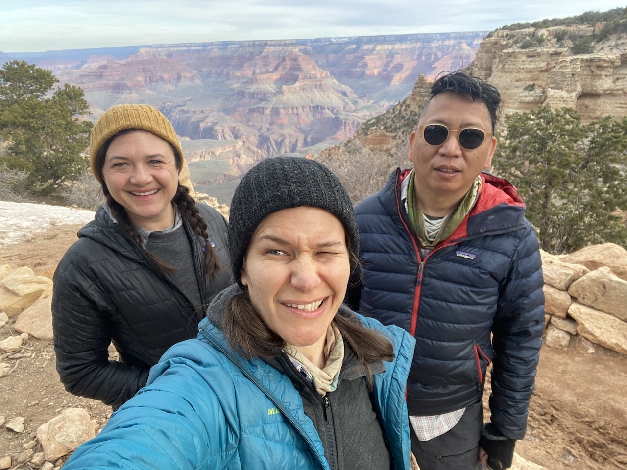
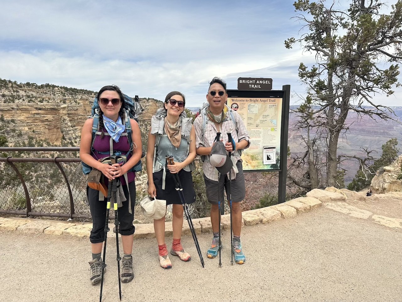
We were joined by our friend Sarah and were excited that this particular route would be her first overnighter below the rim. This trip combined a classic corridor experience (down South Kaibab Trail, staying at Bright Angel Campground on nights 1 and 4, hiking out via Bright Angel Trail), with an off-the-beaten-path visit to Clear Creek and Cheyava Falls in between.

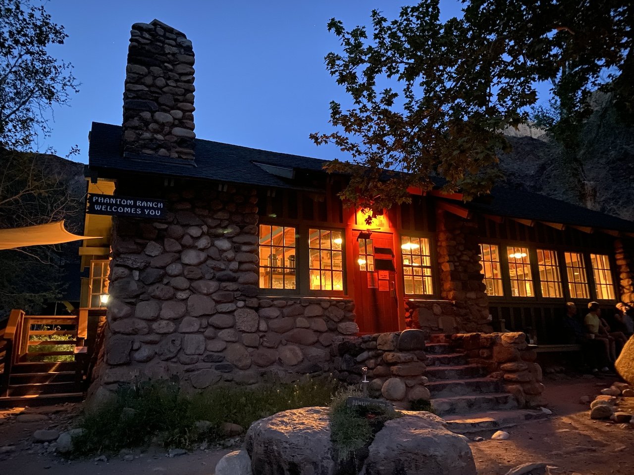
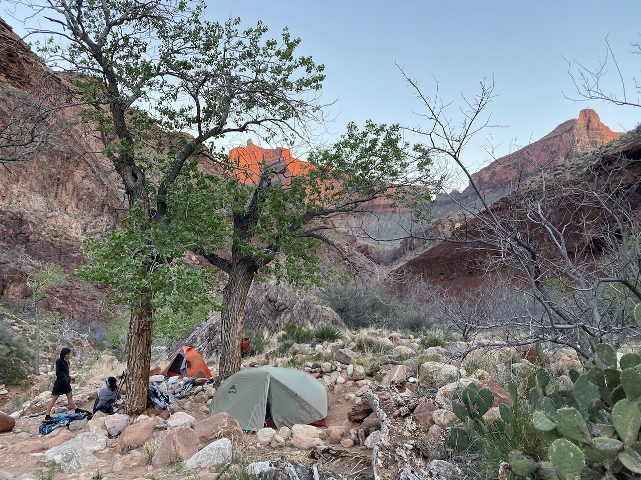
We arrived to our first night’s camp around noon, giving us plenty of time to lounge around under tree shade sipping iced tea at Phantom Ranch — a good thing given our arrival coincided with a heat wave. That night we dined at the canteen for the first time, enjoying a convivial time chatting with hikers visiting this wonder of the world from many different states and countries.

South Kaibab
South Kaibab
IMG_0110.JPG
IMG_0103.jpg
IMG_8913.JPG
Phantom Overlook
Phantom Overlook
IMG_6763.jpeg
IMG_6870.jpeg
resident deer at Bright Angel campground
IMG_8919.JPG
IMG_8939.JPG
impressive trail-building work at Phantom Overlook
IMG_8927.JPG
IMG_9037.JPG
layers of flora and geology
collared lizard sunbathing
IMG_9013.JPG
Phantom Ranch canteen looking quite inviting
Western redbud just starting to bloom
camping at Clear Creek
Popeye and friends
Popeye and friends
IMG_8913.JPG
snow lingering near the rim
IMG_0121.JPG
smelly and happy hikers heading for pizza
South Kaibab IMG_0110.JPG IMG_0103.jpg IMG_8913.JPG Phantom Overlook IMG_6763.jpeg IMG_6870.jpeg resident deer at Bright Angel campground IMG_8919.JPG IMG_8939.JPG impressive trail-building work at Phantom Overlook IMG_8927.JPG IMG_9037.JPG layers of flora and geology collared lizard sunbathing IMG_9013.JPG Phantom Ranch canteen looking quite inviting Western redbud just starting to bloom camping at Clear Creek Popeye and friends IMG_8913.JPG snow lingering near the rim IMG_0121.JPG smelly and happy hikers heading for pizza

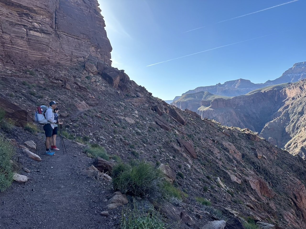
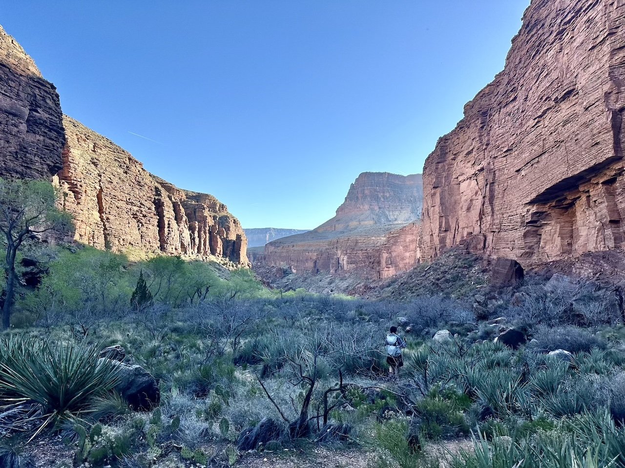
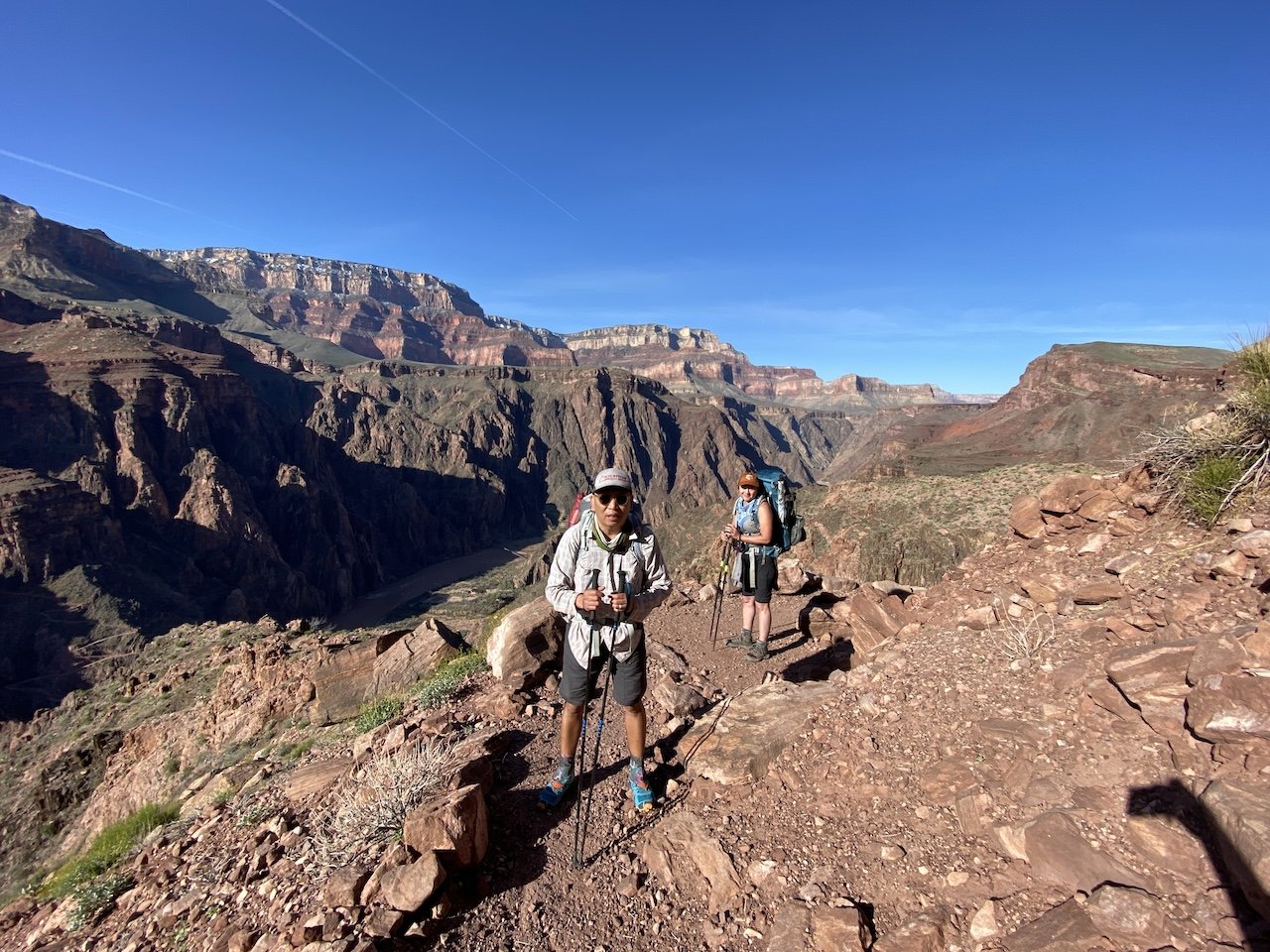
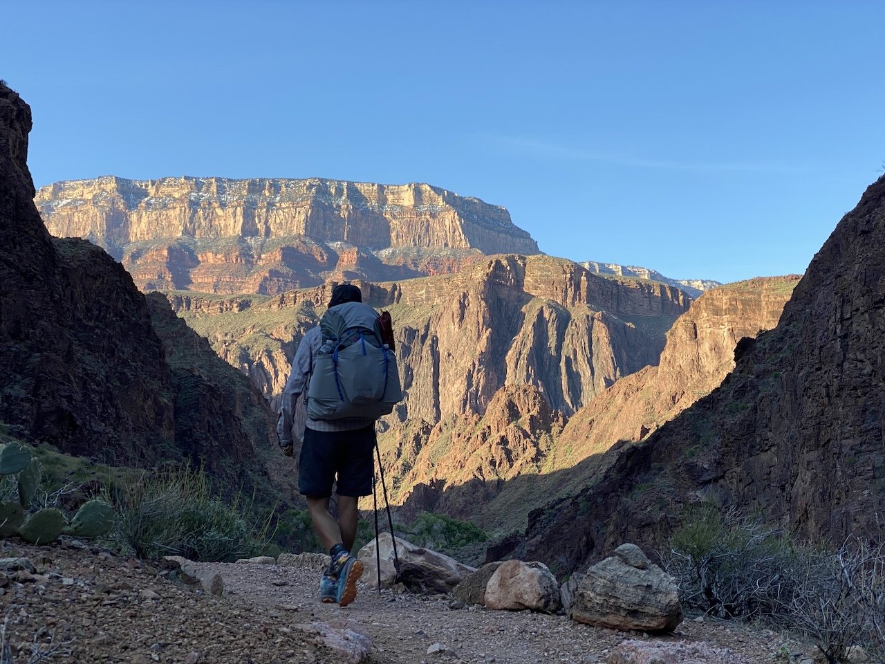
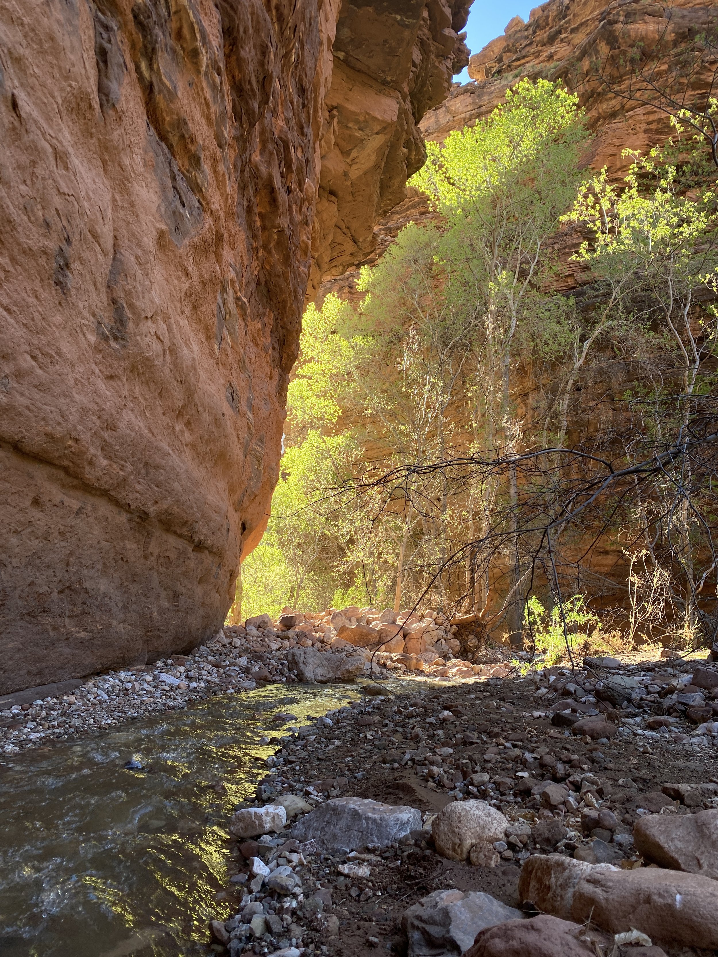
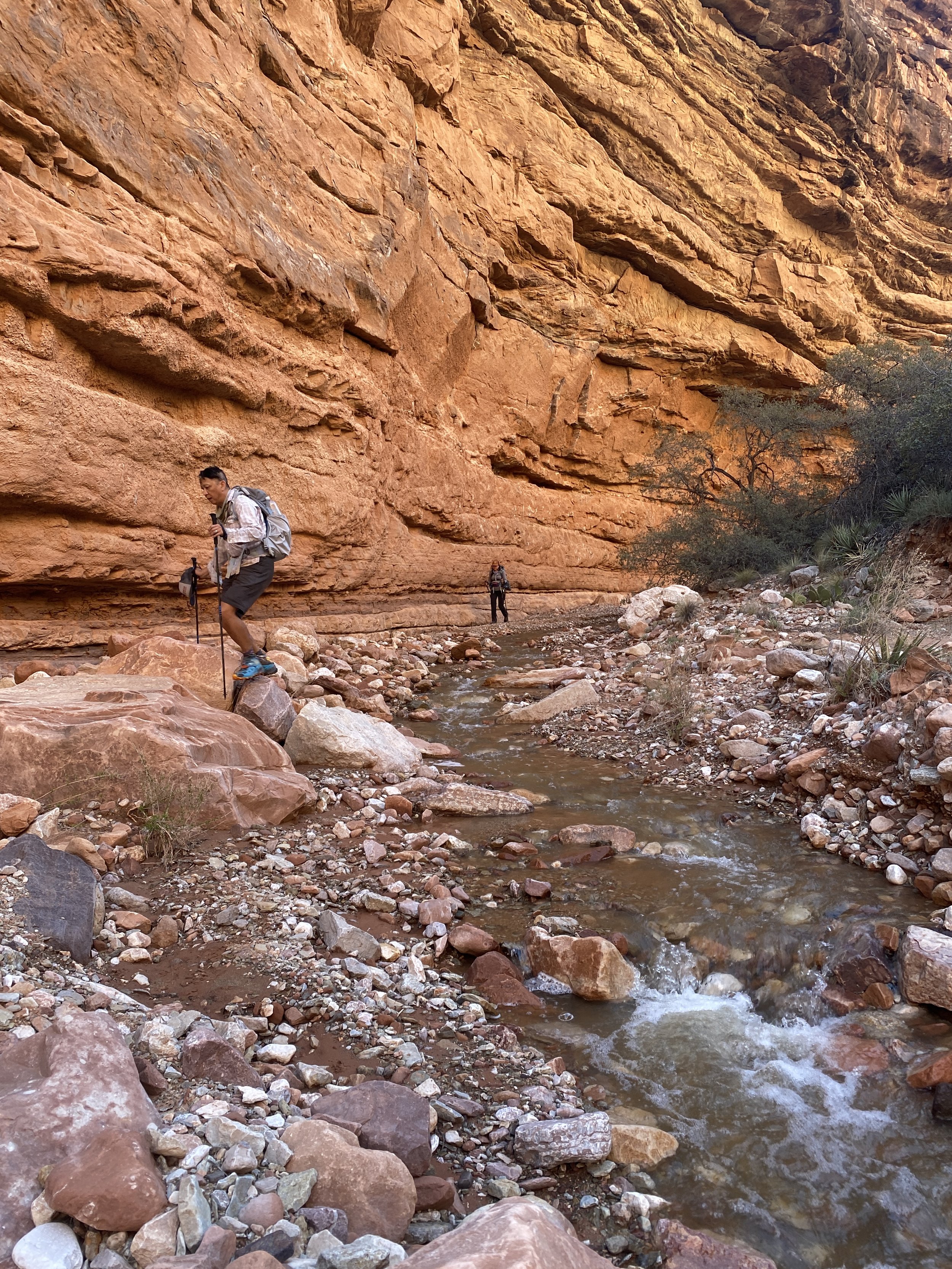
On our second morning we took the North Kaibab Trail for a short distance and then headed east along Clear Creek Trail, where we exchanged trail updates with a couple of hikers returning the other way. They reported the falls had been “just a trickle” when they visited the day prior. Undeterred, we figured we might as well try anyway. After all, how else would we spend our time if we didn’t go through with our plan to hike through the Clear Creek narrows, up some side canyons, bushwhacking the deepest few miles of the cross-country route that was to come?

As luck would have it, suffering under the hot spell was not for naught. To our delight, the combination of above-average temperatures and stubborn perseverance prevailed, and the falls were flowing beautifully.

Cheyava Falls flowing in their 800 feet of glory

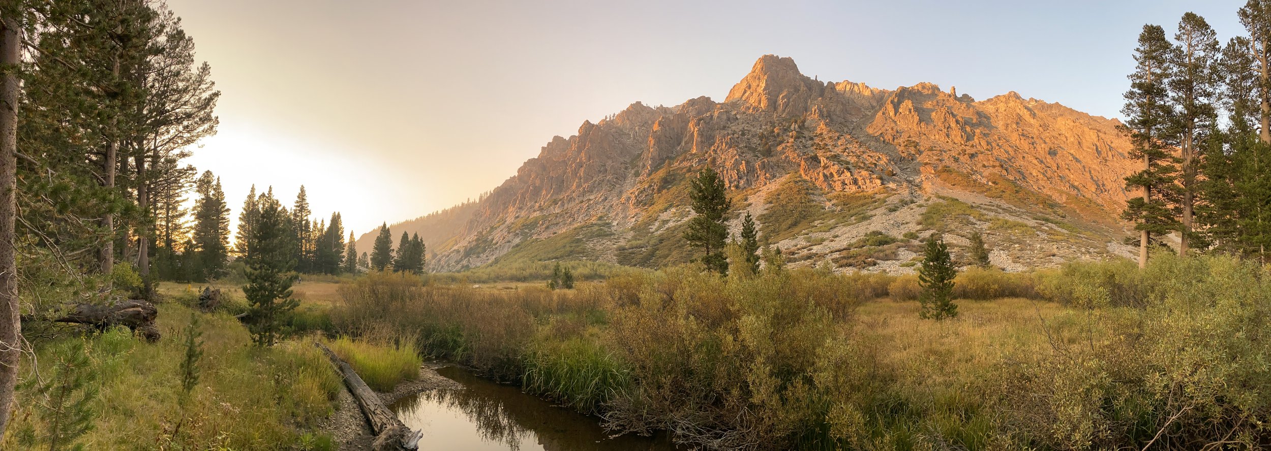
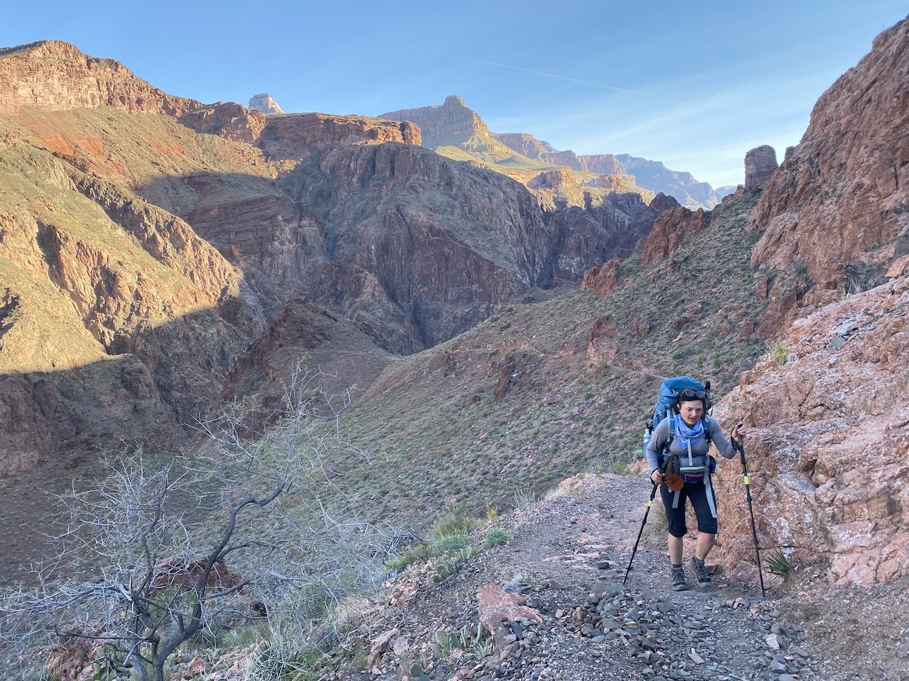
Moving through Grand Canyon means walking through geologic time. But on this trip we were lucky to also move through the seasons over the course of a few short days. Walking, watching, and listening in nature means you sometimes get to witness the changing of the seasons, and we were fortunate to be present for the leap into spring. As we sauntered, the warming trend awoke the canyon out of a long, snowy winter. In the days that followed our descent, we would get to witness that transition in ways large and small.

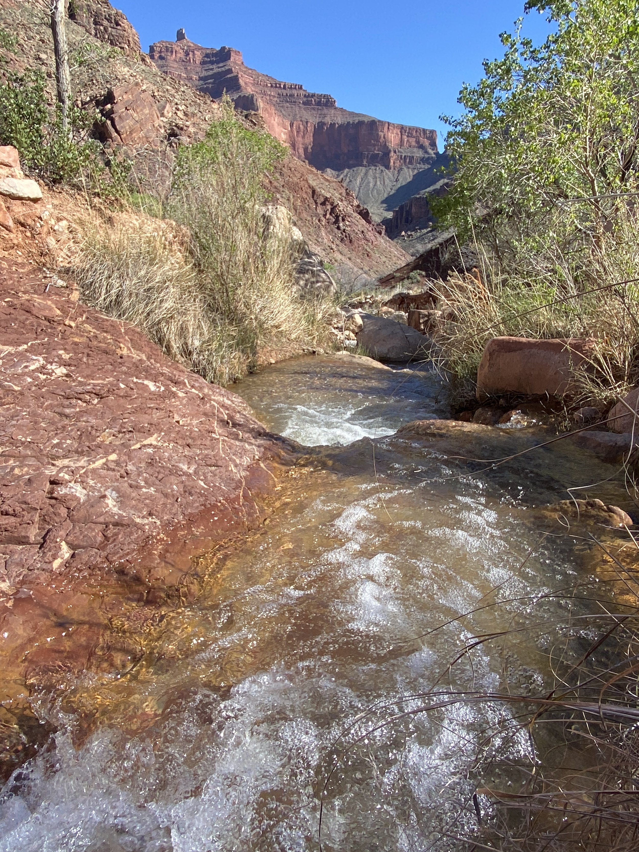
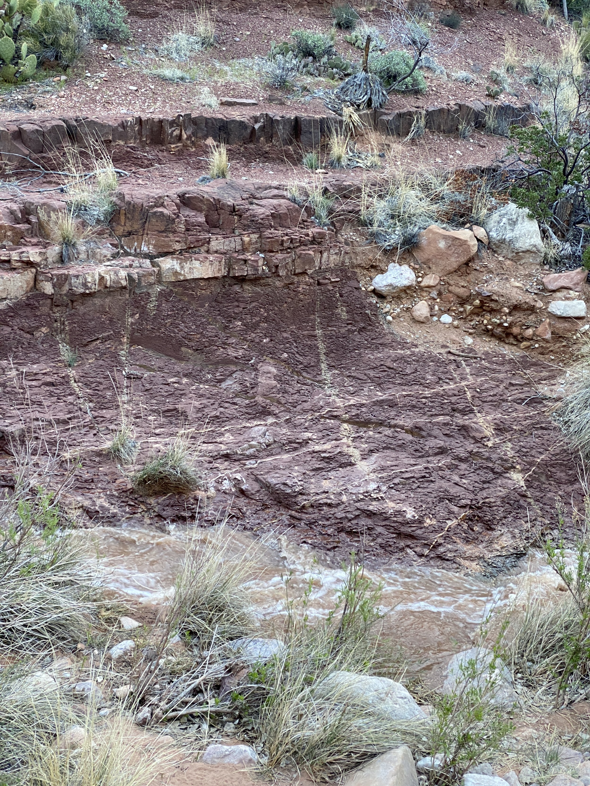
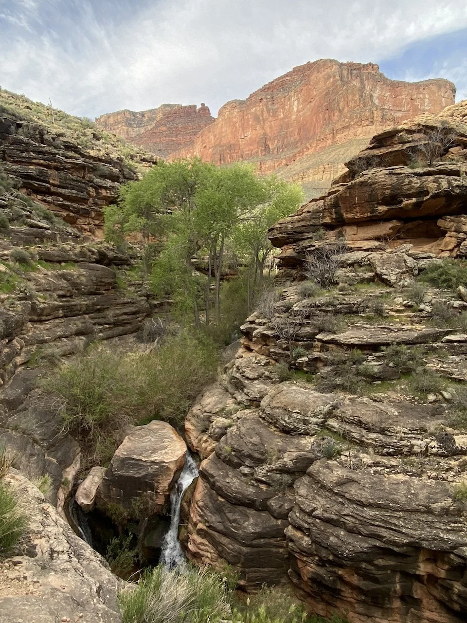
One way we saw this transition was in water. When we arrived to Clear Creek on the second day, the stream was indeed flowing clear. But the water was soon loaded with increasing levels of sediment as tributaries upstream swelled with snowmelt. In this vast, arid, sparsely vegetated land there is little to prevent silt and sand from being transported by water — sometimes hundreds of miles away. It’s precisely these erosion and displacement mechanisms that we have to thank for exposing the layers of earth at Grand Canyon.

Clear Creek flowing clear when we arrived
Sediment-filled water a day later
  • Clear Creek was increasingly loaded with sediment when we visited. Our usual reliance of Aquamira drops and/or using bottle-top filter like the Platypus Quickdraw wasn’t going to cut it. Here’s what we did.

    1. Filled a collapsible Sea to Summit bucket with water.

    2. Diluted some alum powder per John Ladd’s detailed instructions, and mixed the solution into the bucket.

    3. Let the sediment settle for at least 90 minutes.

    4. Filtered the water through a Platypus GravityWorks filter.

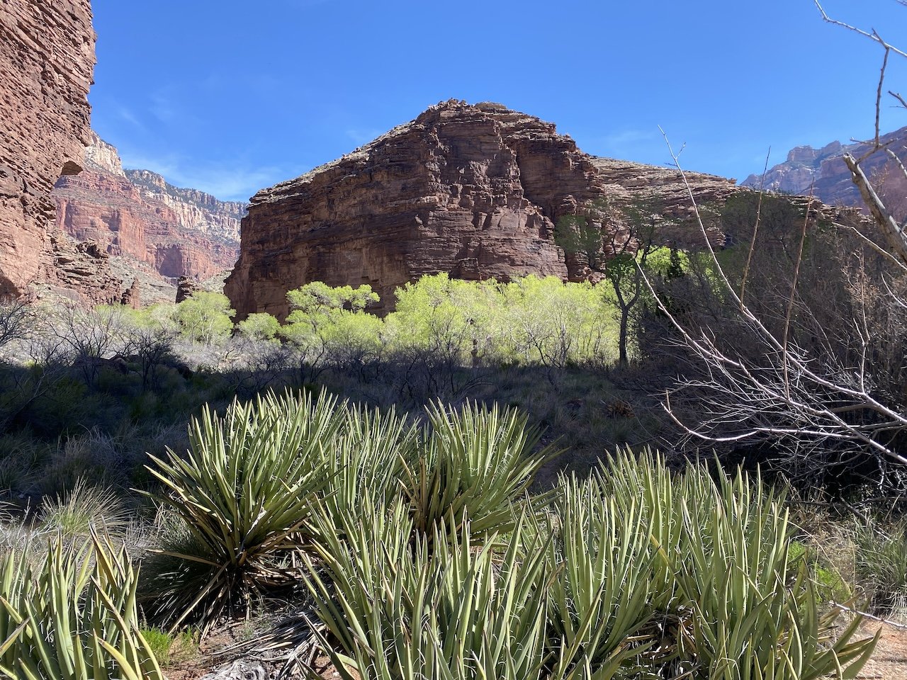
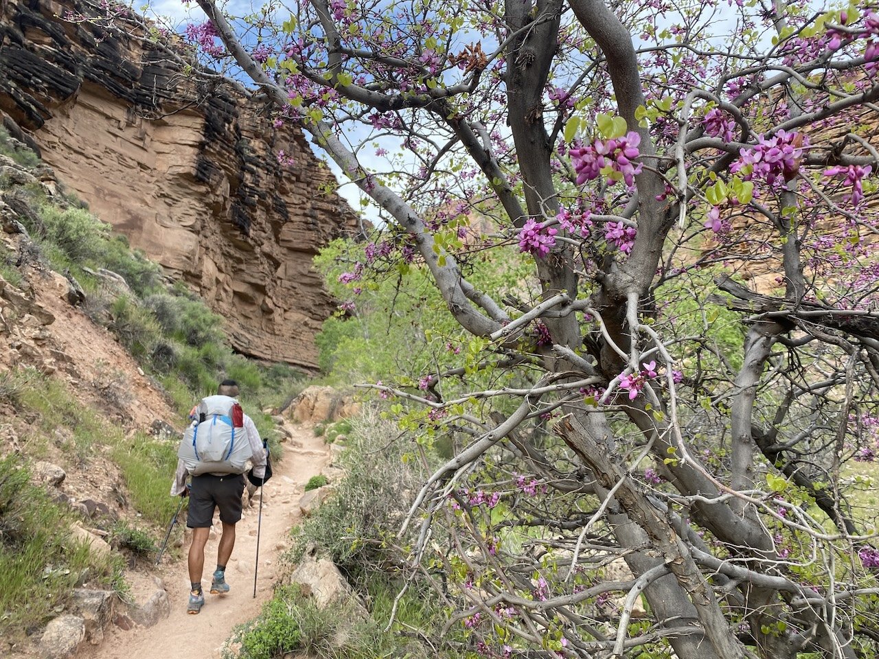
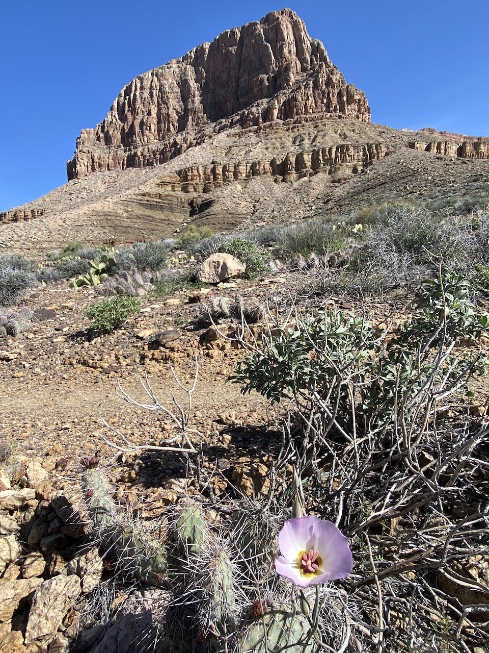
Another way we saw the seasons change was in the flora. The out-and-back portions of this route meant we hiked back along the same stretch of trail a couple of days apart. In the space of just two days, a burst of wildflowers greeted us on the way back that weren’t there when had first arrived.

Experiencing these rhythms of nature puts the human heartbeat in sync with the planet. We are tremendously fortunate to get to enjoy wild spaces that, under different circumstances, would have been developed, dammed…and damned.

With thanks to our hiking pal Sarah for joining us on the hike and for snapping some of the photos in this blog post!

View fullsize winding Mariposa lily blooming along Clear Creek Trail
winding Mariposa lily blooming along Clear Creek Trail
View fullsize IMG_8931.JPG
View fullsize IMG_0270.jpg
View fullsize IMG_0234.JPG
View fullsize IMG_0114.JPG
View fullsize IMG_8942.JPG
View fullsize bighorn sheep, formerly
bighorn sheep, formerly
View fullsize IMG_9027.jpg
View fullsize IMG_9040.JPG
View fullsize along Bright Angel Trail
along Bright Angel Trail
View fullsize IMG_0101.JPG
View fullsize IMG_0141.JPG
View fullsize IMG_0216.JPG
View fullsize shade is a precious commodity
shade is a precious commodity
View fullsize IMG_0150.JPG

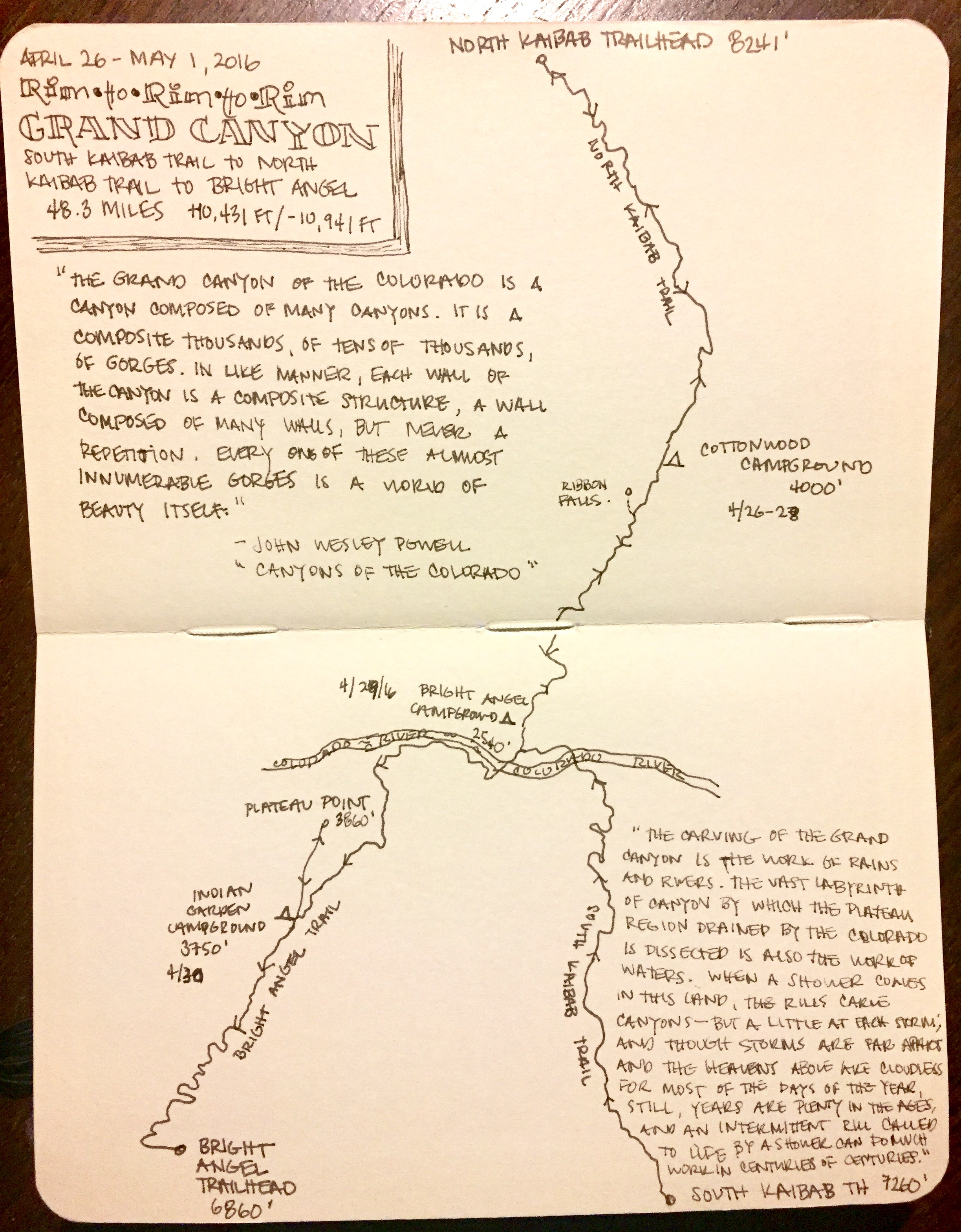
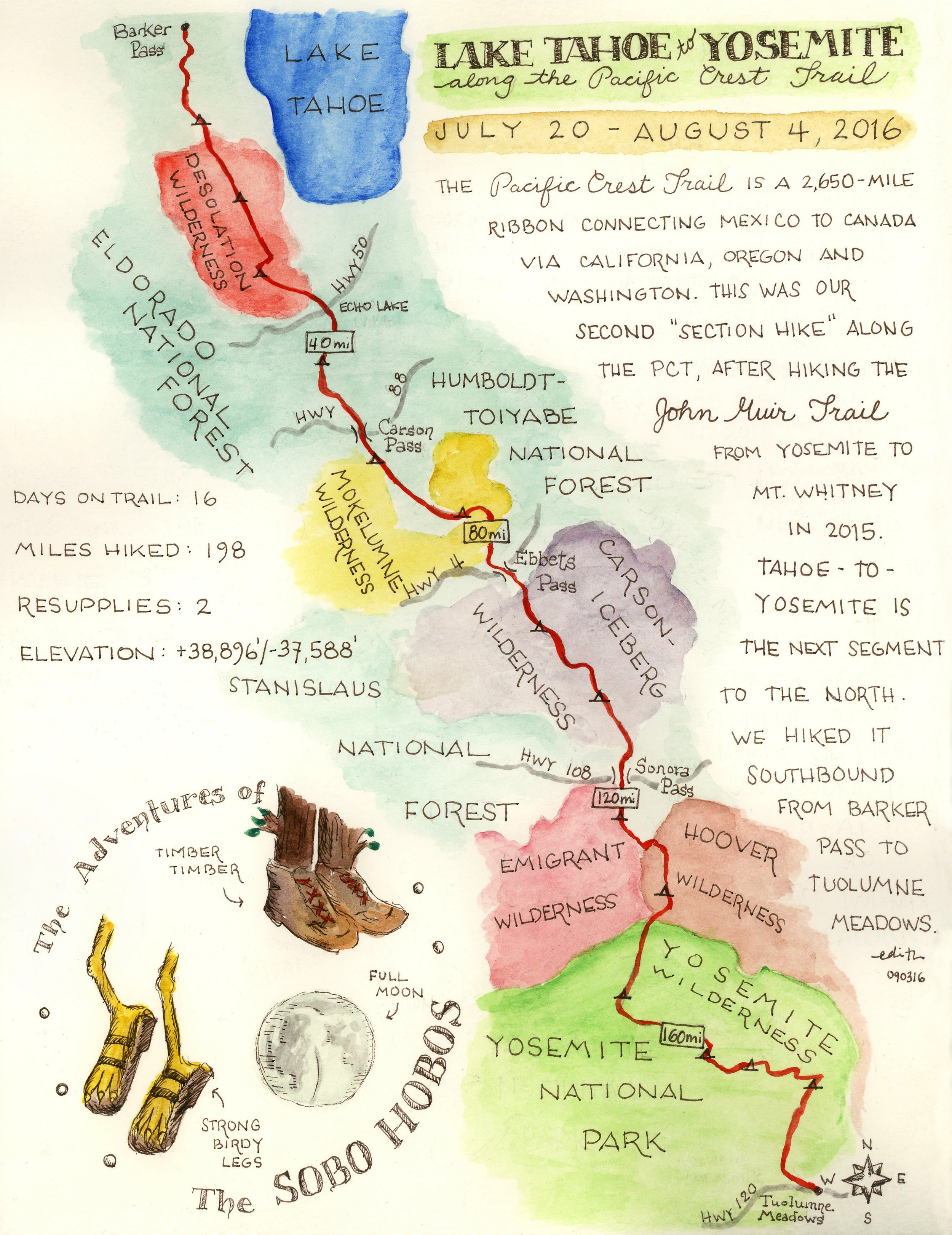
Days: 5 (April 8 - 12, 2023)

Mileage: 44 mi.

Elevations: South Kaibab trailhead 7,260'; Bright Angel campground 2,480'; Clear Creek 3,600; Bright Angel trailhead 6,860’. Total elevation loss/gain 6,913’.

Camp locations: Bright Angel Campground; Clear Creek.

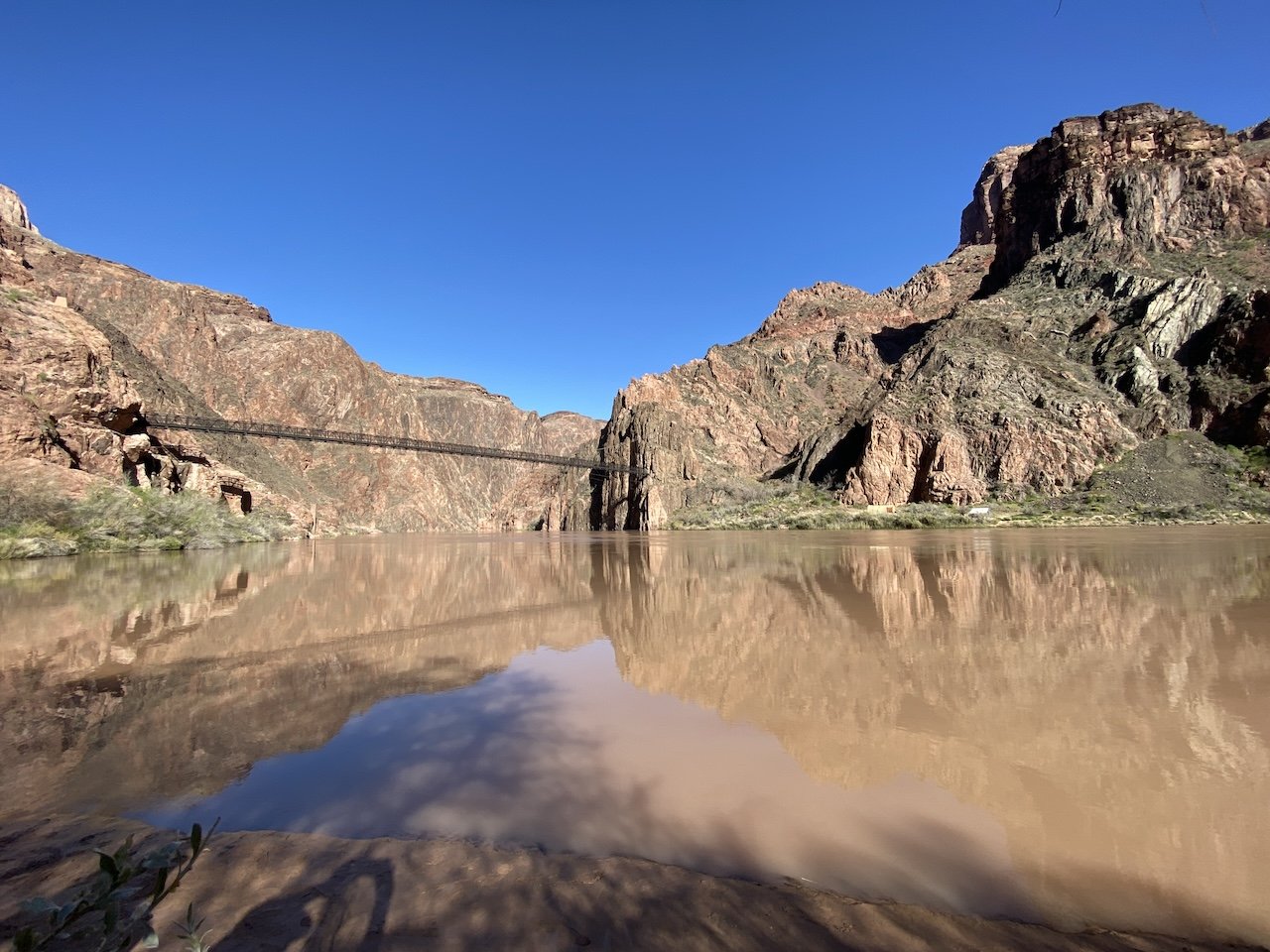
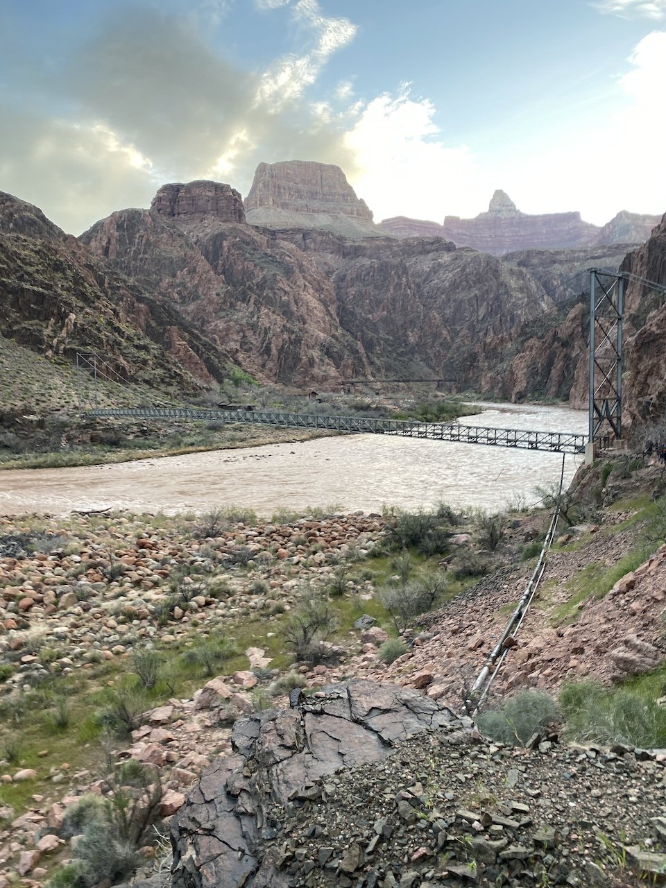
Enjoying watching the Colorado flowing its natural chocolate brown

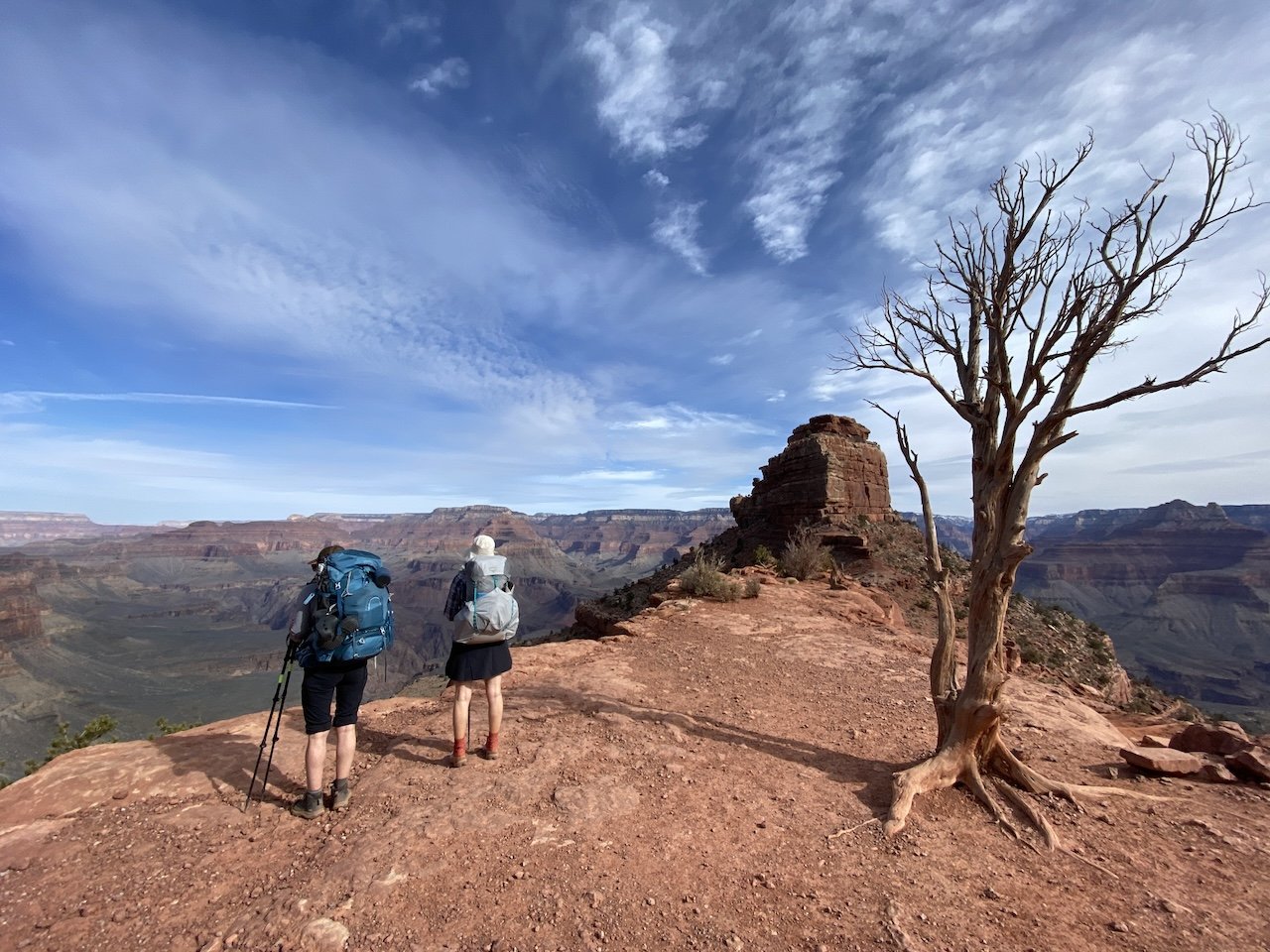
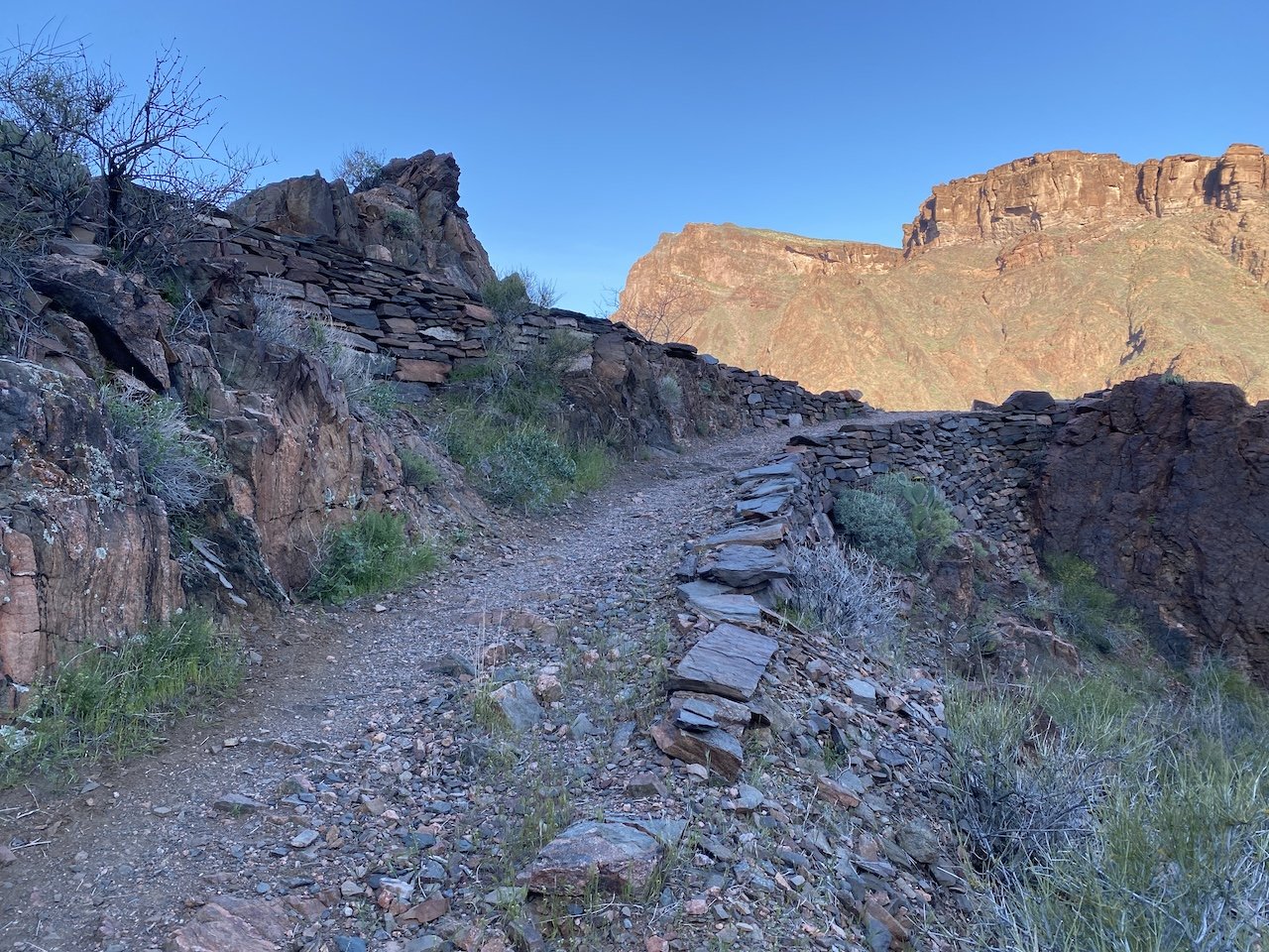
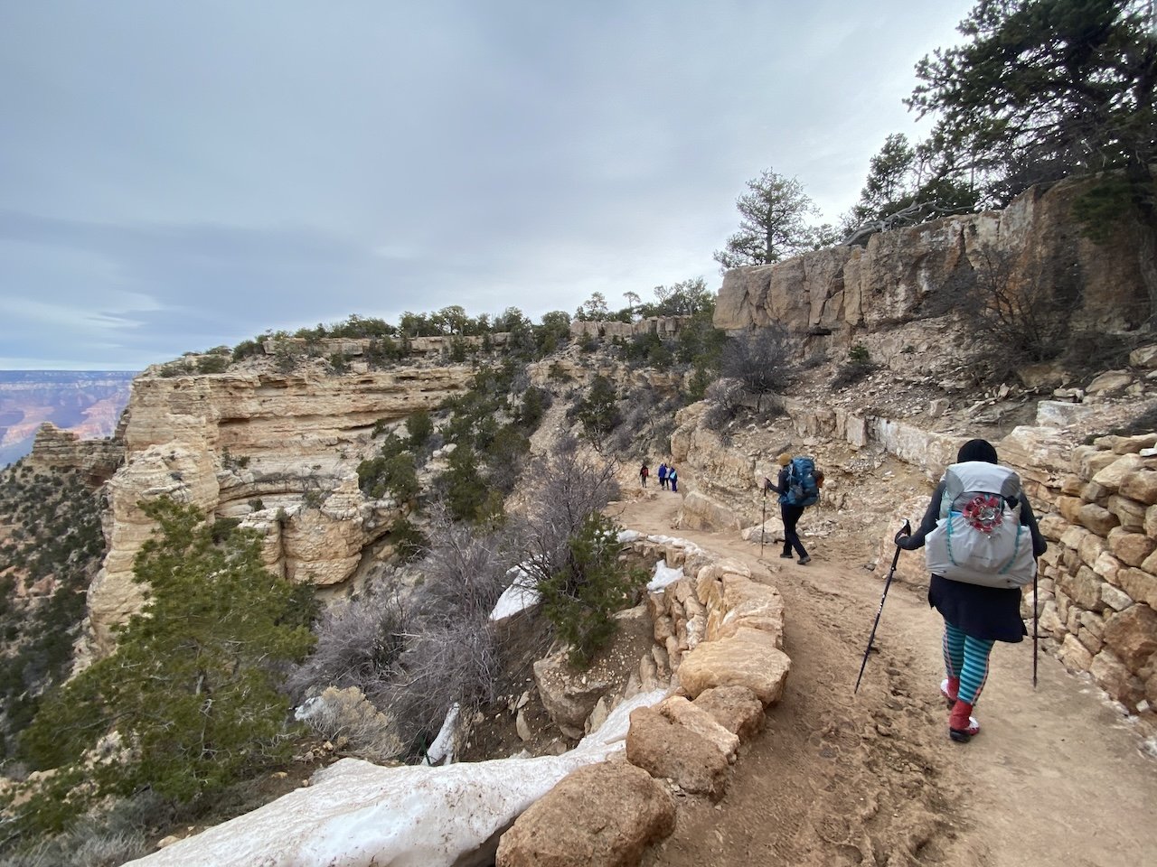
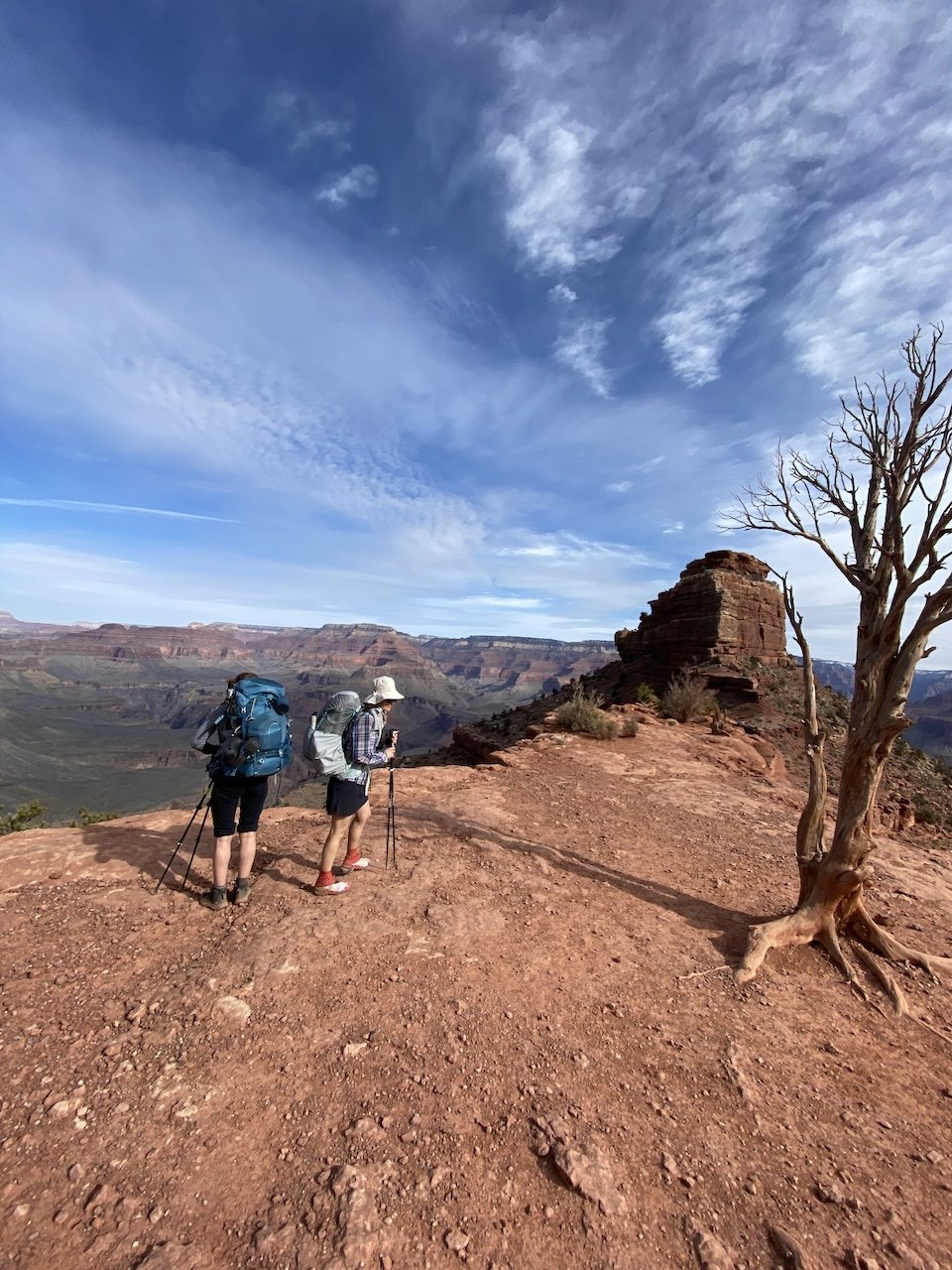
Rock bench at Phantom Overlook, a part of the trail originally built by the Civilian Conservation Corps circa 1935


In Travel Tags Grand Canyon, Clear Creek, Colorado, desert, backpacking, Arizona, Cheyava Falls
The final resting place of a Graumann DC-16 Albatross that crash landed during a CIA operation in 1952

The final resting place of a Graumann DC-16 Albatross that crash landed during a CIA operation in 1952

Hooves on the Ground: Death Valley Albatross Plane Crash Site

May 11, 2020

Death Valley National Park is a vast land full of surprises waiting to be discovered and explored. From the lowest point in North America at Badwater Basin (282 ft. below sea level) to Telescope Peak (11,049 ft.), Death Valley encompasses multiple mountain ranges, valleys, and countless canyons that offer a giant playground for exploring fascinating geology, jaw-dropping terrain, and interesting human and natural history. As the largest national park outside of Alaska, it offers limitless opportunities for exploration and is one of our favorite places to visit.

Read More
In Travel Tags Death Valley, plane crash, Cottonwood Mountains, hiking, camping, backpacking, California, desert, Sierra Nevada
Dear Antlerby Jedediah Cornelius Antler"The buck stops here."The advice and musings of the swankiest eight-point buck you'll ever meet.

Dear Antler

by Jedediah Cornelius Antler

"The buck stops here."

The advice and musings of the swankiest eight-point buck you'll ever meet.


See all art posts

See all travel posts

Subscribe

 Be a true "Jedhead" and sign up for our mailing list here. 

We respect your privacy. Truly

Jed says thank you!


blog
Hooves on the Ground: Onion Valley to Sixty Lake Basin and Col
about 9 months ago
Hooves on the Ground: Grand Canyon's Clear Creek Trail and Cheyava Falls
about a year ago
Hooves on the Ground: Miter Basin
about a year ago
Hooves on the Ground: Tyee/Midnight/Hungry Packer Lakes, John Muir Wilderness
about a year ago
Hooves on the Ground: Yosemite's Murphy Creek to Tuolumne Crest in the early season
about a year ago
Hooves on the Ground: Grand Canyon's Tanner Trail and Escalante Route
about 2 years ago
Hooves on the Ground: Mineral King Loop via Timber Gap and Lost Canyon
about 2 years ago
Hooves on the Ground: Darwin, Evolution, and Piute Canyons via Lamarck Col and Piute Pass
about 3 years ago
Hooves on the Ground: Thousand Island Lake via Rush Creek
about 3 years ago
Hooves on the Ground: Grand Canyon's Hermit-Boucher Loop
about 4 years ago
Elements of Existence
about 4 years ago
Spellbound | Wanderings Through the Witching Hour
about 4 years ago
Hooves on the Ground: Yosemite's Grand Canyon of the Tuolumne and Old Big Oak Flat Road to El Capitan
about 4 years ago
Psyche | Introspections In an Era of Uncertainty
about 4 years ago
Hooves on the Ground: Death Valley Albatross Plane Crash Site
about 5 years ago
Hooves on the Ground: High Sierra Trail
about 5 years ago
Suspension
about 6 years ago
Hooves on the Ground: Nepal
about 6 years ago
Hooves on the Ground: Cottonwood Pass and Lakes Loop (Miter Basin and Mt. Langley)
about 6 years ago
The Troubles We Carry
about 7 years ago

© dearantler 2013-2024. All rights reserved.