


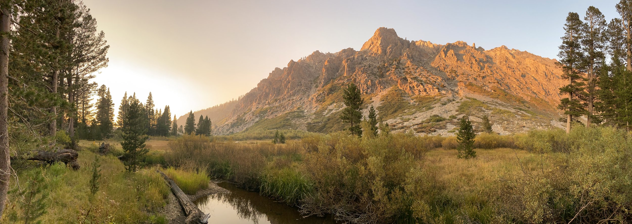


A five-day Sierra trek with beautiful weather, no wildfire smoke, and no mosquitoes? Sometimes you get lucky. This time, we were in the John Muir and Golden Trout Wildernesses and in Sequoia National Park, maximizing our time enjoying a cross-country jaunt of Miter Basin.
We’ve never met a Sierra basin we didn’t like, and Miter is one we’ve been meaning to return to for some time. Our first visit to Miter was brief — a scramble from Soldier Lake for a few hours, as part of a loop of Cottonwood Lakes and Pass that included summiting Mt. Langley. What an indescribably transcendent place, we thought to ourselves. We knew we had to go back.
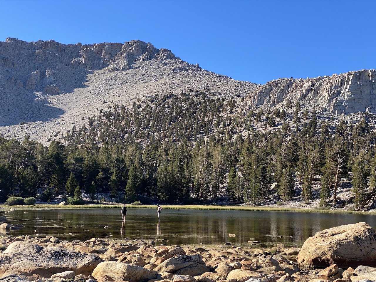
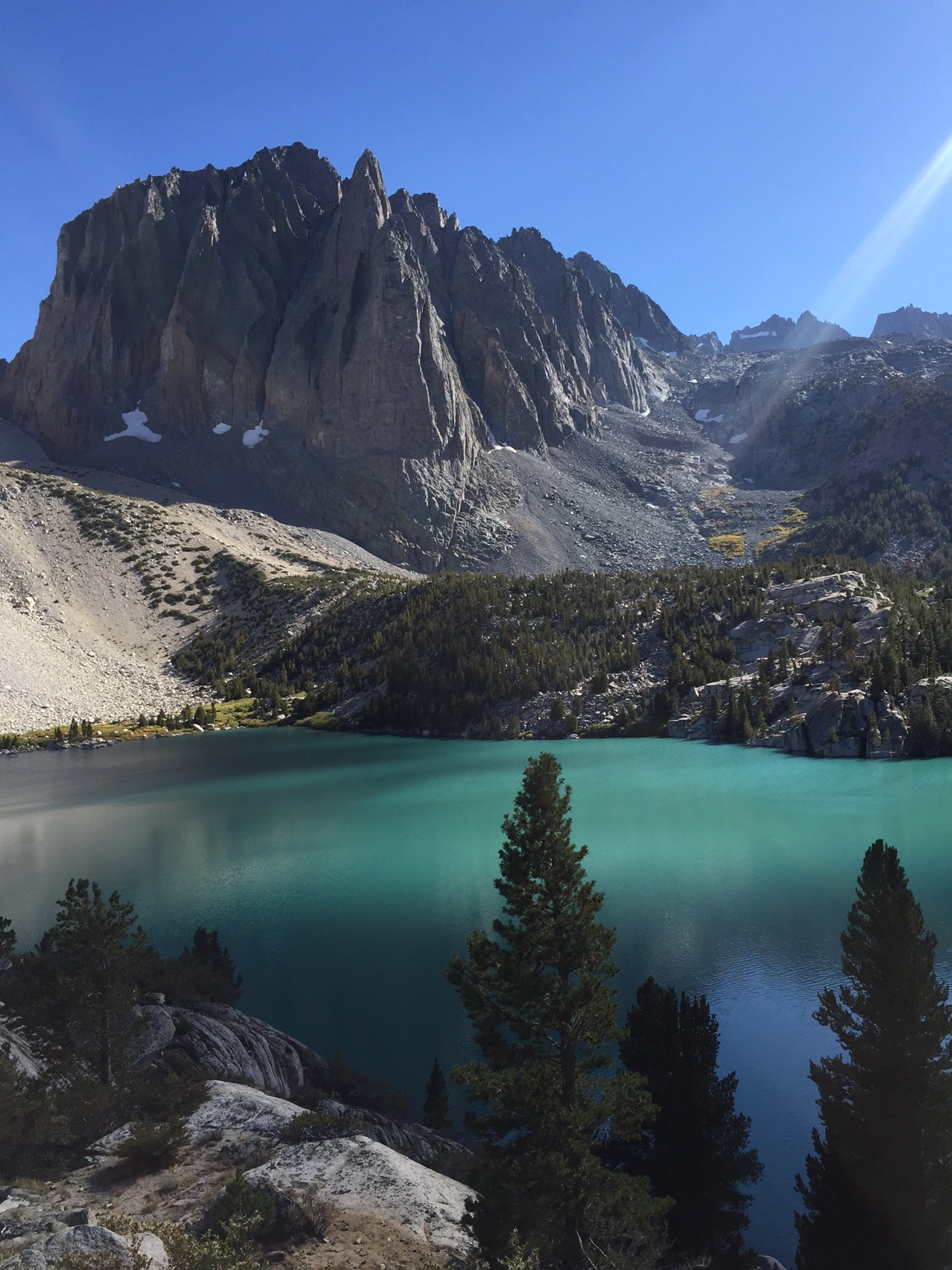
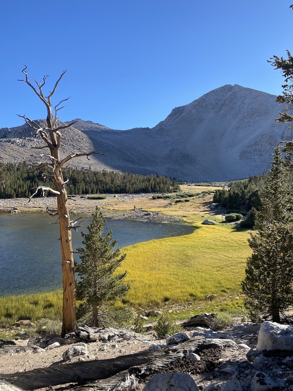
Sky Blue Lake with the imposing formation of The Miter dominating on the right
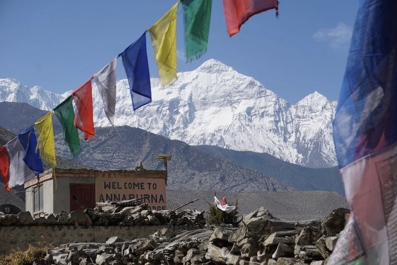
On this trip, we were joined by our Czech pals Jana and Marek, who were interested in a “Wild West wilderness experience,” as they put it. We met Jana in the Himalaya in 2018 while hiking the Annapurna Circuit.
We sometimes forget how fortunate we are to experience nature as we do in the American West, and hiking with Jana and Marek helped remind us. Having large swaths of land protected from development means we have the freedom to roam for days or weeks without stepping into a modern building or crossing an asphalt-covered road. Returning to the comforts of modernity means experiencing them with new eyes and appreciation — which, for us, over the years has tended to be one of the longer-lasting effects of wilderness travel.


Our route began at Cottonwood Lakes trailhead (10,040’) — a thin-aired start for sea-level dwellers. To help us acclimatize, the night before the hike we camped at the walk-in backpackers’ campground near the trailhead (which was virtually empty when we arrived in the afternoon and very full by the evening).
Day 1
From Cottonwood Lakes trailhead, the trail first leads west and then north as it passes through equestrian areas, before entering into Golden Trout Wilderness. Passing on the edge of a meadow near Cottonwood Creek, it climbs up and heads west once more. Here we enjoyed expansive views from just south of Cottownwood Lakes #1 and 2. We lunched in the shade of some lodgepole pines and chatted with passing hikers as we soaked in gorgeous vistas of Cottonwood Basin and Mt. Langley.
We proceeded another mile or so to camp at South Fork Lakes (11,000’) and stopped there for the night to let ourselves further acclimatize before attempting New Army Pass the following morning. We had the westernmost South Fork Lake to ourselves and enjoyed its unique and picturesque underwater rock gardens and how the changing light shifted the scenery surrounding the lakes throughout the evening.
Day 2
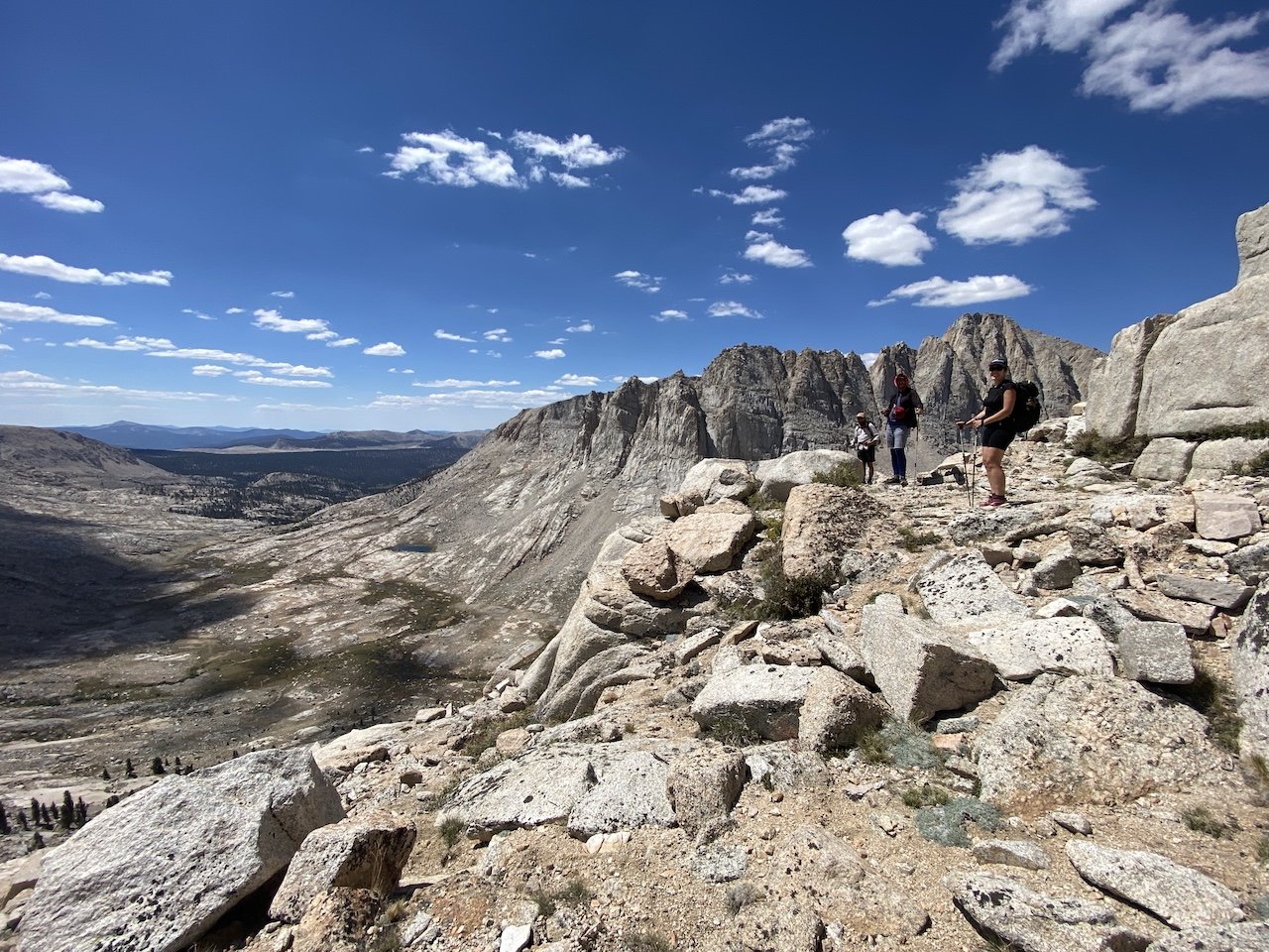
Picking up the trail westward, we started the day by passing Long Lake before a switchback ascent to New Army Pass (12,310’), entering into Sequoia National Park. We were greeted by several resident marmots who begged unsuccessfully for a snack. After taking in the views and exchanging high-fives, we descended gently into the sparse, granite landscape while spying views to the north toward (Old) Army Pass.
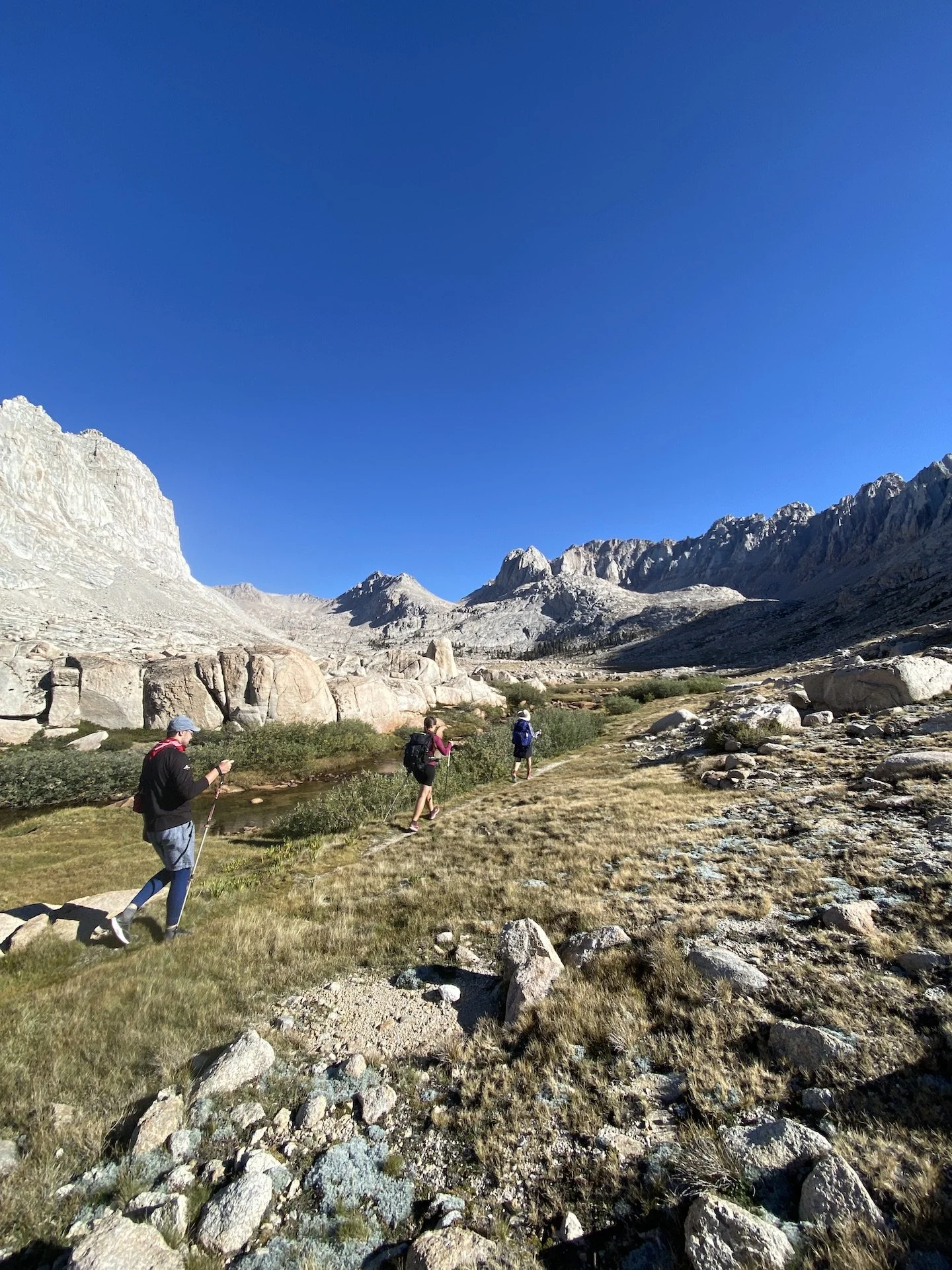
A couple of miles down, we lunched at timberline just below 11,000’ next to a tributary of Rock Creek. We then headed north, and later west, on Upper Rock Creek trail. Though a trail into Miter basin does not appear on the Tom Harrison Mount Whitney High Country map, there is a use trail heading north from the east side of the meadow at Lower Rock Creek Lake. We followed this use trail as it faded and reappeared. Route-finding is sometimes necessary, but we nevertheless found this to be a pleasant route up into Miter Basin and less of a scramble than the bushwhack up from Soldier Lake we had done in the past.
Once in Miter Basin, we proceeded about a mile and a half and found a lovely place to camp near where most maps show three streams converging like a trident. This would be home for the next two nights.
Day 3
We were really looking forward to a day of putzing around the basin. Options abound, and we decided we’d start with a ramble toward Iridescent Lake. This was very much a start-and-stop day full of pauses and exclamations such as, “look at that ridiculous gorgeousness!” and “oooh, I’ve never seen such splendid combination of rock, water, and sky!”
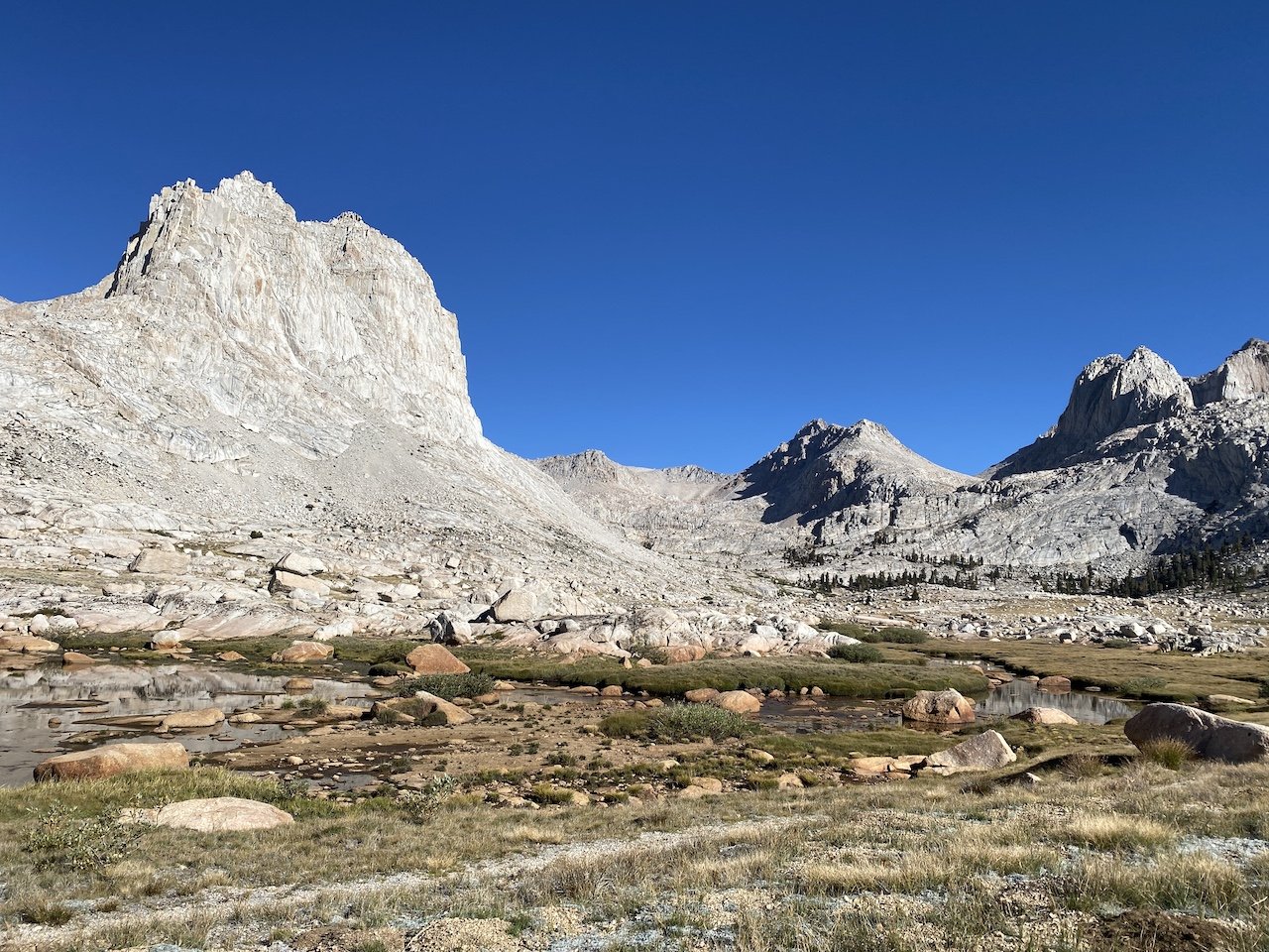
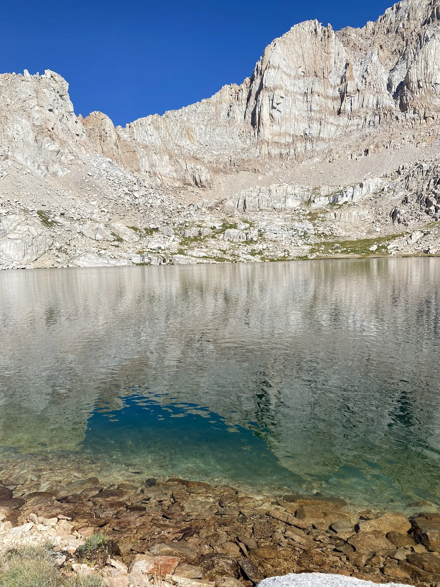
We followed a use trail northbound along the length of the basin, and we eventually split off to head northwest along a slope to ascend nearly 1,000’ to Iridescent Lake. The landscape alternates between sparse rock and marshy meadow. Once at the lake, the color palette changes — the intense indigo of the sky reflected in the green-red-yellow-turquoise rainbow of a truly iridescent lake. We spent a couple of hours napping, taking brisk dips, and sunbathing on the lake’s south shore.
Eventually we picked ourselves up from this idyllic spot to head southwest over the saddle between Iridescent Lake and Sky Blue Lake. The saddle is immediately south of The Miter (12,770’), and it took a bit of scouting to find the best route — particularly on the descent, where some of the dropoffs on the west side are significant. While on this saddle, we looked up and saw that we were being watched by a Sierra bighorn sheep. It was our first time in our years of Sierra travel ever seeing one (though we are certain we’ve been spotted by them before!)
We spent a lazy afternoon at Sky Blue Lake, lunching and napping. Or, more accurately, most of us spent a lazy afternoon. Jana has a penchant for long-distance swimming in cold water and found Sky Blue to be irresistible. She spent a solid 20 minutes swimming shore-to-shore and back, swimming what we estimate was at least a half mile in deep, cold water. We were exhausted and breathless just watching her.
Eventually we headed south, enjoying the gardens that cropped up in between the filigree of the lake’s network of outlet streams. We stopped frequently to take in stupendous 360-degree views before returning back to camp in the early evening.
Day 4
We packed up and headed back out toward Upper Rock Creek trail, retracing our route toward a junction with Siberian Pass Trail. We filled up on water at the junction and then turned right to follow the forested trail as it climbed toward a junction with the PCT, which we joined southbound. Hiking the southwestern slopes of Cirque Peak (12,900’), we eventually left Sequoia National Park and reentered Golden Trout Wilderness. The trail loses and gains elevation until topping out at about 11,500’ before beginning a gentle switchback descent toward Chicken Spring Lake. We found good camping on the west end, quite a distance from the lake — but not before scouting for sites for a little while.
Day 5
With just a little over 5 miles to go, we packed up and headed back onto the PCT, cresting over Cottonwood Pass (11,160’) within the first mile. Leaving the PCT, we continued east through meadows, losing some 1,000’ of elevation as we neared Horseshoe Meadows. Rather than exit out Cottonwood Pass trailhead, we took a connecting trail northward through the equestrian areas which connected us back to Cottonwood Lakes trailhead, where we had started.
We drove down to Lone Pine and enjoyed a celebratory lunch, looking up at Mt. Whitney and its neighboring peaks and discussing where our next adventure might take us.
Days: 5 (Aug. 30 - Sept. 3, 2022)
Mileage: 34 mi.
Elevations: Cottonwood Lakes trailhead 10,040'; New Army Pass 12,300'; Miter Basin ~11,000’; Saddle between Iridescent and Sky Blue lakes 12,000’. Total elevation gain 5,804’.
Camp locations: westernmost South Fork Lake; Miter Basin (2 nights); Chicken Spring Lake.